
New York State
![]()
| CNY Hiking HOME PAGE | ADK Fire Tower Challenge | Catskill Fire Towers |
|
Fire Towers in New York State
|
|
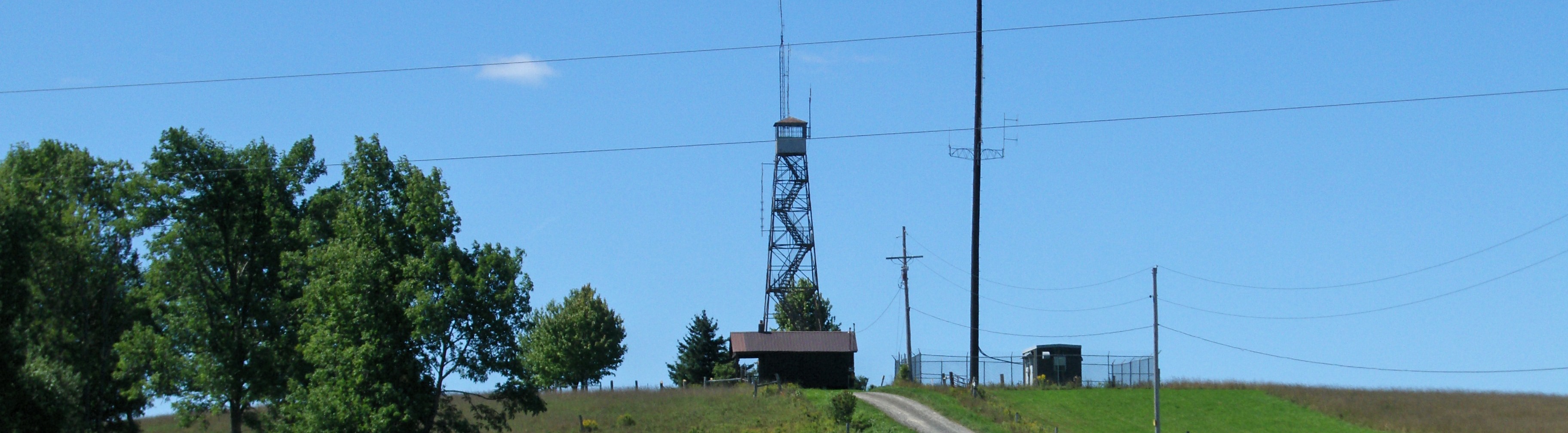
After a series of devastating forest fires in the Adirondacks in the early 1900s, New York state began utilizing forest fire detection stations all across New York State. These stations were managed by the NY DEC, Bureau of Forest Fire Control from 1909 until 1990. At first many towers were nothing more than wooden platforms, until the standard steel towers began being used. There were a total of 127 fire detection stations across the state.
A total of 110 steel towers were owned by NY DEC - Bureau of Forest Fire Control (DEC-FFC). Of the 110, 53 were removed over the years and 57 are still standing. Nearly thirty are currently in some sort of restoration. Five were relocated to another location. Many are available to climb and explore, especially in the Adirondacks. The ADK Fire Tower Challenge was created by one of the chapters of the Adirondack Mountain Club (ADK) to popularize the hiking trails to many of the fire towers of the Adirondacks.
Look below for a list, sorted by county, of all the fire detection stations that were once being used by the DEC-FFC. We did not include any of the ten fire towers that were once in Suffolk County on Long Island. They have all been removed. There are also five fire towers that were privately owned that we did put on the main list below. Those were on Buck Mountain (Hamilton County), Meenagha Mountain (Franklin County), Mount Electra (Herkimer County), Rock Mountain (Lewis County) and Salmon Lake Mountain (Hamilton County). You can find a Google map of most of the active fire towers here courtesy of Will Fisher.
Remember that the fire towers on private property are just that, on PRIVATE PROPERTY. Do not trespass in order to visit those fire towers. You can find out more on the Adirondack and Catskill Fire Towers from the book Views From On High: Fire Tower Trails in the Adirondacks and Catskills
.
List of Fire Towers in New York State
Fire Tower Location County Summit Elevation Status of Fire Tower Alma Hill Allegany 2548 feet on PRIVATE LAND Jersey Hill Allegany 2240 feet REMOVED Ingraham Hill Broome 1860 feet Radio/TV towers Page Pond Hill Broome 2000 feet on PRIVATE LAND Hatzfelt Hill Cattaraugus 2410 feet REMOVED McCarty Hill Cattaraugus 2323 feet REMOVED Summit Hill Cattaraugus 2385 feet REMAINS Berry Hill Chenango 1960 feet REMAINS Chenango Lake Chenango 1966 feet relocated to Brookfield Lyon Mountain Clinton 3820 feet REMAINS Palmer Hill Clinton 1148 feet on PRIVATE LAND Alander Mountain Columbia 2240 feet Moved to Washburn Mountain Beebe Hill Columbia 1726 feet REMAINS Washburn Mountain Columbia 1542 feet Moved to Beebe Hill Morgan Hill Cortland 2020 feet REMOVED in 1977 Bramley Mountain Delaware 2817 feet REMOVED Rock Rift Delaware 2402 feet REMAINS Twadell Point Delaware 2296 feet on PRIVATE LAND Mount Utsayantha Delaware 3214 feet REMAINS & RESTORED Beacon Mountain Dutchess 1600 feet REMAINS & RESTORED Clove Mountain Dutchess 1400 feet on PRIVATE LAND Stissing Mountain Dutchess 1370 feet REMAINS & RESTORED Mount Adams Essex 3250 feet REMAINS Belfry Mountain Essex 1863 feet REMAINS (Radio Towers) Boreas Mountain Essex 3776 feet REMOVED Goodnow Mountain Essex 2690 feet REMAINS & RESTORED Hurricane Mountain Essex 3678 feet REMAINS Makomis Mountain Essex 1663 feet REMOVED Pharaoh Mountain Essex 2556 feet REMOVED Poke-O-Moonshine Essex 2165 feet REMAINS & RESTORED Vanderwhacker Mountain Essex 3409 feet REMAINS Whiteface Mountain Essex 4865 feet Moved to Adirondack Museum Ampersand Mountain Franklin 3313 feet REMOVED Azure Mountain Franklin 2500 feet REMAINS & RESTORED Debar Mountain Franklin 3300 feet REMOVED Loon Lake Mountain Franklin 3320 feet REMAINS Mount Morris Franklin 3136 feet on PRIVATE LAND Saint Regis Mountain Franklin 2874 feet REMAINS Kane Mountain Fulton 2200 feet REMAINS & RESTORED Hunter Mountain Greene 4040 feet REMAINS & RESTORED Blue Mountain Hamilton 3759 feet REMAINS & RESTORED Cathead Mountain Hamilton 2431 feet on PRIVATE LAND Dunn Brook Mountain Hamilton 3605 feet REMOVED in 1919 Hamilton Mountain Hamilton 3238 feet REMOVED Kempshall Mountain Hamilton 3346 feet REMOVED Owls Head Mountain Hamilton 2812 feet REMAINS & RESTORED Pillsbury Mountain Hamilton 3597 feet REMAINS Snowy Mountain Hamilton 3897 feet REMAINS & RESTORED T-Lake Mountain Hamilton 3071 feet REMOVED Tomany Mountain Hamilton 2579 feet REMOVED Wakely Mountain Hamilton 3766 feet REMAINS West Mountain Hamilton 2913 feet REMOVED Beaver Lake Mountain Herkimer 1726 feet REMOVED Dairy Hill Herkimer 1812 feet REMOVED Fort Noble Mountain Herkimer 2338 feet REMOVED Moose River Mountain Herkimer 2205 feet REMOVED Penn Mountain Herkimer 1813 feet REMOVED Rondaxe Mountain (Bald Mtn) Herkimer 2349 feet REMAINS & RESTORED Stillwater Mountain Herkimer 2267 feet on PRIVATE LAND Woodhull Mountain Herkimer 2365 feet REMAINS (radio towers) Bald Mountain Lewis 1640 feet REMOVED (the other Bald Mtn) Gomer Hill Lewis 2120 feet REMAINS (radio towers) New Boston Lewis 1643 feet Moved to Thompson Park in Watertown Number Four Lewis 1540 feet Moved to Lowville DEC Demonstration area Swancott Hill Lewis 1500 feet REMOVED Brookfield Madison 1900 feet REMOVED Morrow Mountain Madison 2142 feet REMOVED Graham Mountain Orange 1300 feet REMAINS Pocatello Mountain Orange 1020 feet Moved to Graham Mountain Sterling Mountain Orange 1320 feet REMAINS & RESTORED Castor Hill Oswego 1560 feet REMOVED Hooker Hill Otsego 2320 feet REMOVED Ninham Mountain Putnam 1340 feet REMAINS & RESTORED Dickinson Hill Rensselaer 1760 feet REMAINS & RESTORED Number Seven Hill Rensselaer 2010 feet REMOVED Jackie Jones Mountain Rockland 1260 feet REMAINS Arab Mountain St Lawrence 2519 feet REMAINS & RESTORED Cat Mountain St Lawrence 2260 feet REMOVED Catamount Mountain St Lawrence 1820 feet REMOVED Moosehead Mountain St Lawrence 2060 feet REMOVED Sand Hill St Lawrence 320 feet REMOVED Tooley Pond Mountain St Lawrence 1782 feet Moved to Cathedral Rock Whites Hill St Lawrence 1436 feet REMOVED Cornell Hill Saratoga 420 feet Moved to Wilton Wildlife Preserve and Park Hadley Mountain Saratoga 2680 feet REMAINS & RESTORED Ohmer Mountain Saratoga 2565 feet REMOVED in 1915 Spruce Mountain Saratoga 2009 feet REMAINS Leonard Hill Schoharie 2620 feet needs restoration Petersburg Mountain Schoharie 2320 feet REMOVED Sugar Hill Schuyler 2090 feet REMAINS Erwin Steuben 1710 feet REMOVED Prattsburgh Steuben 2163 feet REMOVED Chapin Hill Sullivan 1420 feet REMOVED Roosa Gap Sullivan 1647 feet REMAINS (radio equipment) Padlock Hill Tompkins 1900 feet Moved to NY State Fair in 1985 Balsam Lake Mountain Ulster 3720 feet REMAINS & RESTORED Belleayre Mountain Ulster 3375 feet REMOVED Gallis Hill Ulster 780 feet Moved to Overlook Mountain High Point Mountain Ulster 2200 feet REMOVED Mohonk Mountain Ulster 1610 feet REMAINS (private resort) Overlook Mountain Ulster 3120 feet REMAINS & RESTORED Red Hill Ulster 2980 feet REMAINS & RESTORED Slide Mountain Ulster 4180 feet REMOVED in 1915 Mount Tremper Ulster 2720 feet REMAINS & RESTORED Crane Mountain Warren 3420 feet REMOVED Gore Mountain Warren 3562 feet REMAINS (radio equipment) Prospect Mountain Warren 2020 feet REMOVED Swede Mountain Warren 1900 feet Possibly opening soon!!! Black Mountain Washington 2640 feet REMAINS (radio equipment) Colfax Mountain Washington 2267 feet REMAINS (radio equipment) Cross River Mountain Westchester 800 feet REMOVED Nelson Mountain Westchester 540 feet REMOVED
Thanks for visiting our website!
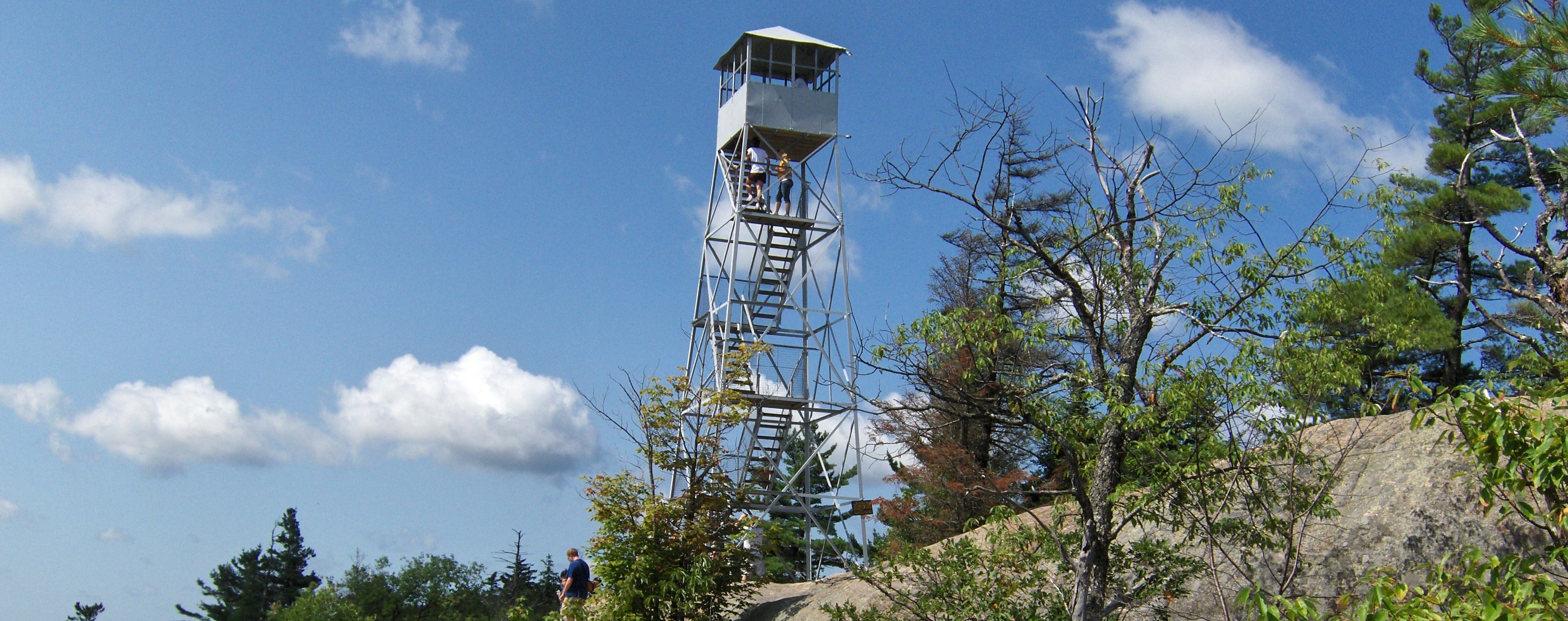
Rondaxe Fire Tower on Bald Mountain in the Old Forge area of the Adirondacks
| CNY Hiking HOME PAGE | New York State Parks | Adirondack Park |
