| CNY Hiking HOME PAGE | Hiking in Madison County | Link Trail | NCT - New Woodstock-Tioughnioga WMA |
|
Hiking in Madison County Tioughnioga Wildlife Management Area Link Trail Dead End Section
|
Guide to Hiking the Link Trail
3rd Edition (2014) - Only $5 Guide to the 40+ mile Link Trail with description, pictures and maps of the trail. The guide comes to you as a pdf file, meaning you print just the pages you need, when you need it. Use the buy now button below and we'll email you the file usually within 24 hours. |
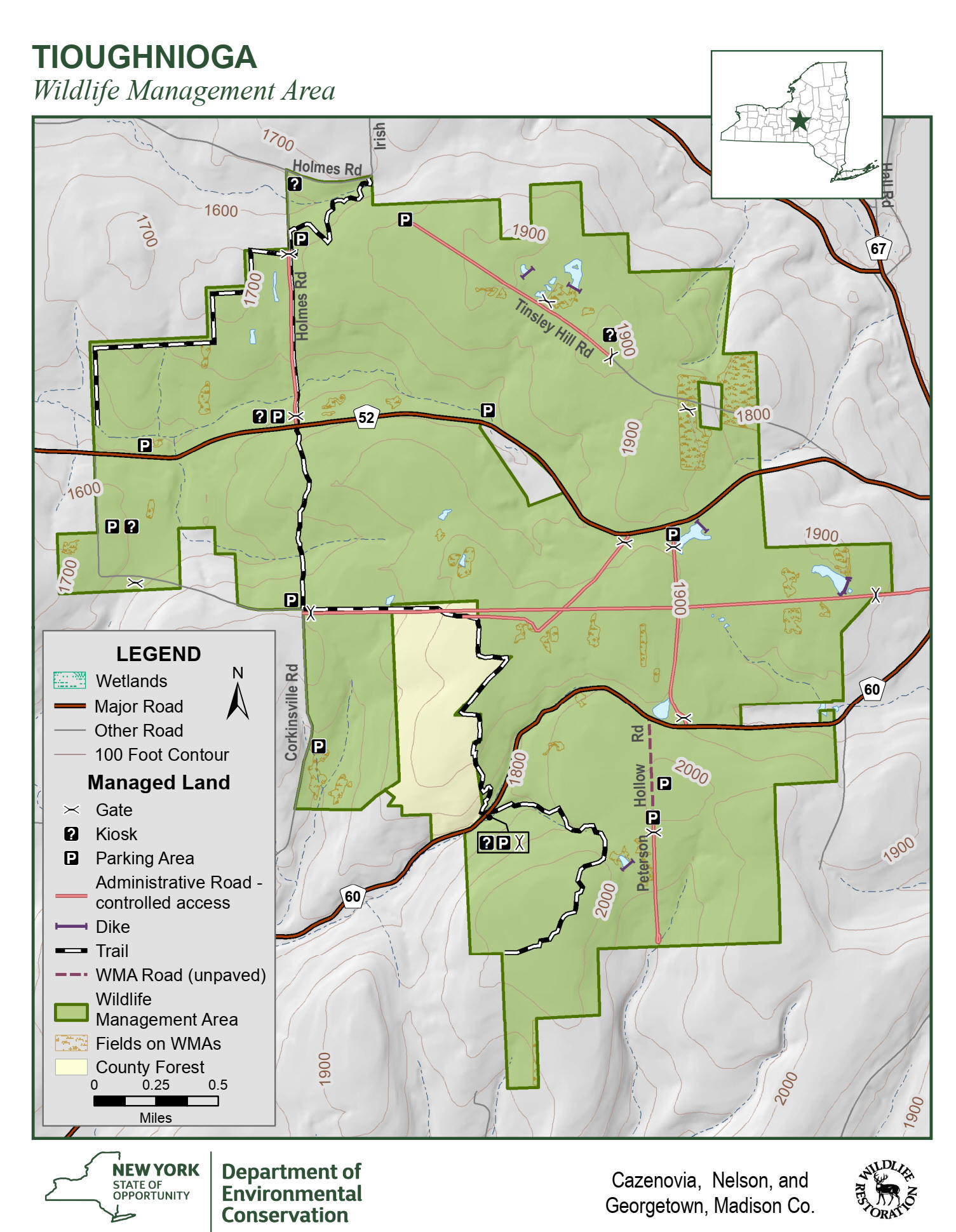
The 3737 acre Tioughnioga Wildlife Management Area is very popular for hunting, however there are a few hiking trails that travel through the WMA including the North Country National Scenic Trail as well as the Link Trail (see map below). It's suggested that you don't hike in the WMA during big game hunting season.
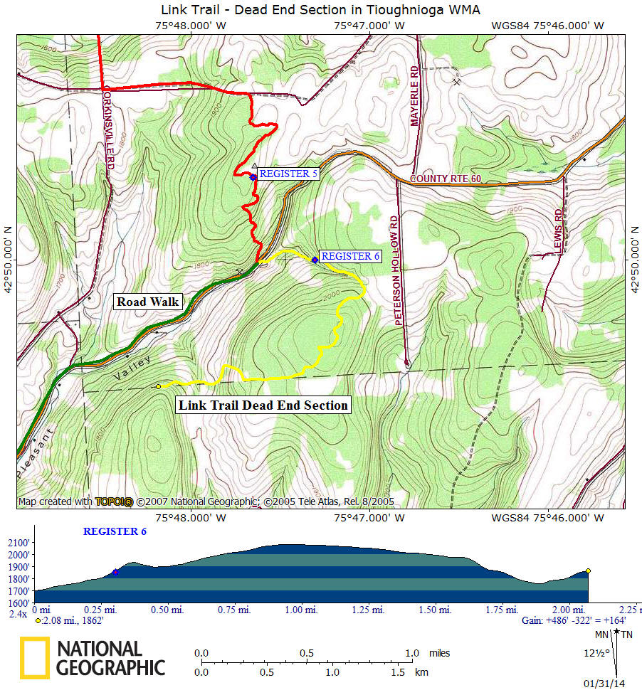
This 2.1 mile section of the Link Trail comes to a dead end soon after leaving Tioughnioa WMA due to the loss of permission for the trail on a new land owner’s property. The loss of this 0.8 mile section of the Link Trail has created a gap in the trail as well as a 4.6 mile road walk.
You can still hike the dead end section up to the land owner’s property line for a four mile round trip hike. This section features the highest point on the Link Trail at 2080 feet as well as a nice footbridge over a ravine on private property. There is also a nice view from along the trail on private property. It is unfortunate that the trail is no longer continuous.
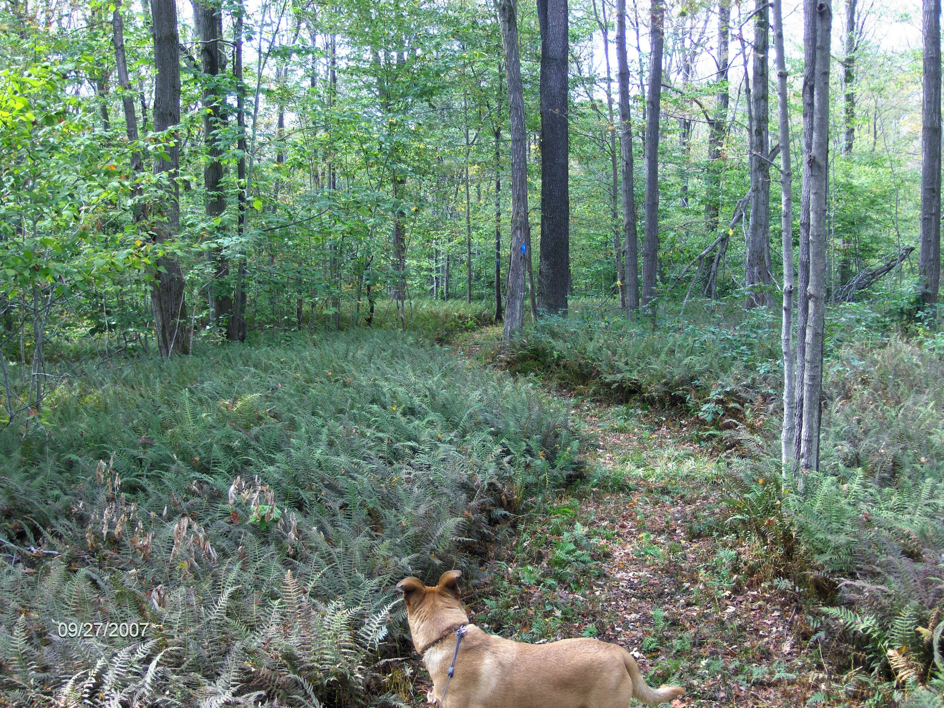
Link Trail high point in Tioughnioga WMA
| State Lands SE of Syracuse | State Lands SW of Syracuse | Hiking in NY State Lands |
| CNY Hiking Home Page | North Country Trail in CNY | Finger Lakes Trail |
(c) 2006-today CNY Hiking - All rights reserved. Any use of information from this site without permission is strictly forbidden.