| CNY Hiking Home Page | North Country Trail in CNY | Morgan Hill State Forest | Onondaga Trail |
|
North
Country Trail Onondaga Trail Morgan Hill State Forest Labrador Hollow Unique Area Hemlock Glen, Jones Hill, Spruce Pond, Shackham Pond
|
This 17 mile stretch of trail is probably one of the most popular sections of the North Country National Scenic Trail within central New York, as well as all of New York and possibly along the whole 4600 miles of the trail. This is one of our favorite sections of the North Country Trail as well and we've logged many miles along this well worn path in Morgan Hill State Forest. The trail enters the state forest from private property from NY 13 west of Cuyler.
The North Country Trail coincides with the Onondaga Trail in Morgan Hill State Forest. The Onondaga Trail is one of six branch trails of the Finger Lakes Trail System. This trail system has well over 900 miles of hiking trails in New York. This seventeen mile section of trail has numerous ups and downs as well as some steep sections. This difficult stretch of the the NCT has an overall elevation gain of just over 3000 feet. If you're looking for a challenging hiking adventure, the NCT in Morgan Hill State Forest is for you.
There are numerous camping opportunities along the trail in the state forest including the Hemlock Lean-To. There are many scenic sections of the trail including Hemlock Glen, Tinker Falls, the view from the hang glider spot on Jones Hill, Spruce Pond and Shackham Pond. A new staircase was built in 2010 to eliminate some steep sections near the top of Tinker Falls, as well as new switchbacks. There is a footbridge that was built in 2007 over Shackham Brook. The trail travels by an old family cemetery near Shackham Pond.
The trail leaves the state forest soon after crossing Fabius Brook and enters private land then soon there are views of the small hamlet of Fabius. It is because of the generosity of the landowners that the trail is able to pass through this great area. Please be sure to stay on the trail and respect the landowners rights. There is also a section of trail near the Jones Hill vista that travels on private property. The area around Tinker Falls and Jones Hill is in Labrador Hollow Unique Area. There is no camping allowed in Labrador Hollow Unique Area as well as on private property.
The stretch of the North Country Trail from NY 13 to the Morgan Hill State Forest boundary is CLOSED for HUNTING from Nov 15-Dec 25. Please respect the landowners request and stay off this section of trail during these dates. There is NO CAMPING on PRIVATE PROPERTY!
This section of trail is maintained by the Onondaga Chapter of the Adirondack Mountain Club. If your interesting in more information about this hiking club, join or volunteer, see their website at ADK-Onondaga Chapter. Check below for a topo map, a few pictures and detailed description of this section of the trail. You'll even find the "Scrappy Campsite" and the "Pond Campsite" where we like to camp occasionally on the map below. The site s include a stone fire pit. The Scrappy Campsite is next to a reliable stream and the Pond Campsite is next to Shackham Pond.
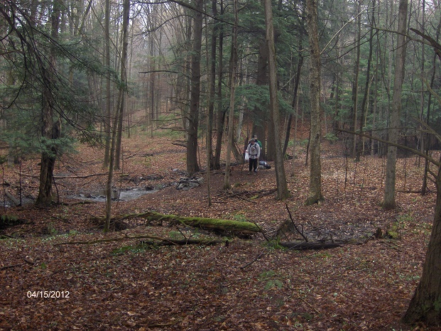
Backpackers leaving the "Scrappy Campsite" in Morgan Hill State Forest
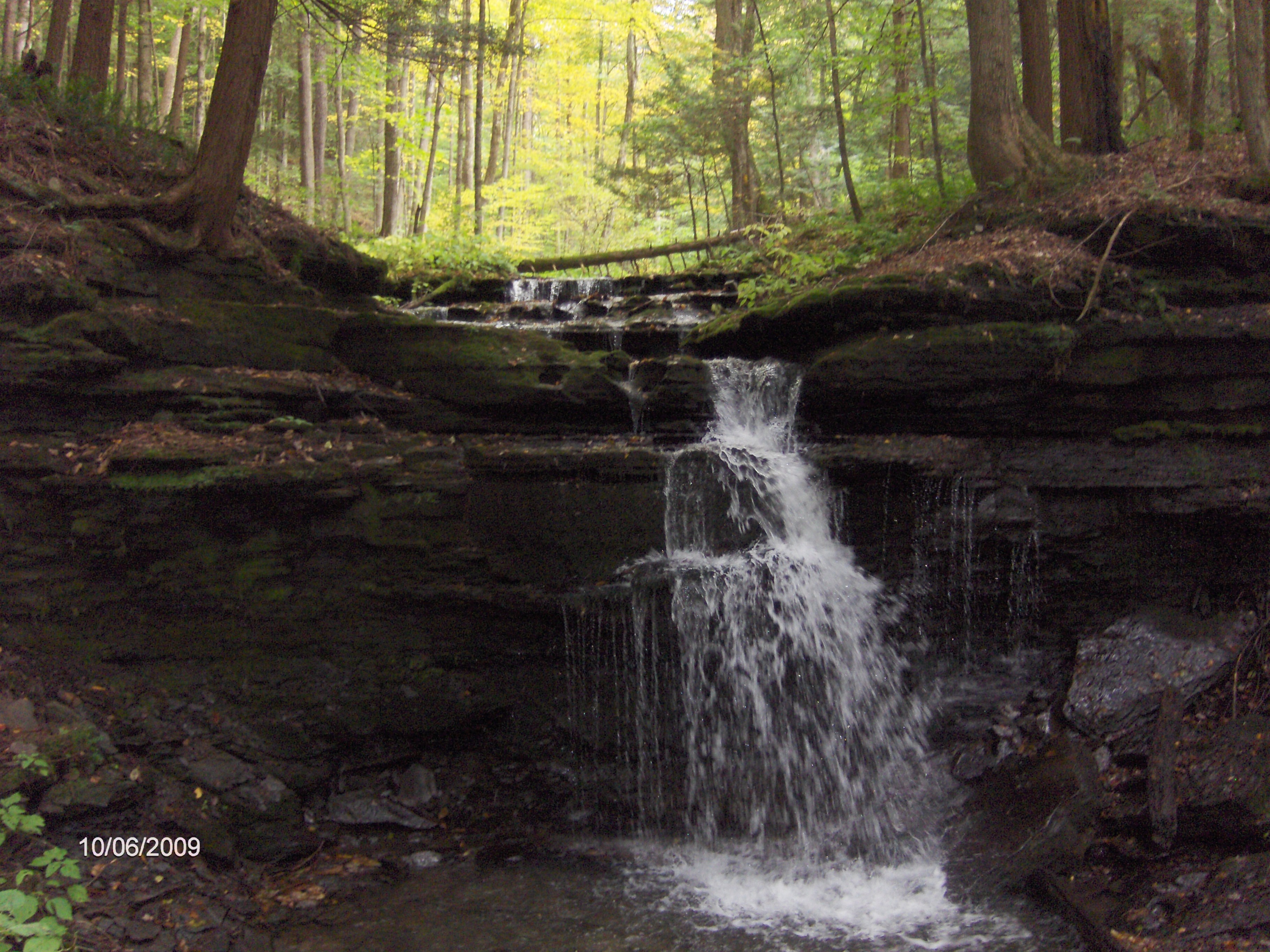
Waterfalls along North Country Trail in Hemlock Glen
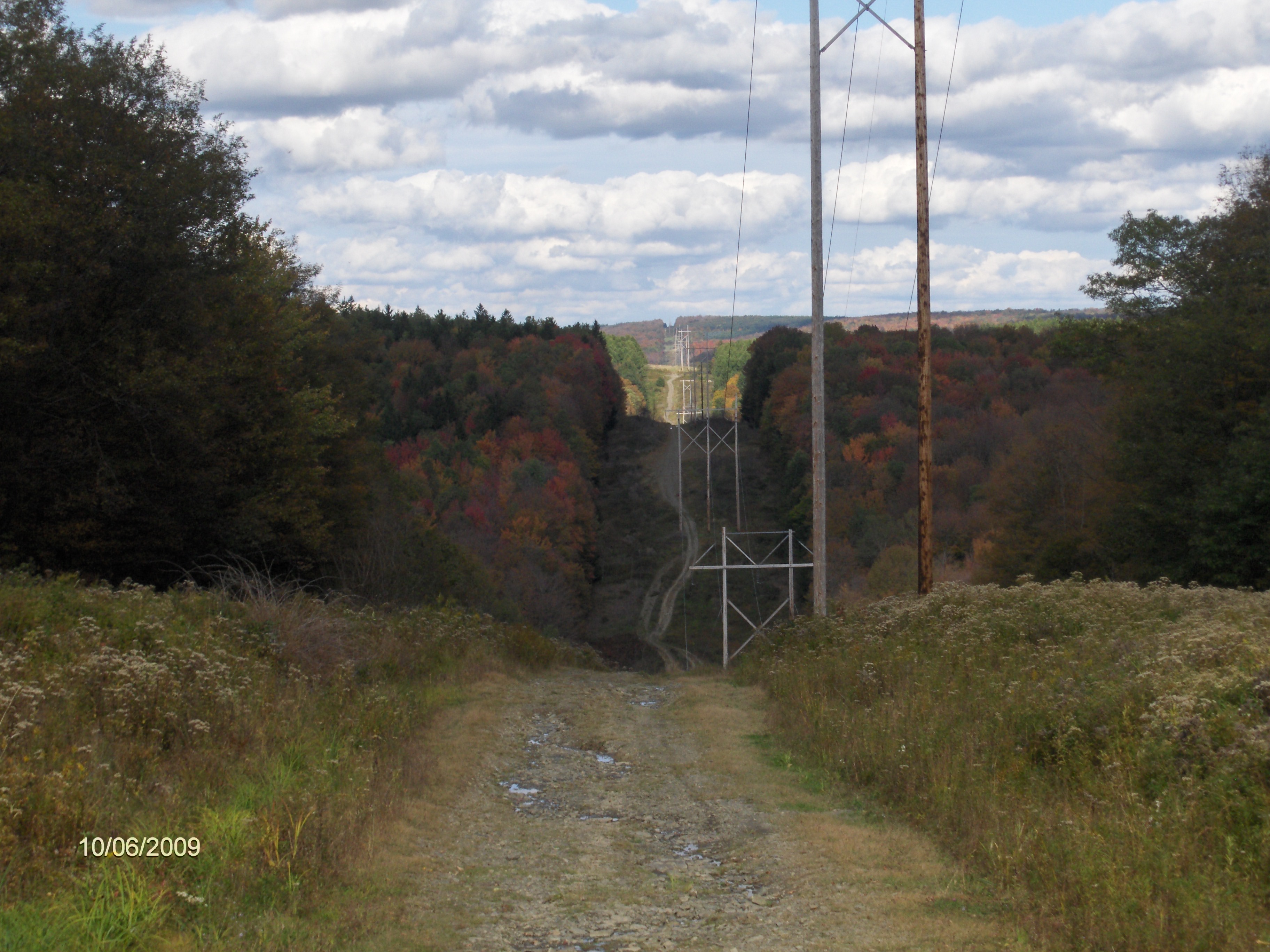
North Country Trail crossing a power line
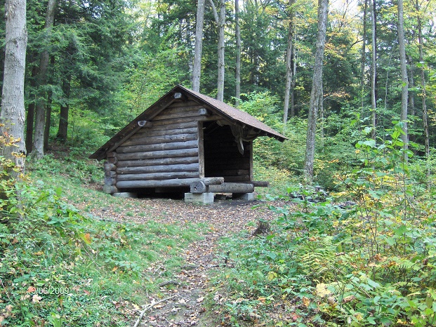
Hemlock Lean To
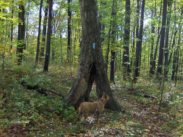
Snag tree along the NCT in Labrador Hollow Unique Area
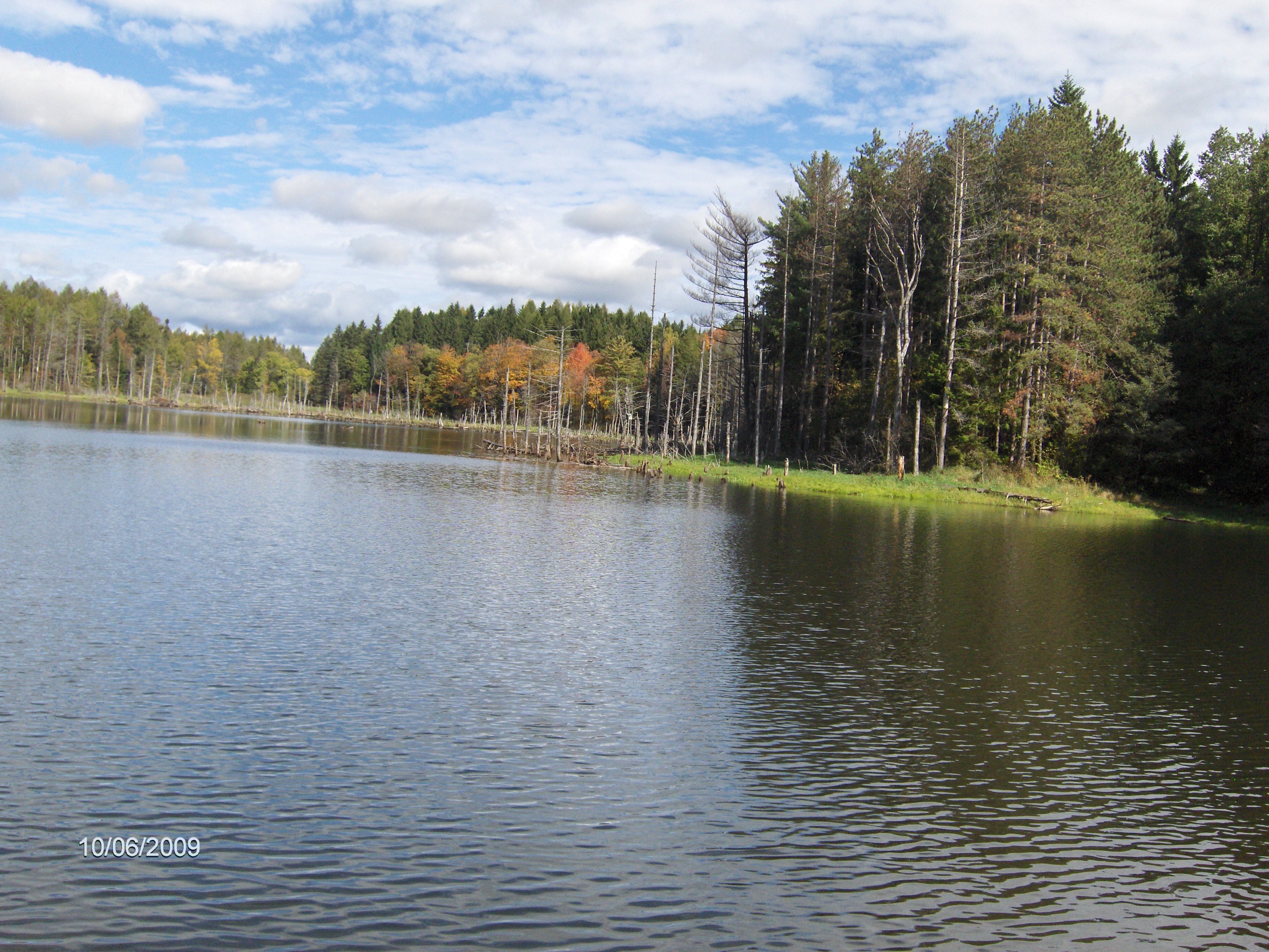
Shackham Pond in Morgan Hill State Forest
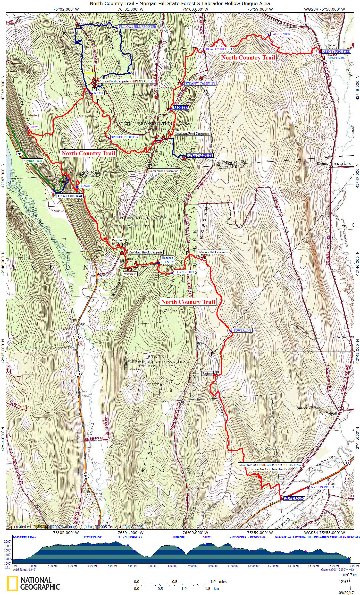
Guide to the Hiking Trails at Morgan Hill State Forest
includes Labrador Hollow Unique Area
**ONLY $5**
Created by CNY Hiking, this guide comes to you as a pdf file that you can either print out or send it to your smart phone or Kindle. You'll have maps & info on hikes at Morgan Hill State Forest at your finger tips. Use the Buy Now button below and we'll send you the pdf file via email usually within 24 hours of payment.
Mile Elevation Trail Description (Follow blue blazes) 0.0 1178 feet Large DEC parking area off NY 13 at Tioughnioga River Bridge. Turn left and follow NY 13. WARNING: busy road.
GPS coordinates N42 43.443 W75 58.253.0.4 1188 feet Turn right on West Keeney Road and then a quick left off road onto farm tractor lane. Entering PRIVATE PROPERTY. STAY ON TRAIL. NO CAMPING ON PRIVATE PROPERTY! No parking available here.
NOTE: This stretch of trail from here to the Morgan Hill State Forest boundary is CLOSED for HUNTING from Nov 15 to Dec 25.0.6 1207 feet Turn left 0.7 1234 feet Turn right 0.8 1267 feet Turn left and begin steep uphill climb with many switchbacks. 1.85 1764 feet Turn left 2.0 1816 feet Cross an old section of Chickadee Hollow Road. 2.5 1844 feet Cross an old section of Chickadee Hollow Road. Entering Morgan Hill State Forest 2.95 1861 feet Cross Chickadee Hollow Rd.
3.3 1870 feet Trail register and then cross seasonal dirt Chickadee Hollow Road (parking along shoulder of dirt road).
GPS N42 44.720 W75 59.6634.0 1854 feet Cross under power lines.
5.1 1998 feet Highest point along trail in Morgan Hill State Forest. Off to your right is the old Morgan Hill Fire Tower & camping area. No water available here.
5.3 1939 feet Cross seasonal dirt Morgan Hill Rd (parking along shoulder of road). Begin descending.
GPS N42 46.099 W76 00.0985.65 1809 feet Cross a scenic ravine. This is Hemlock Glen Brook that your crossing. Soon turn right on old snowmobile trail. 5.8 1828 feet Turn right off old snowmobile trail and begin steep descent into Hemlock Glen. 6.1 1554 feet Cross Hemlock Glen Brook and then reach a side trail to right leads 150 feet to Hemlock Lean-To
6.3 1454 feet Pass a campsite on the right and soon a small waterfall on the left. 6.8 1304 feet Cross Shackham Brook on footbridge and reach the Shackham Brook camping area.
6.9 1349 feet Cross paved Shackham Road (shoulder parking). Soon a trail register and then start ascending, sometimes steeply. GPS N42 46.183 W76 01.148 7.6 1828 feet The trail levels off.
8.1 1795 feet Enter Labrador Hollow Unique Area. The descent will soon become steeper.
8.3 1684 feet Pass an impressive stone bench. Continue steep descent on switchbacks. 8.65 1422 feet Descend on wooden stairs and soon reach ledge/rim of Tinker Falls. Trail will ascend quickly on switchbacks.
8.8 1529 feet Junction of the orange blazed Skyline Trail. Blue blazed North Country Trail turns right. Skyline Trail goes straight steeply ascending to NY 91 parking area in 0.3 miles. GPS N42 46.820 W76 02.182 9.1 1718 feet Turn right on hang glider access road. 9.4 1862 feet Turn right off hang glider access road. 9.7 1918 feet Reach clearing with great views to the west. This spot is known as the hang glider spot. Follow access road.
9.8 1903 feet Turn left off access road
10.3 1746 feet Cross small stream.
10.6 1904 feet Re-enter Morgan Hill State Forest. Soon begin steep descent toward Spruce Pond.
11.0 1700 feet End of descent, reach Spruce Pond. Junction of the orange blazed Fellows Hill Loop Trail. NCT turns right. 11.1 1694 feet Reach North Country Trail Kiosk. (Parking 150 feet to left) Spruce Pond Camping area along east side of pond (FREE permit from DEC needed to camp). Orange blazed Fellows Hill Loop Trail goes left here.
GPS N42 47.961 W76 01.53411.3 1687 feet Cross seasonal dirt Herilhy Road with limited parking. GPS N42 47.820 W76 01.519 11.9 1576 feet Trail register.
12.4 1719 feet Begin steep descent toward Shackham Road. 12.9 1538 feet Cross paved Shackham Road (shoulder parking). GPS N42 47.400 W76 00.618
13.0 1505 feet Cross small outlet stream of Shackham Pond. Trail turns right and passes by old family cemetery on your right. The cemetery campsite is located nearby. Trail passes pond on the earthen dam.
13.05 1513 feet Trail turns left. An old snowmobile trail goes straight. 13.1 1515 feet Trail veers right. A herd path that goes straight leads to the Pond Campsite. 13.5 1504 feet Cross seasonal dirt Onondaga One Rd (Herlihy Rd EXT) (Parking) GPS N42 47.743 W76 00.377
13.9 1501 feet To the left of the trail is a stone rock fire pit near a small scenic stream (about 50 feet from trail) known as the Scrappy Campsite. 14.6 1544 feet Cross seasonal dirt Rowley Hill Rd (parking). GPS N42 48.431 W75 59.875
14.8 1497 feet Cross a tributary of Fabius Brook.
15.3 1620 feet State Forest Boundary, entering PRIVATE PROPERTY. Trail is now descending.
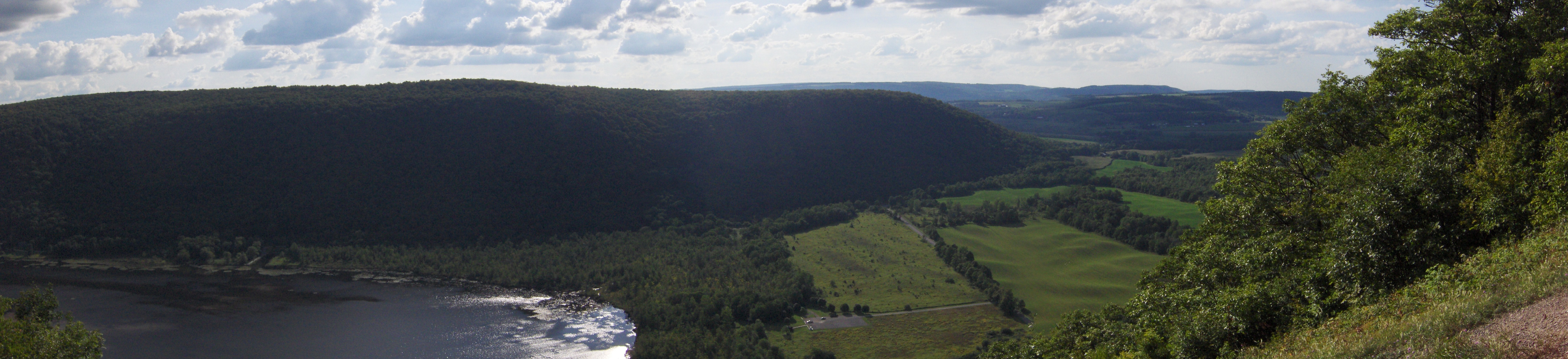
15.8 1454 feet Enter edge of field, "Fabius View" (look below for a panoramic picture).
16.9 1243 feet Trail register and soon reach West Keeney Road turn right and reach Bardeen Road, which is the end of this section. See NCT in Highland Forest for continuation. Shoulder Parking. GPS N42 48.332 W75 58.033
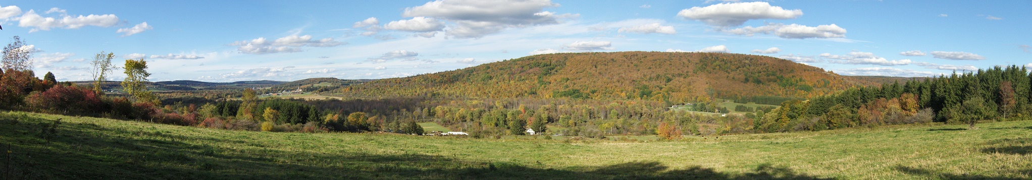
Fabius View from along the North Country Trail
| CNY Hiking Home Page | Morgan Hill State Forest | North Country Trail in CNY |
| North Country Trail in New York | Morgan Hill Long Loop | Skyline Trail |