| Best of the NCT in New York | NCT in New York | NCT in Western New York | NCT in Central New York | CNY Hiking HOME PAGE |
|
Hiking
in Cortland County Best of the North Country Trail in New York Woodchuck Hollow Woodchuck Hollow Lean To
|
Here is a hike where the total distance is completely up to you. You can hike from Carson Road along the North Country Trail to the Woodchuck Hollow Lean To for a short 1.4 mile one way hike or you can continue along the North Country Trail for another one mile to explore the beauty of Woodchuck Hollow. If you do go all the way to the Neal Brook Trail junction, you'll have a 4.8 mile round trip hike.
There is little doubt why we've labeled this section of the trail as one of the best along the North Country Trail in New York. We included a video from You Tube of this hike below. There are also pictures, a map and a detailed description of this hike below.
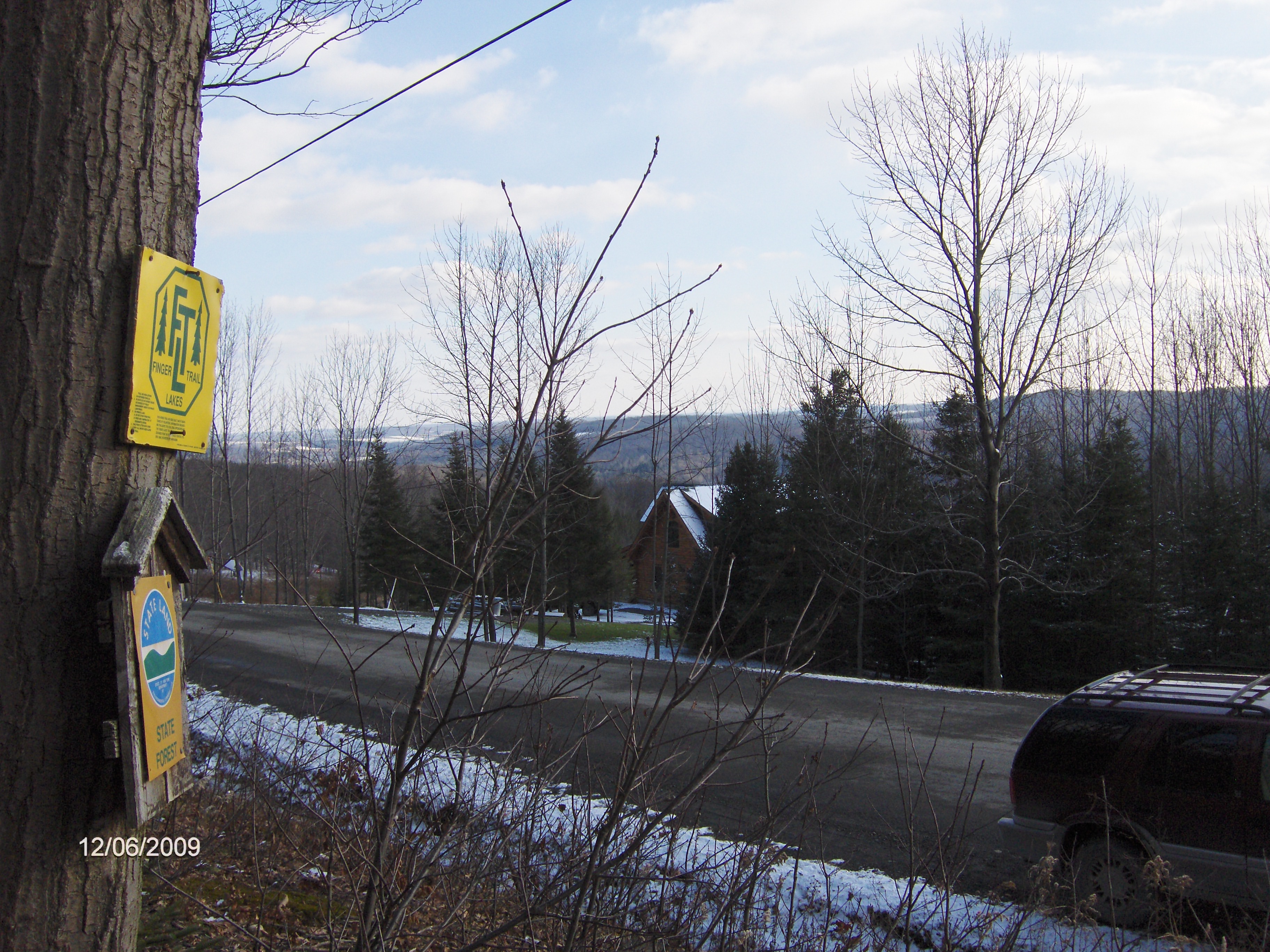
Parking is along the side of Carson Road and be very careful of the ditch by the side of the road. There are some nice views as you prepare to start the hike including the ski slopes of Greek Peak. The trail immediately climbs gently as you start with yellow boundary markers almost everywhere.
Soon the trail veers right and soon merges with an old woods road as the trail runs parallel with an old stone wall. The trail will veer to the left and reach a high point. The trail descends on good grades and crosses a few small streams before reaching another old road. This area is wet as the trail follows the old road briefly before veering left.
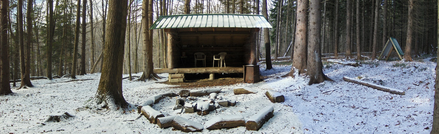
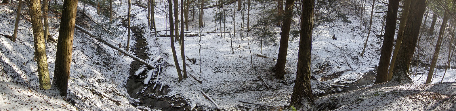
There's a nice view from atop a ravine of a stream. The trail runs briefly runs along the top of the ravine. You'll pass under a couple of unique blow downs that have become "arches" on the trail. The trail descends to next to a stream before turning up an old road. You see the lean to in the short distance. There is no marked trail that leads to the lean to. A short steep hike off the main trail up a bank brings you closer to the lean to.
There is a new "open aire" privy that one needs to walk almost 0.2 mile uphill along a blue blazed trail to reach the privy. The hike to the lean to was 1.4 miles. The North Country Trail continues north along Woodchuck Hollow for nearly another mile. It is an area worth exploring. The NCT coincides with the Finger Lakes Trail during this section.
Directions: From NY 392, turn onto Carson Road and drive to the Finger Lakes Trail sign on the northside of the road. Park along the side of the road (be careful of the ditch). The GPS coordinates are N42 30.193 W76 06.735 for those who have a GPS devise.
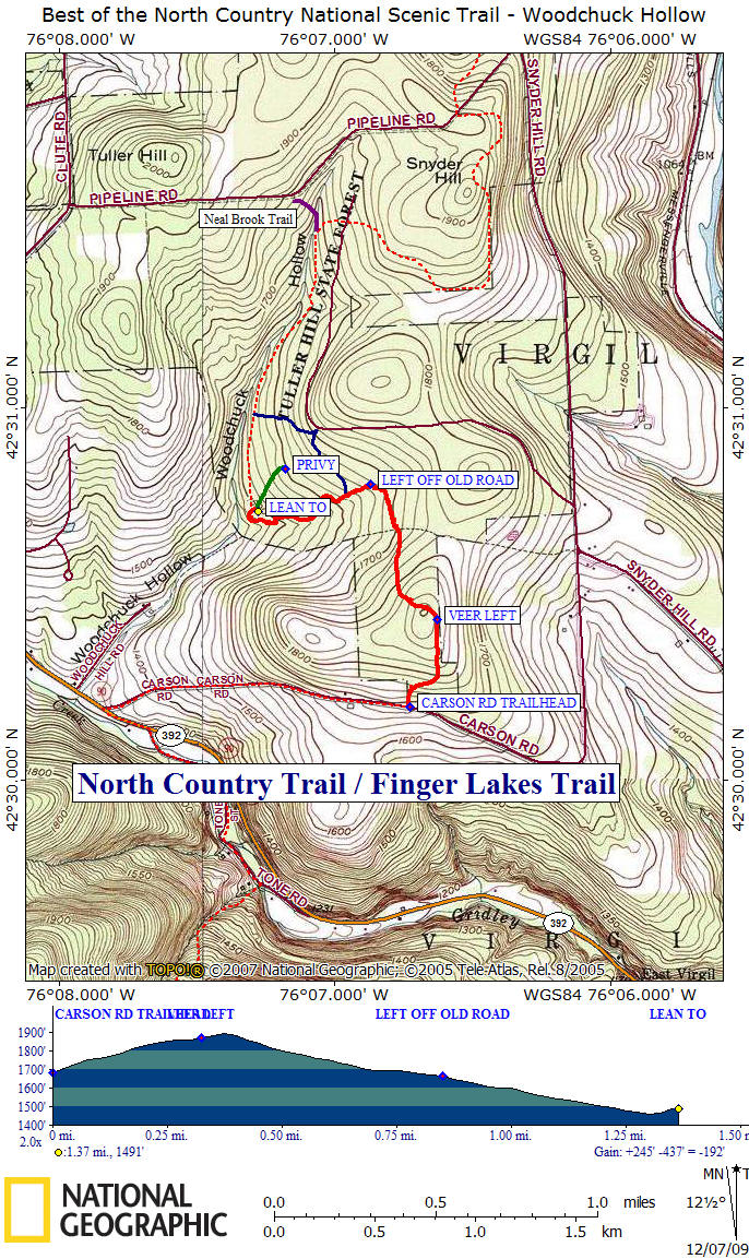
Mile Elevation Description 0.0 1683 feet From Carson Road, the trail enters Tuller Hill State Forest. Follow white blazes. Ascending.
0.2 1842 feet Trail now following old woods road. Old stone wall on right.
0.3 1869 feet Trail veers left off old woods road.
0.4 1894 feet Highest point along this hike.
0.8 1677 feet Trail reaches and now follows an old road.
0.85 1663 feet Trail veers left off old road.
0.95 1622 feet Junction of blue blazed access trail that leads 0.5 miles to seasonal dirt Cortland Nine Road.
1.1 1552 feet Nice viewpoint of stream below from top of ravine.
1.2 1525 feet First of two "blow down arch's" along the trail. Second is a few hundred feet ahead.
1.3 1467 feet Turn right off main North Country Trail to lean to ahead.
1.4 1491 feet Reach the Woodchuck Hollow Lean To. End of this hike or you can continue up along the North Country Trail for another mile in Woodchuck Hollow. Simply retrace your steps to return to trailhead.
Pictures from along the North Country Trail
Trailhead on Carson Road
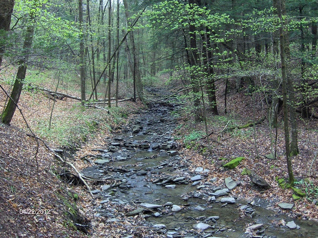
Stream near Woodchuck Hollow Lean To
| Best of the NCT in New York | NCT in New York | NCT in Western New York | NCT in Central New York | CNY Hiking HOME PAGE |