Hiking in Catskill Park
Shavertown
Trail
![]()
| CNY Hiking HOME PAGE | Catskill Waterfalls | Delaware County | Catskill Forest Preserve | Catskill 67 |
|
Hiking in Delaware County Hiking in Catskill Park Shavertown Trail
|
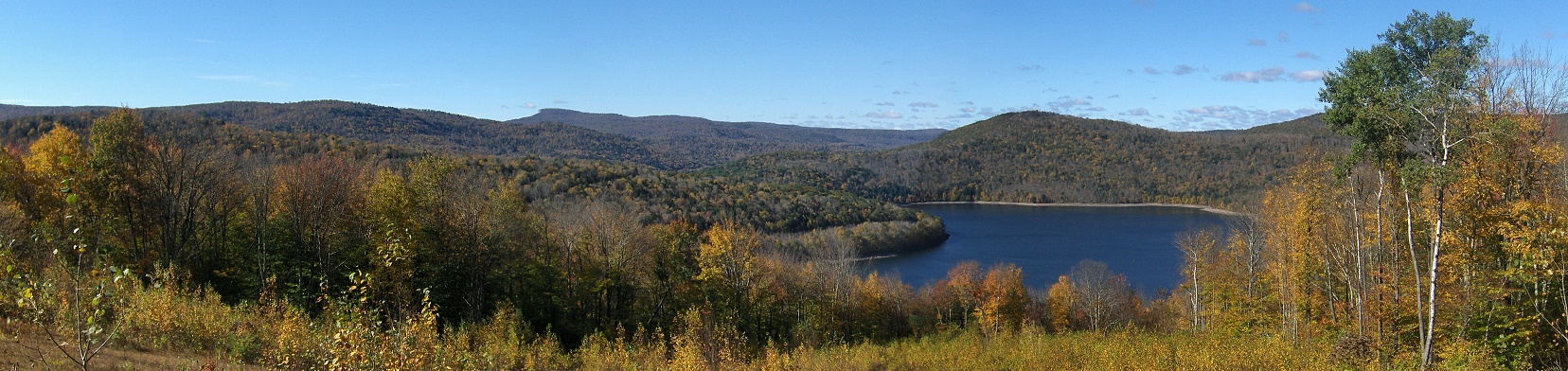
The Shavertown Trail was built and is maintained by the Catskill Mountain Club as a partnership with the New York City Department of Environmental Protection (NYC DEP) and the town of Andes. The trail features a beautiful pond with a scenic overlook of Pepacton Reservoir as well as a pleasant walk through the woods past craggy boulders. It's a one mile hike to Snake Pond and the scenic overlook. If you walk the whole trail it's a 5.3 mile round trip hike.
The one mile hike to Snake Pond and the scenic overlook has an overall elevation gain of 521 feet. The rest of the trail doesn't feature any views, just a nice walk in the forest. There is very limited parking along the side of the road across from the trailhead sign. The start of the trail is located on BWS Road 4 just off NY 30 north of the Shavertown Bridge over the Pecacton Reservoir, east of Downsville. The GPS coordinates of the start of the trail are N42 05.441 W74 49.198 for those who have a GPS devise. We suggest that you use the DEP parking area that is located about 200 feet south from the start of the trail.
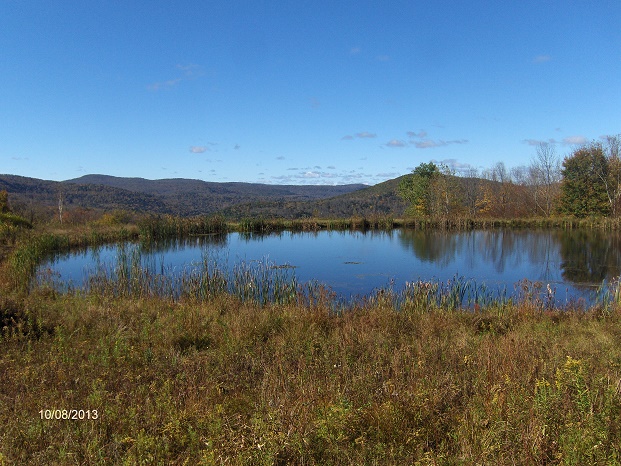
Snake Pond
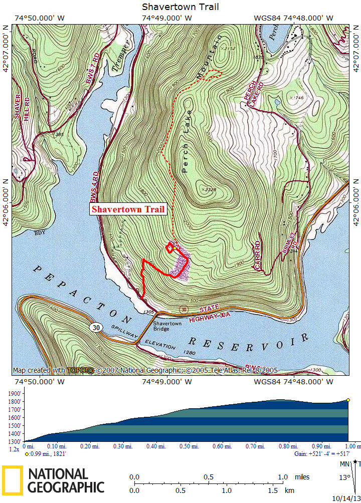
Elevation profile of above map is only for the hike around pond & to the scenic overlook
| CNY Hiking HOME PAGE | Catskill Waterfalls | FLT Eastern/Catskill Section | Catskill Forest Preserve | Catskill 3500 Club |