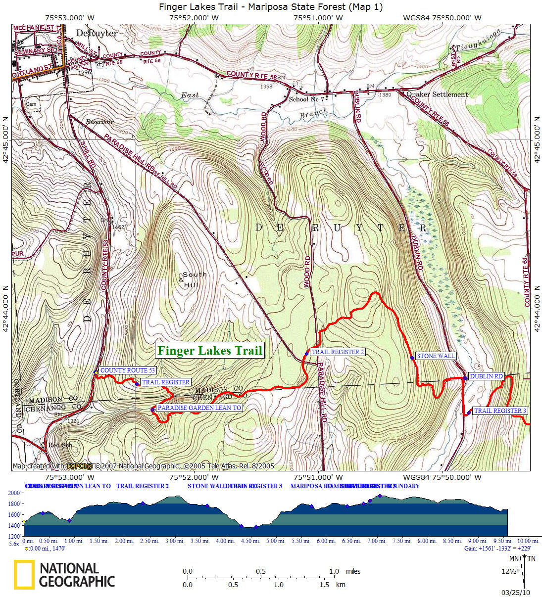
Hiking in Madison County
Finger Lakes Trail
Mariposa
State Forest
![]()
| Finger Lakes Trail | FLT Central Section | Mariposa State Forest |
|
Hiking in Chenango County Hiking in Madison County Finger Lakes Trail Mariposa State Forest
|

The Finger Lakes Trail enters Mariposa State Forest from the west off Linklaen Road aka Madison County Route 53. This is a newer section of trail due to the closure of trail by a private landowner near Chippewa Falls and Cuyler Hill State Forest. Now there is a road walk prior to entering Mariposa State Forest. This section starts 0.2 miles north of the Chenango-Madison County line. From the trailhead, ascend and follow the old woods road until the trail turns left off the old road.
There are some winter views as you ascend into a new growth forest before entering a pine forest as you reach the first of several trail registers in Mariposa State Forest. Soon you'll a spring on your right. The trail descends and crosses a stream. The trail turns right after the stream crossing and soon you will reach Paradise Garden Lean To. This lean to was rebuilt in August 2008 by the Onondaga Chapter of the Adirondack Mountain Club. The Finger Lakes Trail was rerouted in 2009 to bring the trail closer to the lean to. The old 0.4 mile trail is marked with orange blazes and can be used by those who want to create a loop hike.
Before reaching Paradise Hill Road there are remnants of an old circus stable just off the trail. The trail reaches an elevation of 1947 feet near Stage Coach Hill and then passes an old foundation from many years ago. The trail reaches Dublin Road at an elevation of 1377 feet, follows the road for 0.2 miles and then turns into the woods then climbs again.
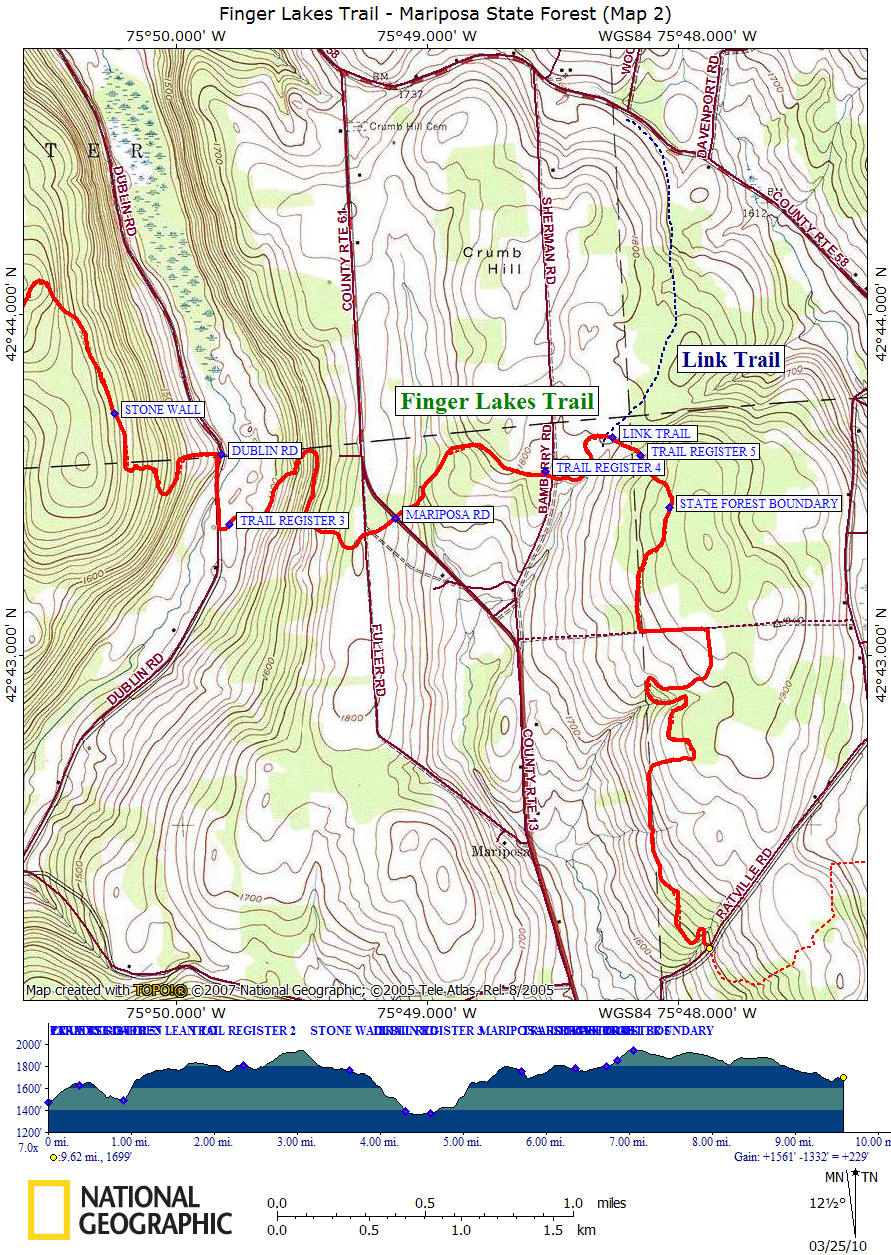
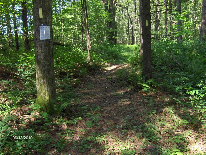
Soon after crossing Bamberry Road the trail reaches the junction of the southern terminus of the yellow blazed Link Trail. The Link Trail heads north toward Cazenovia with it's northern terminus in Canastota at the Erie Canal Trail. The Link Trail coincides with the North Country Trail from Tioughnioga WMA to Canastota.
After the Link Trail junction the climbs to another high point at 1945 feet before leaving the forest and entering private land on its way to Bucks Brook State Forest. Please note the the trail between Mariposa and Bucks Brook State Forest is CLOSED on private property for hunting between OCT 1 - DEC 31. Please respect the landowners request and stay off the trail during these dates.
This section of trail ends at the Ratville Road crossing of the trail in Bucks Brook State Forest. This stretch of the Finger Lakes Trail is featured on map M22 from the FLTC.
While in the area check out Alice's Dowry Bed & Breakfast in Cincinnatus. It's conveniently located for those looking to hike the Finger Lakes Trail.
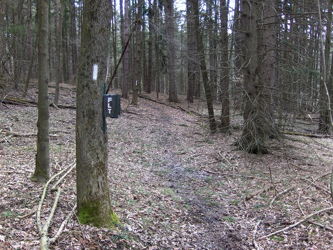
Trail register along trail near CR 53
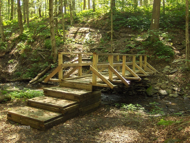
Bridge over small stream east of Mariposa Road
Junction of the yellow blazed Link Trail
Mile Elevation Description (west to east) 0.0 1470 ft Madison County Route 53 Trailhead (Linklaen Street). Ascend old woods road. GPS N42 43.623 W75 52.795
0.4 1625 ft Trail Register
0.7 1517 ft Cross stream, then turn right. Old trail goes left with orange blazes 0.4 miles.
0.9 1495 ft Paradise Garden Lean-To. Trail passes right by lean to and then ascends, somewhat steeply.
2.3 1809 ft Cross Paradise Hill Rd, then pass a trail register.
2.5 1786 ft Cross Wood Rd
3.05 1947 ft The highest point along the FLT in Mariposa State Forest, begin descending.
3.65 1760 ft Pass an old stone wall. Descent will become steeper.
4.3 1377 ft Reach Dublin Road (parking area) and turn right following road.
4.5 1369 ft Trail turns left into forest.
4.6 1377 ft Trail register
5.6 1789 ft Cross an old woods road.
5.7 1755 ft Cross Mariposa Road
5.8 1694 ft Cross a small stream
6.4 1779 ft Trail register, then cross Bamberry Road (parking)
6.75 1786 ft Junction on the left with the yellow blazed Link Trail
6.9 1851 ft Trail register
7.1 1945 ft High point, entering PRIVATE LAND. The trail a couple of miles ahead is closed from 10/1-12/31.
7.55 1881 ft Turn left on old road.
7.8 1926 ft Turn right off old road.
8.2 1813 ft Cross stream. Trail ahead is closed from 10/1-12/31.
8.8 1823 ft This section of trail is closed 10/1-12/31 from here to Bucks Brook State Forest.
9.45 1668 ft Entering Bucks Brook State Forest.
9.6 1703 ft Reach seasonal dirt Ratville Road. Parking along side of road.