Catskill Forest Preserve
Delaware Wild Forest
Campbell
Mountain
![]()
| CNY Hiking HOME PAGE | Finger Lakes Trail | FLT Eastern/Catskill Section | Catskill Forest Preserve |
|
Finger Lakes Trail Catskill Forest Preserve Delaware Wild Forest Campbell Mountain
|
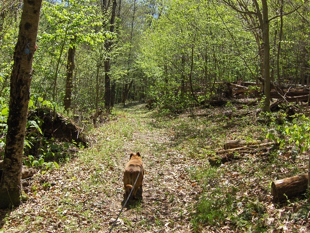
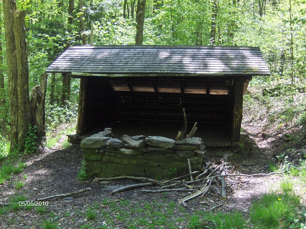
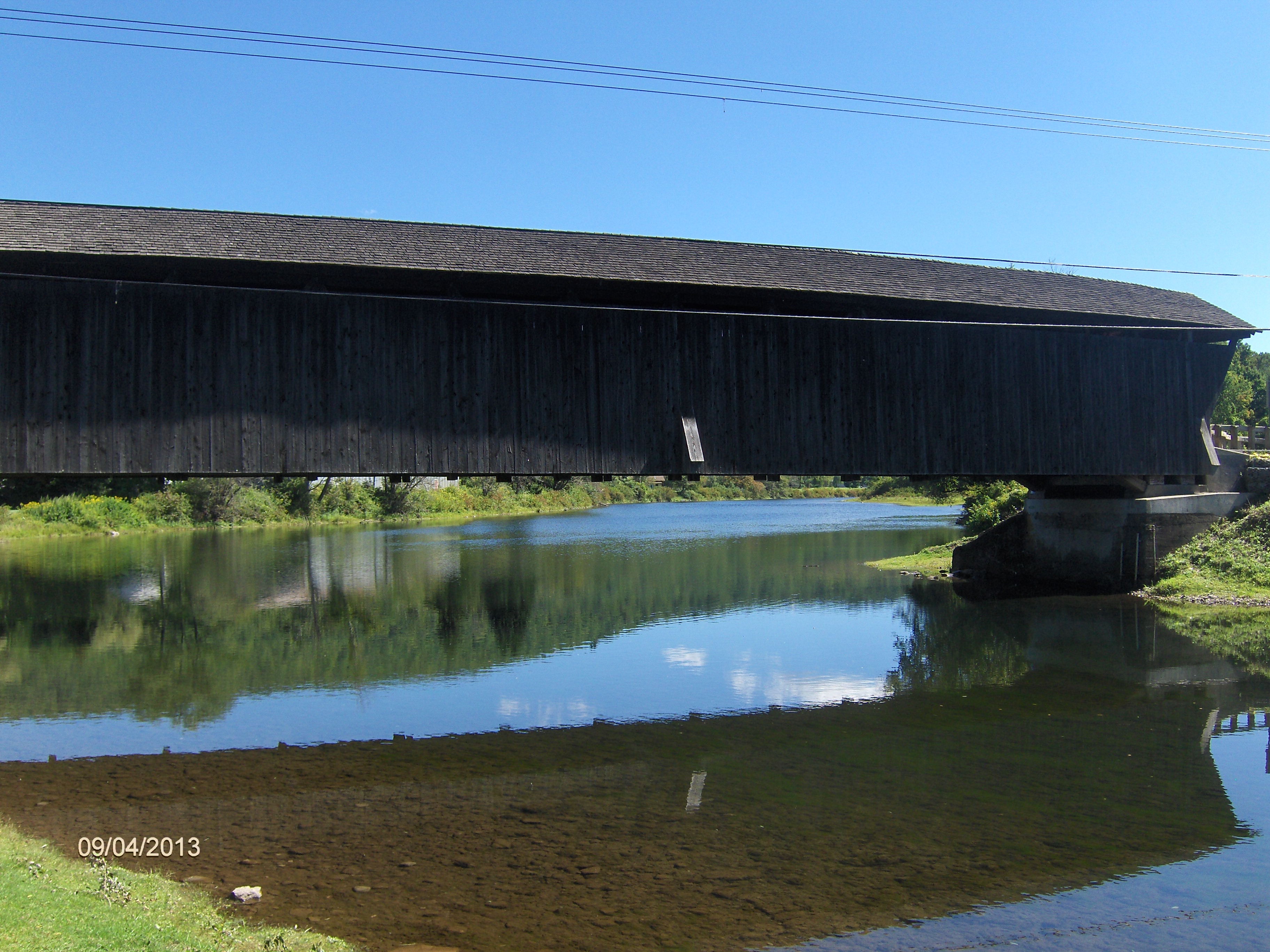
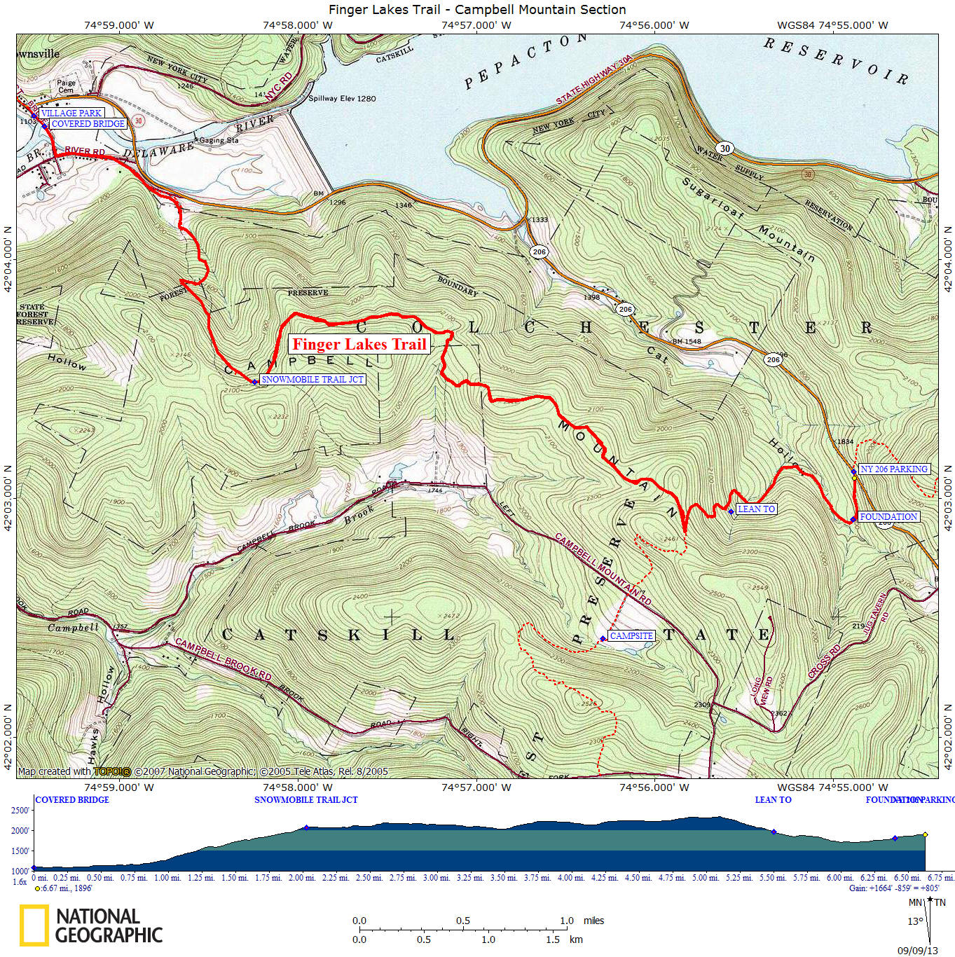
This section of the Finger Lakes Trail is the start of the FLT in the Catskill Forest Preserve as you cross the East Branch Delaware River over the Downsville Covered Bridge. This 6.7 mile section of the trail is mostly within Delaware Wild Forest section of the Catskill Forest Preserve and climbs Campbell Mountain. While not a 3500er, this section still takes the trail to a height of over 2300 feet. This moderate section of trail has an overall elevation gain of 805 feet and also has a lean to.
During this section the Finger Lakes Trail follows multi-use trails that are also used by snowmobiles in the winter. You are no longer following white blazes within the Catskill Forest Preserve, except in limited locations. Now you begin following DEC discs as the FLT follows trails within the Catskill Forest Preserve. This section begins as you cross the East Branch of the Delaware River on the historic Downsville Covered Bridge. There is excellent parking at the Village Park located prior to crossing the bridge. As soon as you step off the bridge you are in Catskill Park.
The trail follows a few rural roads in Downsville before finally turning right down a private driveway on Mink Brook Road to the yellow FLT sign and the start of the off road section. Your following an old logging road and will soon enter Delaware Wild Forest of the Catskill Forest Preserve. Eventually the trail will reach and follow a snowmobile trail marked with orange discs. The trail will cross one of the summits of Campbell Mountain before finally reaching and turning onto the Campbell Mountain Trail, marked with blue discs. You are now descending.
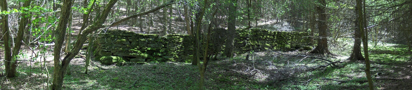
The trail will soon pass the Campbell Mountain Lean To with a side trail on your right. The trail passes near a few large stone foundations. Looks like the area was some type of complex a long time ago. See panorama above on the largest of the ruins. You may notice a seasonal piped spring on your right after passing under power lines. You'll hear the occasional traffic noise as the trail climbs toward NY 206 and finally reaching a trail register, kiosk and small parking area on the busy highway. The Finger Lakes Trail continues across NY 206. For a continuation see FLT-Brock Mountain section.
We have a few pictures, map and detailed description of this section of the Finger Lakes Trail below. We also have a video of our hike from NY 206 to Campbell Mountain Lean To in 2010 below. The official Finger Lakes Trail Conference website has up to date trail conditions as well as hiking maps you can purchase from them. This stretch of trail is featured on map M30 from the FLTC.
Directions from Syracuse: This section of the Finger Lakes Trail is over 120 miles away from Syracuse and is a 2.5 hour trip. I-81 south to Exit 8 Whitney Point. Turn left on US 11 south, then left on NY 26 to a quick right on NY 206. NY 206 to Downsville and then right on Bridge Street. The Village Park is on your right just before the Downsville Covered Bridge.
Hiking the Finger Lakes Trail
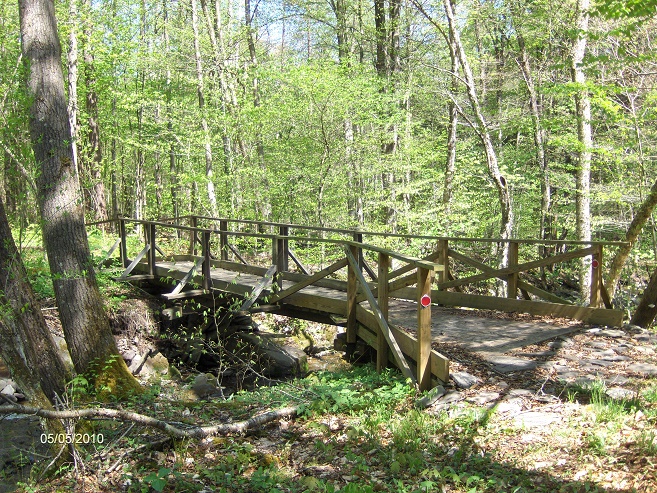
Bridge over stream in Cat Hollow
Campbell Mountain Lean To
Downsville Covered Bridge over East Branch Delaware River
Mile Elevation Trail Description 0.0 1091 feet Cross East Branch Delaware River on Downsville Covered Bridge. Entering Catskill Forest Preserve. Follow road.
0.15 1099 feet Turn right on River Road. 0.4 1111 feet Veer right onto Mink Brook Road. 0.7 1143 feet Turn right onto private driveway and head toward yellow FLT sign. 1.0 1296 feet Cross stream and soon enter Delaware Wild Forest. Ascending.
2.05 2075 feet Turn left on DEC snowmobile trail marked with orange discs.
5.15 2339 feet Reach the Campbell Mountain Trail marked with blue discs. Turn left and descend following Campbell Mountain Trail.
5.55 1971 feet A short side trail that leads to the Campbell Mountain Lean To is on your right.
6.3 1735 feet Cross stream on bridge.
6.45 1765 feet Large rock foundations located near trail and soon a seasonal piped spring is on your right.
6.7 1893 feet Pass a gate and reach NY 206 and the end of this section. Parking. Trail Register. The FLT continues across the road. For a continuation see Brock Mountain.
| CNY Hiking HOME PAGE | Finger Lakes Trail | FLT Eastern/Catskill Section | Catskill Forest Preserve |