Catskill Forest Preserve
Middle Mountain Wild Forest
Balsam Lake Mountain Wild Forest
Big Pond to
Alder Lake
![]()
| CNY Hiking HOME PAGE | Finger Lakes Trail | FLT Eastern/Catskill Section | Catskill Forest Preserve |
|
Finger Lakes Trail Catskill Forest Preserve Middle Mountain Wild Forest Balsam Lake Mountain Wild Forest Big Pond to Alder Lake
|

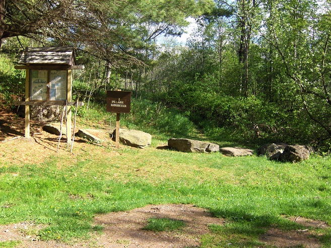
This 3.3 mile section of the Finger Lakes Trail follows the red discs of the Touchmenot Trail and is within Middle Mountain as well as Balsam Lake Mountain Wild Forests of the Catskill Forest Preserve. This section also marks the trail crossing over from Delaware County to Ulster County as you start from the small parking area near Big Pond. There is a kiosk and trail register where the trail leaves the parking area. The panorama above of Big Pond is from the parking area next to the road/pond.
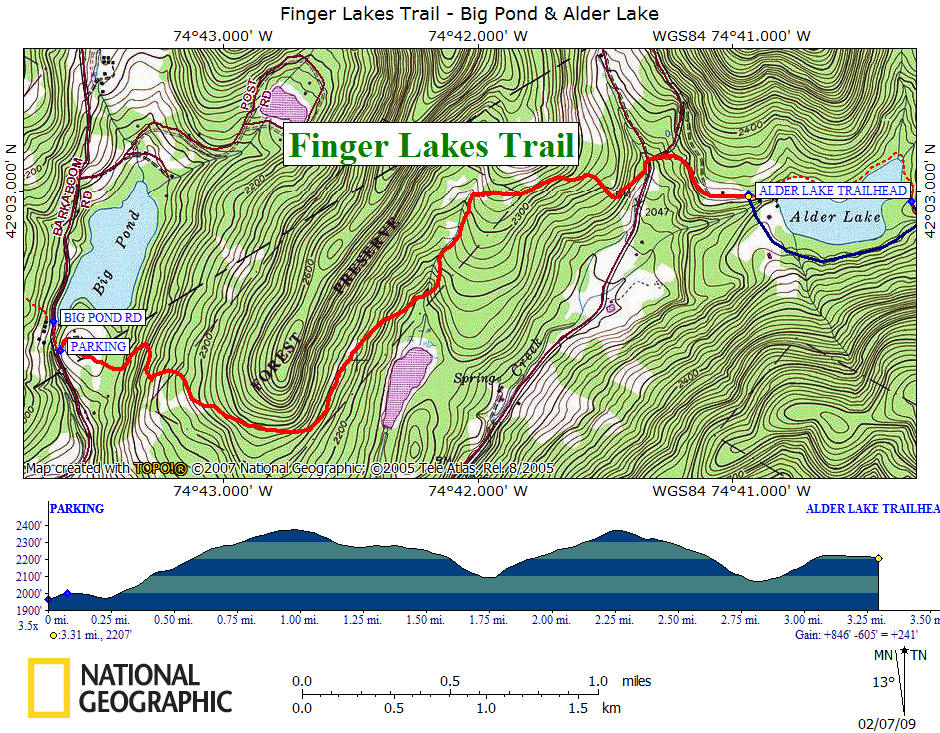
There is a total elevation gain of about 850 feet through this section. Although there are some steep sections, this is still a very easy to moderate section of the Finger Lakes Trail. This section is popular for those looking for remnants of the past. You can expect to see a few old stone foundations and a few old stone walls. The end of this section is at the parking area at Alder Lake. This stretch of the FLT is featured on map M31 from the FLTC.
Parking area, kiosk and trail register at Big Pond Trailhead
Directions from Syracuse: This section of the Finger Lakes Trail is over 160 miles away from Syracuse and is a 3 hour trip. I-81 south to NY 17 East. NY 17/I-86 East to Exit 94 Roscoe. Turn left on Stewart Ave, then right on old NY 17/CR 179. Sharp left on Beaverkill Rd/CR 152. Beaverkill Road becomes Turnwood Road/CR 54 after 9 miles. At the big bend turn left onto Big Pond Road prior to Turnwood General store. Follow road to Big Pond Trailhead on right (prior to reaching pond). The GPS coordinates for the parking area are N42 02.560 W74 43.600 for those who have a GPS devise.
You'll pass by the entrance to Little Pond State Campground on your way to the trail.
Mile Elevation Trail Description 0.0 1966 feet From the parking area off Big Pond Road the trail follows the TouchMeNot Trail. Follow red discs.
0.25 1975 feet Start of a sometimes steep ascent. You are now in Ulster County.
1.0 2378 feet High point. Trail now descends.
1.8 2097 feet Cross seasonal stream. Begin another sometime steep ascent.
2.2 2323 feet Trail turns right.
2.3 2373 feet Begin descending.
2.4 2327 feet Entering Balsam Lake Mountain Wild Forest.
2.9 2076 feet Alder Lake (Creek) Road. Turn left and follow road. Follow signs to Alder Lake.
3.0 2134 feet Veer right to Alder Lake.
3.3 2207 feet Alder Lake Trailhead parking area and the end of this section. For a continuation see Mill Brook Ridge.
| CNY Hiking HOME PAGE | Finger Lakes Trail | FLT Eastern/Catskill Section | Catskill Forest Preserve |