Catskill Forest Preserve
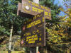
Balsam Lake Mountain Wild Forest
Mill Brook
Ridge
Alder Lake, Balsam Lake Mountain
![]()
| CNY Hiking HOME PAGE | Finger Lakes Trail | FLT Eastern/Catskill Section | Catskill Forest Preserve |
|
Finger Lakes Trail Catskill Forest Preserve Balsam Lake Mountain Wild Forest Mill Brook Ridge Alder Lake, Balsam Lake Mountain
|
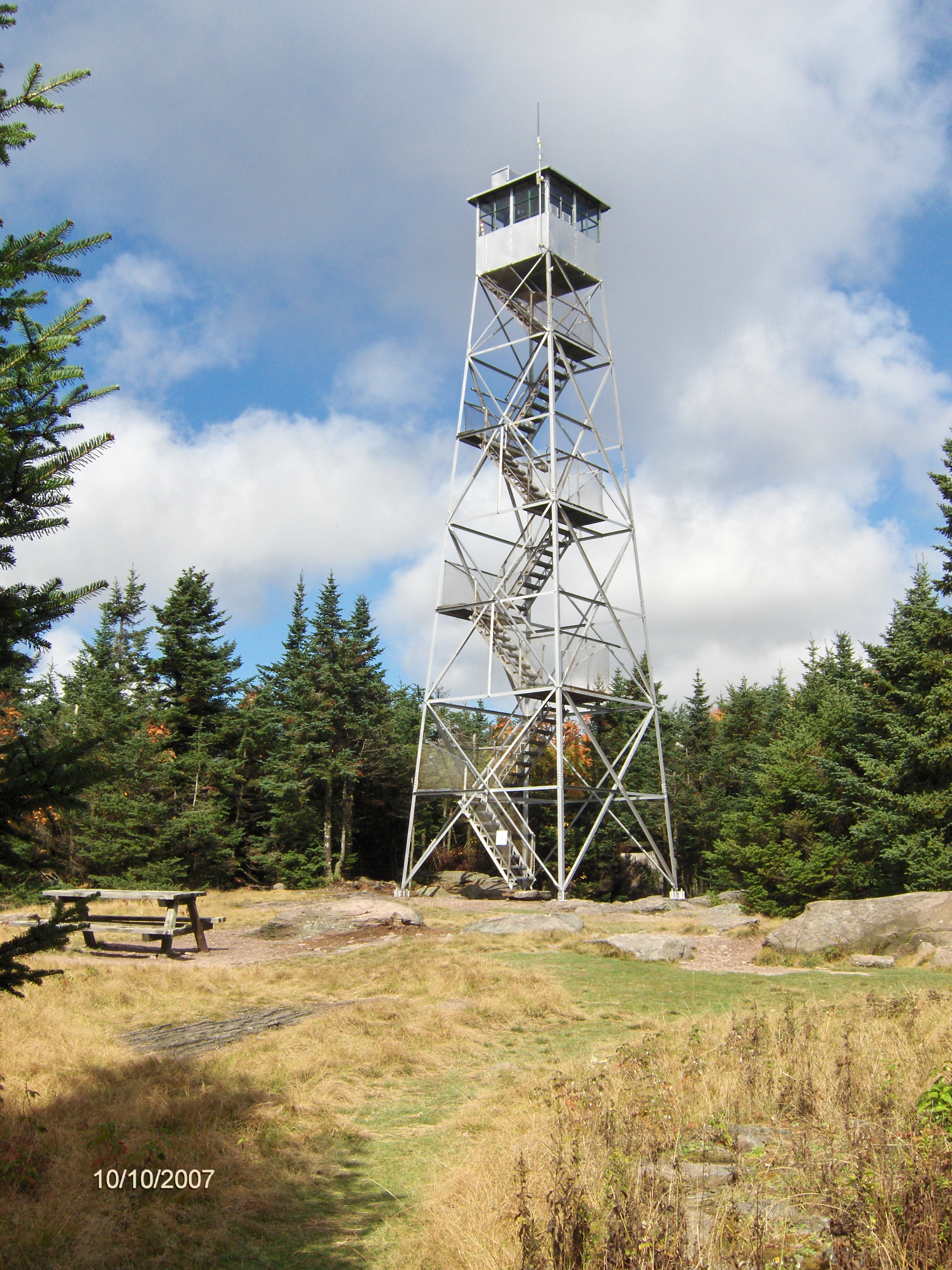
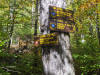
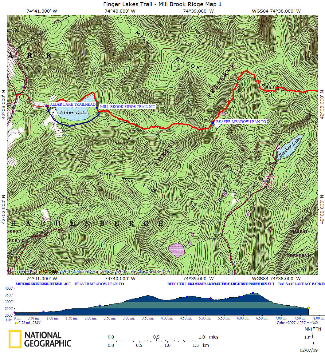
This 7.8 mile section of the Finger Lakes Trail within the Balsam Lake Mountain Wild Forest of the Catskill Forest Preserve may be the most popular section of the FLT in the Catskills. This section is possibly the most difficult anywhere on the FLT with a nearly 2100 foot overall elevation gain. The highlights within this section is the remains of the old Coykendall Lodge, Mill Brook Ridge, Balsam Lake Mountain (a short 0.2 mile side trip to the fire tower), Beaver Meadow and Balsam Lake Mountain Lean To, numerous views and the highest point of the whole 549 mile Finger Lakes Trail at 3660 feet.
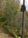
From the Alder Lake Trailhead, follow the Alder Lake Loop Trail (red discs) past the remains of the old Coykendall Lodge on the left. There are picnic tables here, so it's a great spot to relax and enjoy the view. When you reach the lake, take the trail to the left. This first part is a pleasant walk along Alder Lake passing numerous campsites on your left. Reaching the Mill Brook Ridge Trail (yellow discs) marks the end of a pleasant walk and begins your ascent up Mill Brook Ridge.
After 2.25 miles you reach Beaver Meadow Lean To. After leaving Beaver Meadow the trail becomes steep again as you continue to ascend toward Mill Brook Ridge. After almost three miles of walking you reach Mill Brook Ridge, however your still not done climbing until you reach the high point of the trail on the ridge at 3476 feet in another 0.5 mile.
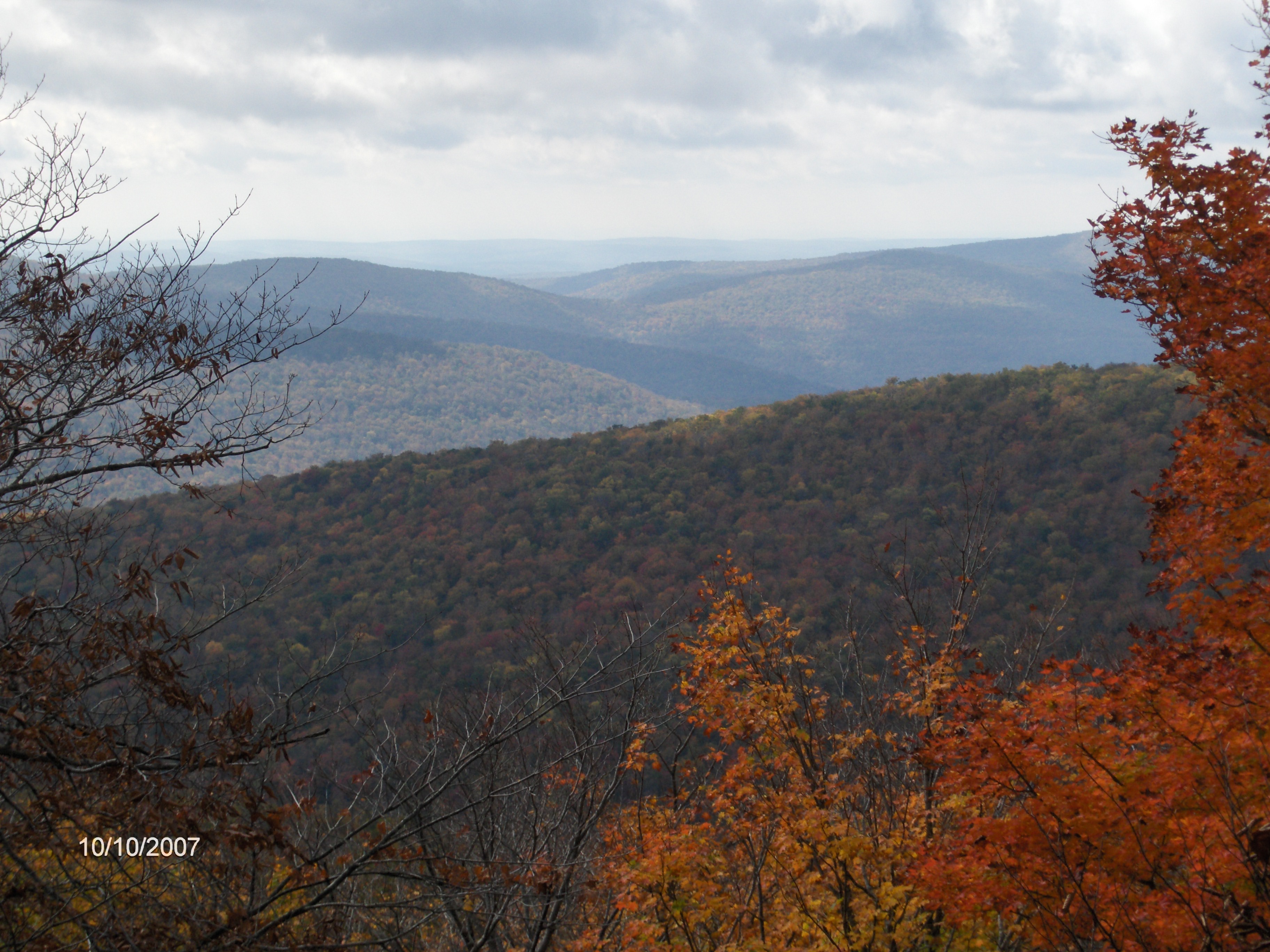
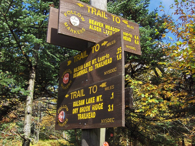
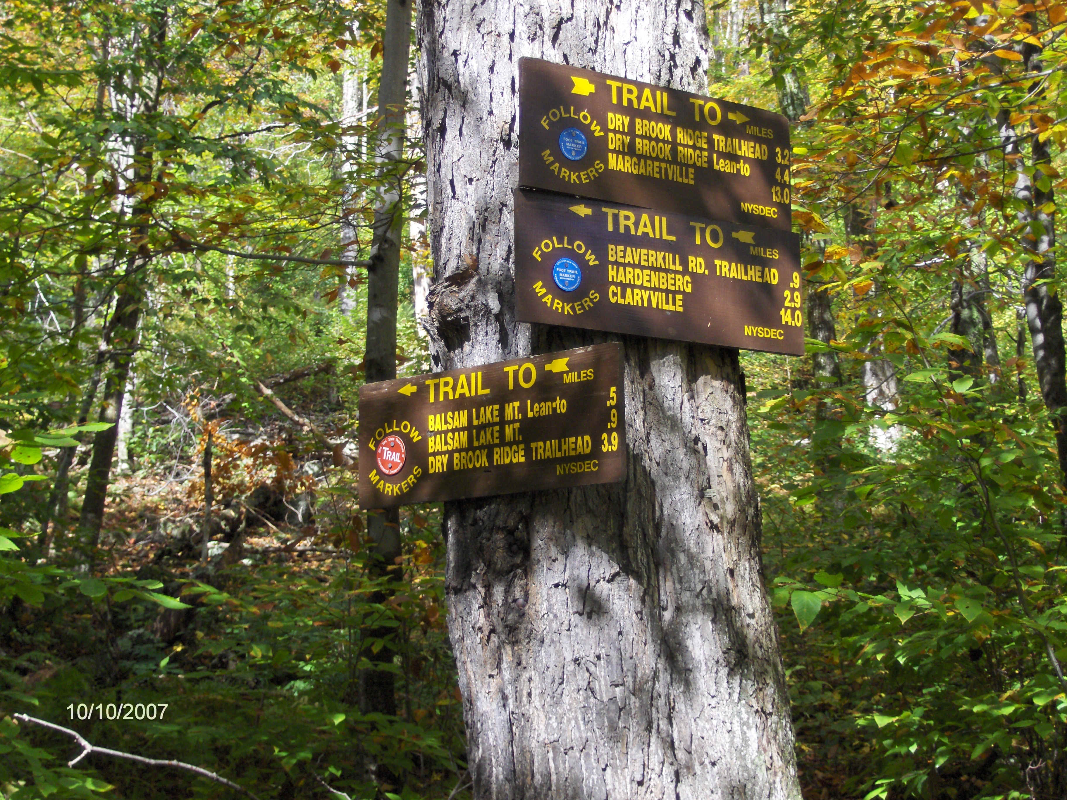
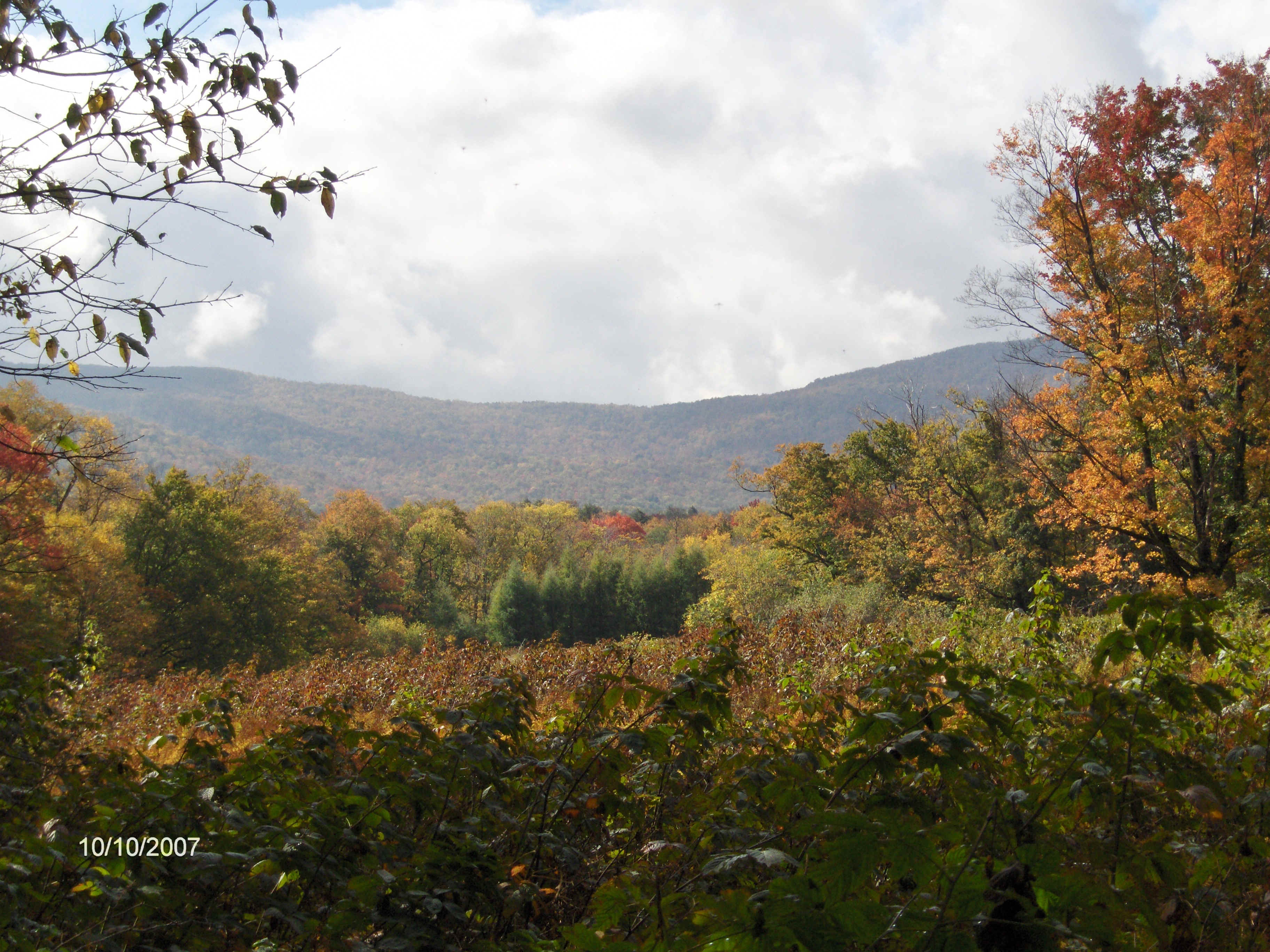
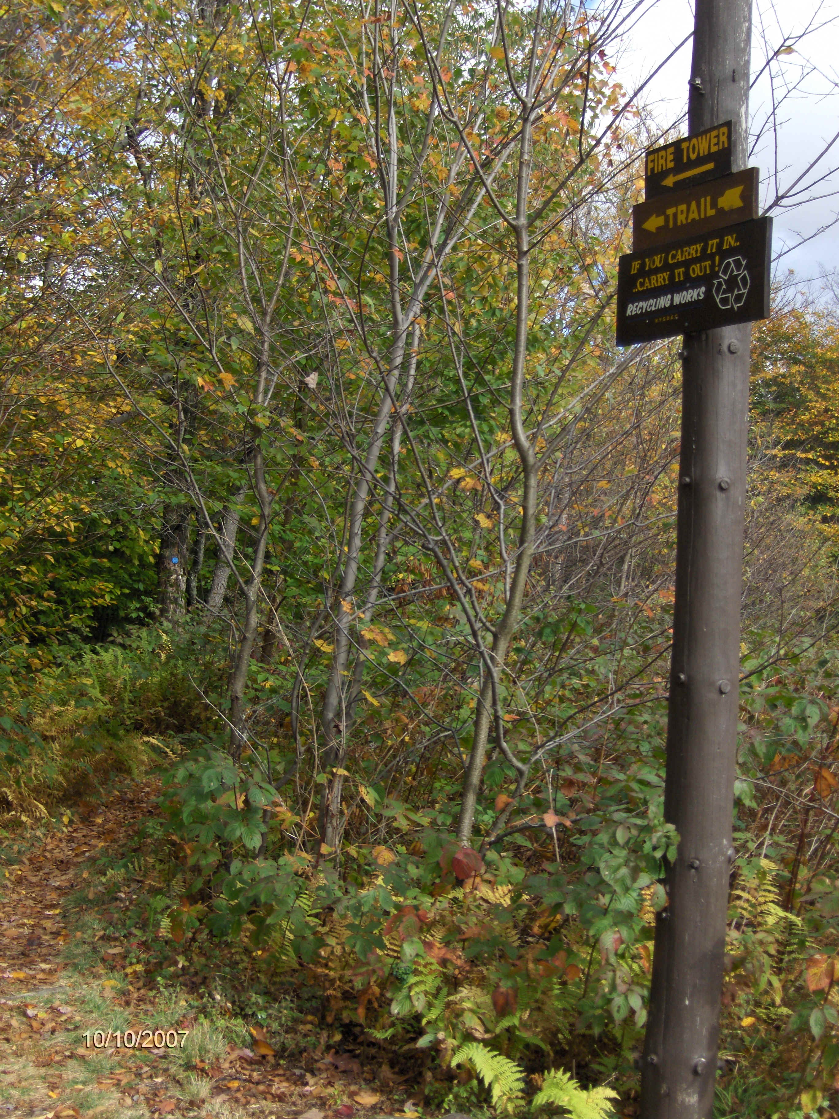
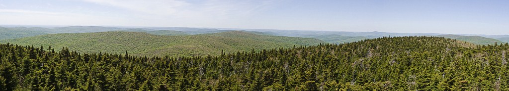
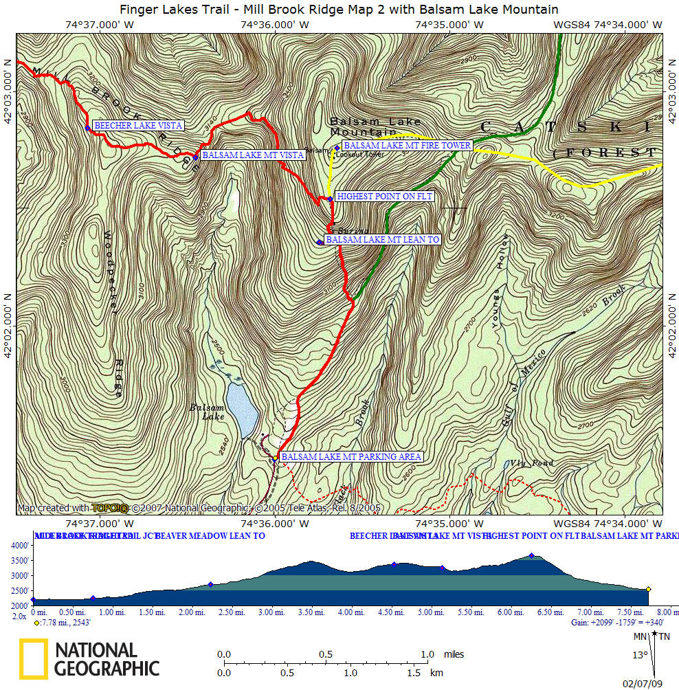
The trail now descends for a bit before beginning another climb and the vista of Beecher Lake. Those attempting the Catskill 67 may be interested in bushwhacking toward Woodpecker Ridge, which starts in this area. The trail descends again and reaches a point with views of Balsam Lake Mountain. After a short descent you'll begin the climb up Balsam Lake Mountain. As you reach the junction of the Mill Brook Ridge Trail and Balsam Lake Mountain Trail (red discs), this is the highest point along the whole distance of the FLT at 3660 feet. Turn left here for a short side trip to the fire tower.
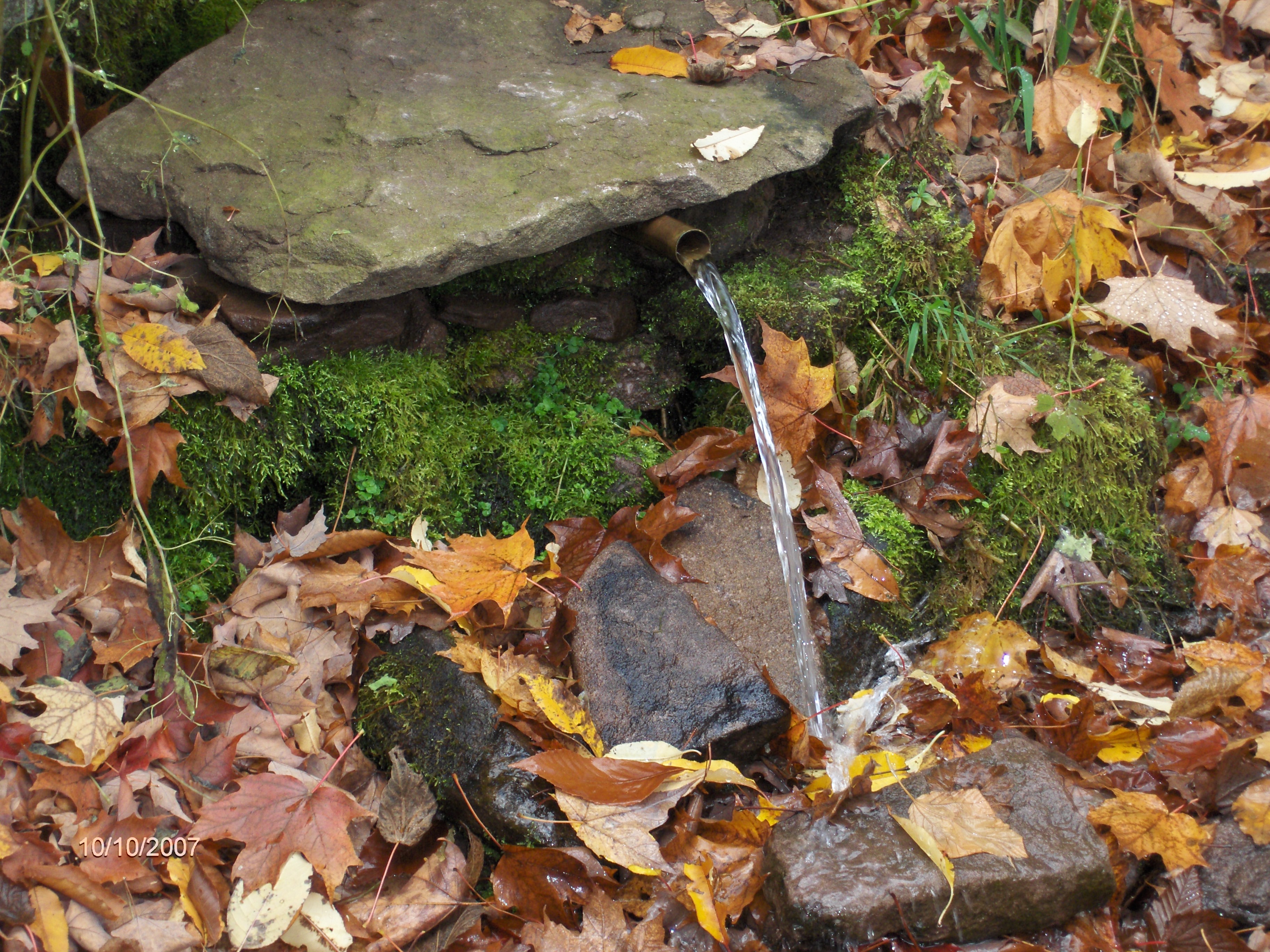
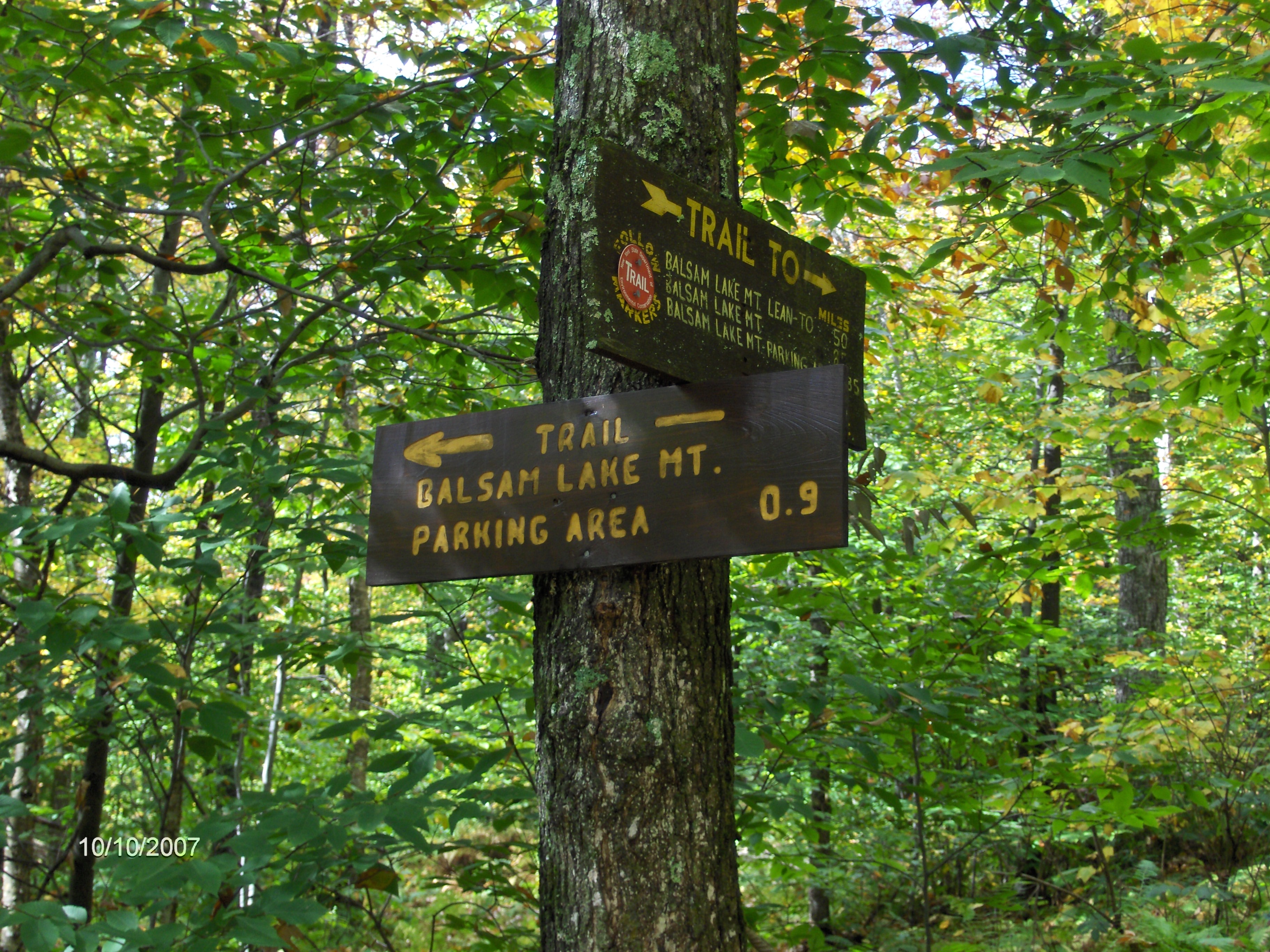
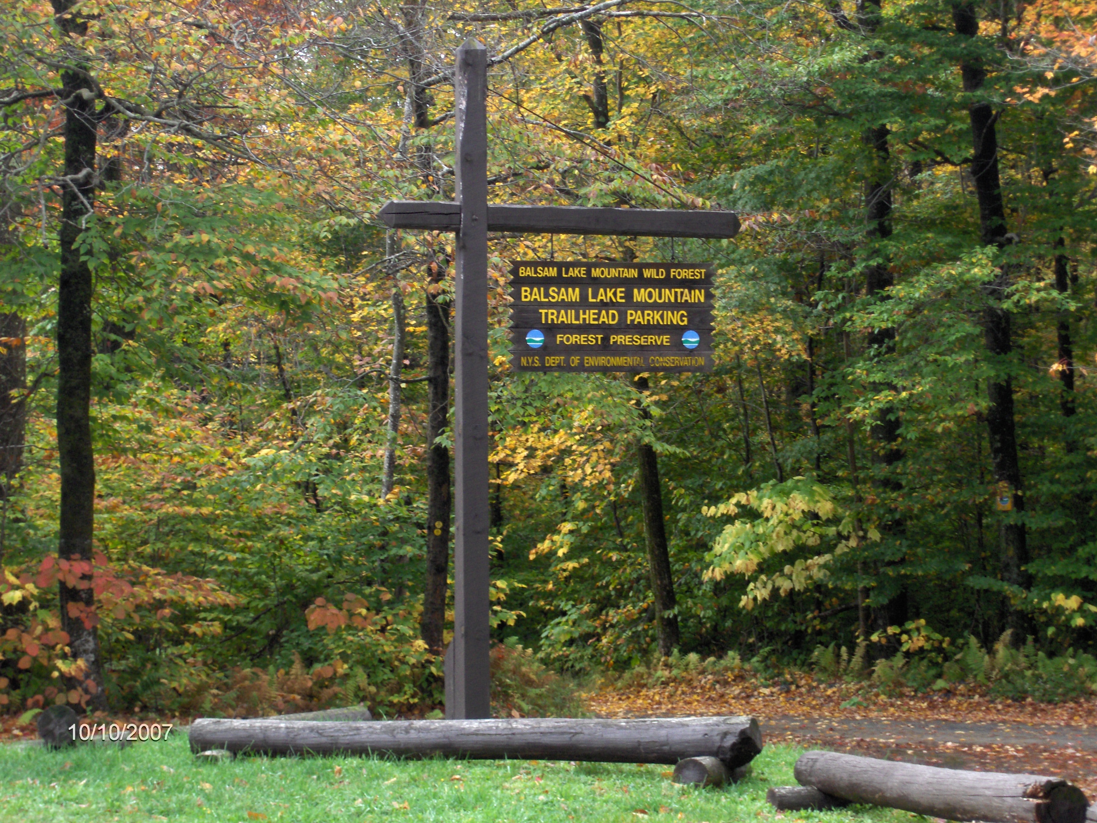
The rest of this section now descends Balsam Lake Mountain following red discs, passing a piped spring and lean to on the way to the junction of Dry Brook Ridge Trail (blue discs). Turn right here and your now following an old woods road toward the Balsam Lake Mountain Parking Area, which is the end of this section. This stretch of the Finger Lakes Trail is featured on maps M31 and M32 from the FLTC.
Directions from Syracuse: This section of the Finger Lakes Trail is over 160 miles away from Syracuse and is a 3 hour trip. I-81 south to NY 17 East. NY 17/I-86 East to Exit 94 Roscoe. Turn left on Stewart Ave, then right on old NY 17/CR 179. Sharp left on Beaverkill Rd/CR 152. Beaverkill Road becomes Turnwood Road/CR 54 after 9 miles. In Turnwood turn left still following County Route 54 (now Alder Lake Road). Follow road and signs to the Alder Lake Trailhead. The GPS coordinates are N42 02.986 W74 40.932 for the Alder Lake Trailhead.
Mile Elevation Trail Description 0.0 2203 feet From the parking area at the Alder Lake Trailhead. Head left past the ruins of an old lodge following red discs of the Alder Lake Loop Trail.
0.75 2240 feet Junction of the Mill Brook Ridge Trail (yellow discs). Now follow Mill Brook Ridge Trail.
1.65 2514 feet Entering Beaver Meadow.
2.25 2697 feet Beaver Meadow Lean To.
2.4 2736 feet Leave Beaver Meadow.
3.0 3114 feet Reach Mill Brook Ridge. Continue to climb.
3.5 3476 feet Highest point on Mill Brook Ridge.
4.55 3356 feet Beecher Lake vista.
5.15 3261 feet View of Balsam Lake Mountain.
5.9 3356 feet Begin ascent of Balsam Lake Mountain.
6.2 3594 feet Western view of Mill Brook Ridge.
6.3 3660 feet Highest point along whole Finger Lakes Trail. Junction of the Balsam Lake Mountain Trail. Turn left and its 0.2 mile to the summit and fire tower. The Finger Lakes Trail turns right and follows the red discs of the Balsam Lake Mountain Trail. Begin steep descent.
6.4 3595 feet Piped spring on your left.
6.5 3460 feet Side trail on your right leads 0.2 mile to Balsam Lake Mtn Lean To.
6.9 2890 feet Junction of the Dry Brook Ridge Trail (blue discs). Turn right and follow blue discs.
7.45 2664 feet Trail veers left off old road.
7.6 2575 feet View to your right.
7.8 2543 feet Reach the Balsam Lake Mountain Parking Area and the end of this section. For a continuation see Fall Brook.
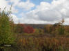

Beautiful Alder Lake
| CNY Hiking HOME PAGE | Finger Lakes Trail | FLT Eastern/Catskill Section | Catskill Forest Preserve |