in Pennsylvania:
Blue Mountain
Loop
![]()

| CNY Hiking HOME PAGE | Best of the AT in Pennsylvania | Appalachian Trail in Pennsylvania |
|
Best of the Appalachian Trail in Pennsylvania: Blue Mountain Loop
|
|

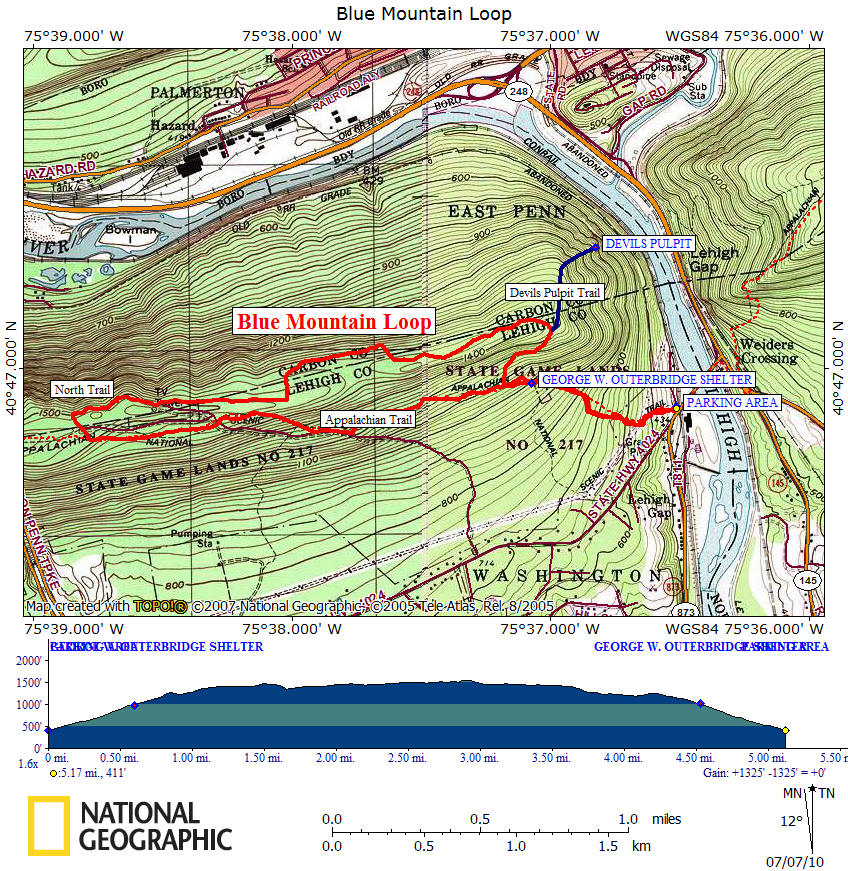
Directions: From Syracuse, NY (2:45) - I 81 South to Clark Summit, Pa & exit 194. I-476 South to US 209 South. Turn left on PA 248 East, then right on PA 873. Cross bridge over Lehigh River. There is a small AT parking area on the right before the junction of Mountain Road. Be sure not to park on or block the private driveway. The GPS Coordinates for the small AT parking area are N40 46.876 W75 36.525 for those who have a GPS devise in their vehicle.
The Hike: This loop is a 5.2 mile hike or 6.0 miles if you decide to visit "Devils Pulpit". This hike has an overall elevation change of over 1300 feet (not including Devil's Pulpit) and you are completely exposed for close to two miles on the top of the mountain. There are a few pictures, a map and complete description of this hike below. I recommend you do this this hike in the fall. This is a great loop hike and is one of our favorites. If you decide to check out the Devil's Pulpit, take caution as the trail is a bit hard to follow.
Mile Elevation Trail Description 0.0 411 feet Lehigh Gap Trailhead for Appalachian Trail. Head south on AT (uphill), pass signage for AT. Ascend steeply. Follow white blazes.
0.1 517 feet Cross under power lines. Views of Lehigh Gap & other side of Blue Mt.
0.6 972 feet Pass spring on right, then reach Outbridge Lean-To. Turn right and ascend.
0.7 1105 feet Reach junction of North Trail (scenic route). Turn right & ascend, following blue blazes. Soon views to the south.
1.0 1283 feet Junction of orange blazed Devils Pulpit Trail to the right. Devils Pulpit is 0.4 mile away (0.8 mile round trip). It is a very steep trail with views of Lehigh Gap. Veer left on North Trail.
1.2 1397 feet Continuous views to the north, east and west. Follow blue blazes carefully.
1.6 1440 feet Trail descends briefly, then more views.
2.88 1509 feet Last views before turning left toward tower. Almost directly above Lehigh Tunnel of the Pennsylvania Turnpike (I-476).
2.93 1544 feet High point of hike, pass by tower, cross tower dirt road.
3.0 1512 feet Reach junction of white blazed Appalachian Trail. Turn left and begin descent following white blazes.
3.4 1445 feet Cross dirt Tower Road.
4.5 1092 feet Reach junction of blue blazed North Trail. Continue straight on AT.
4.6 984 feet Pass Outbridge Lean-To, then a spring on the left. Begin steep descent.
5.1 517 feet Cross under power lines. Views of Lehigh Gap & Lehigh River.
5.2 411 feet Reach Trailhead Parking Area.
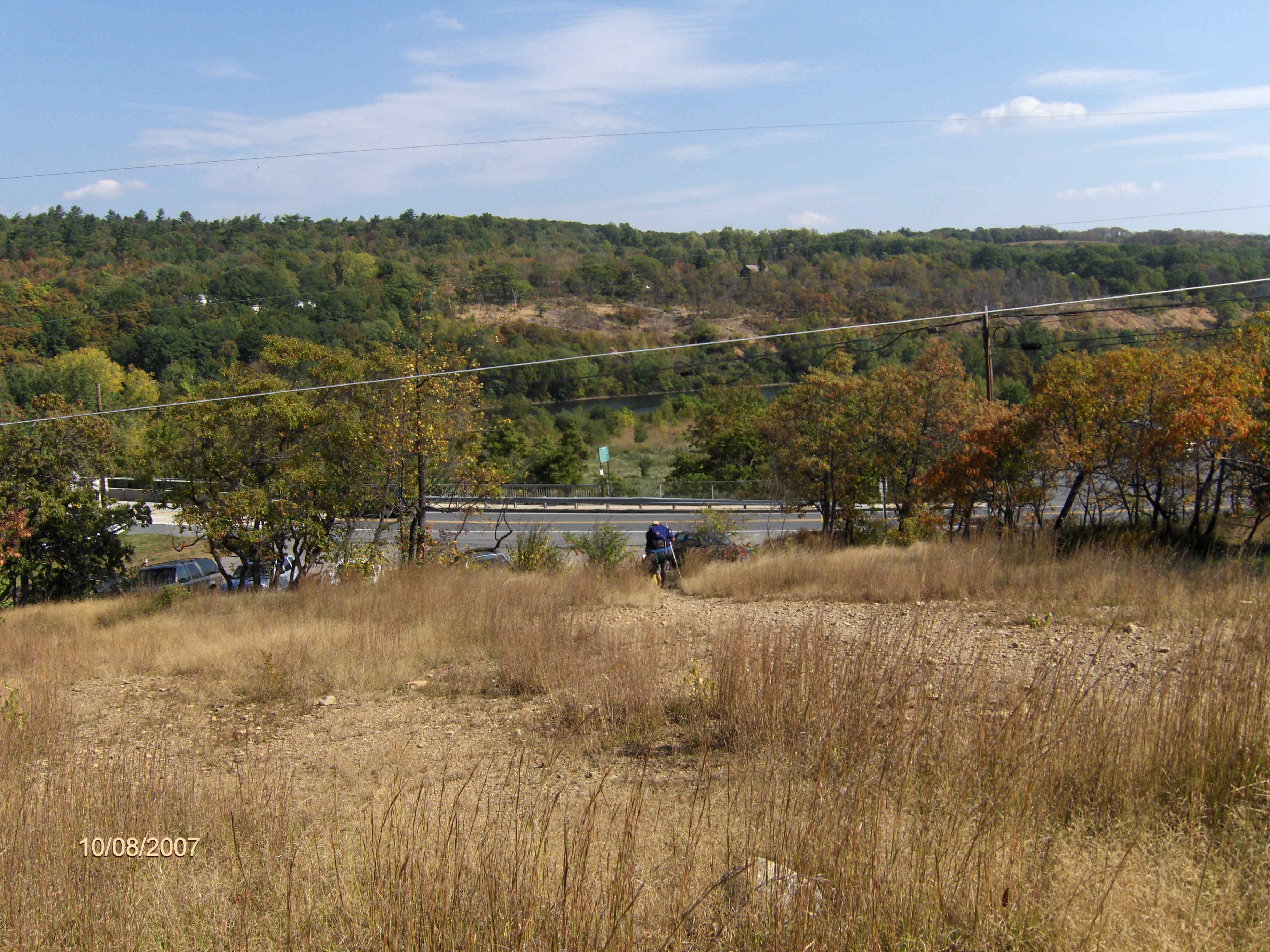
Looking back toward the parking area and PA 873
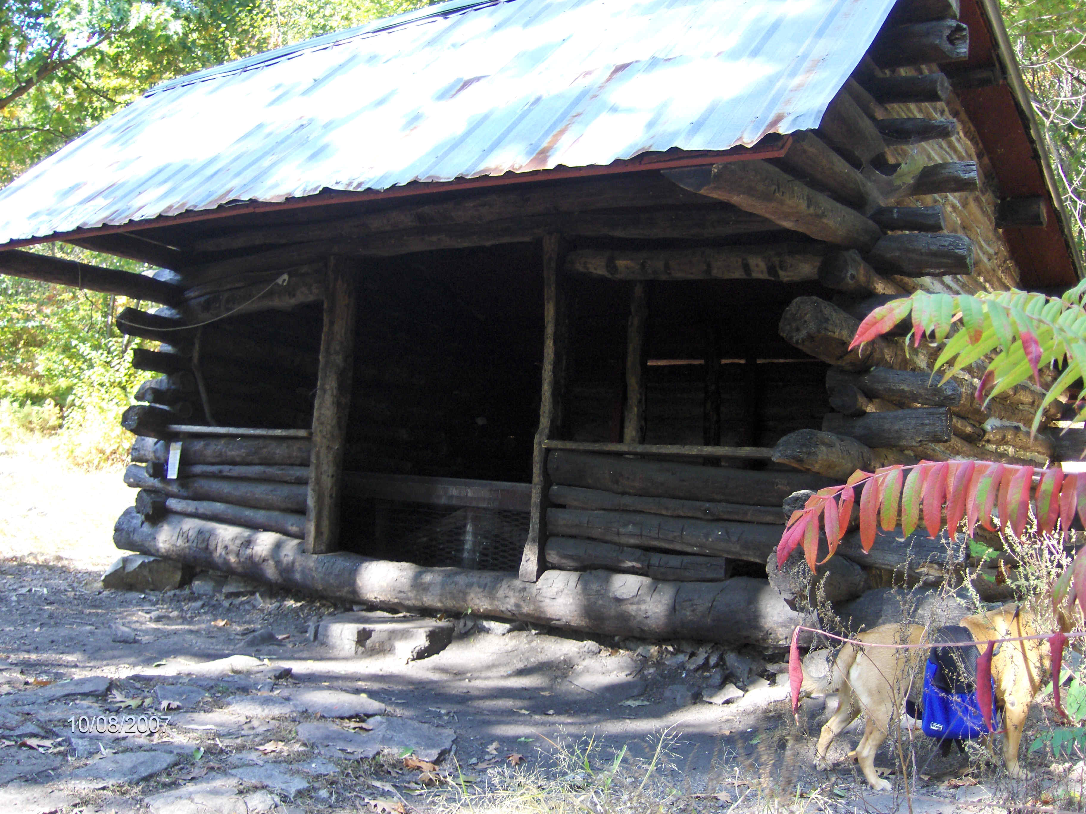
Outbridge Lean To along the Appalachian Trail

Exposed on Blue Mountain on the North Trail
| CNY Hiking HOME PAGE | Best of the AT in Pennsylvania | Appalachian Trail in Pennsylvania |
| Pulpit Rock & The Pinnacle | Wolf Rocks & Lunch Rocks | Lookout Rocks & Hahn's Lookout |
| Pine Hill Loop |
contact CNY HIKING by email at contact@cnyhiking.com
(c) 2006-today CNY Hiking - All rights reserved. Any use of information from this site without permission is strictly forbidden.