Finger Lakes Trail
Bucks Brook
State Forest
![]()
| CNY Hiking HOME PAGE | Finger Lakes Trail | FLT Central Section | Hiking in Chenango County | Bucks Brook State Forest Loop |
|
Hiking in Chenango County Finger Lakes Trail Bucks Brook State Forest
|
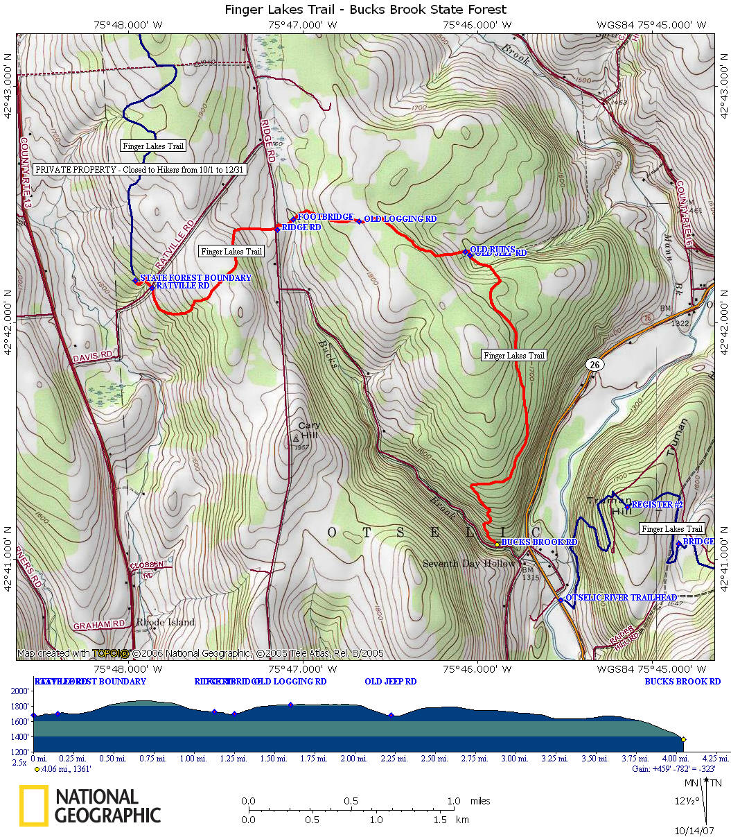
The Finger Lakes Trail in Bucks Brook State Forest is one of the more popular sections of the trail. This is partly due to hiking guide books that featuring the Bucks Brook State Forest Loop. This stretch of the Finger Lakes Trail is featured on map M22 from the FLTC.
The FLT comes into the state forest from the north from private property and Marisposa State Forest. The section of trail on private property is closed during big game hunting season Oct 1 - Dec 31. Please respect the landowners request and stay off that section of trail.
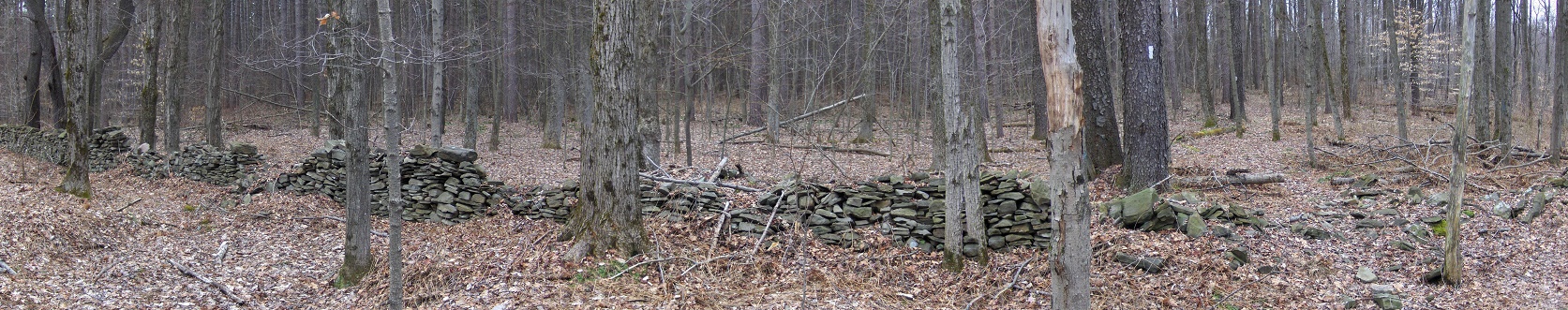
The trail crosses seasonal dirt Ratville Rd and continues toward Ridge Road. From there the trail crosses Bucks Brook on a footbridge, then passes the remains of an old wall (panorama above) and continues past old logging roads. The trail descends past the remnants of an old foundation and will soon reach a small stream. This is a great spot for a campsite near the old walls and the stream. The trail crosses an old jeep trail and soon climbs, then eventually descends steeply to Buck Brook Road.
While in the area check out Alice's Dowry Bed & Breakfast in Cincinnatus. It's conveniently located for those looking to hike the Finger Lakes Trail.
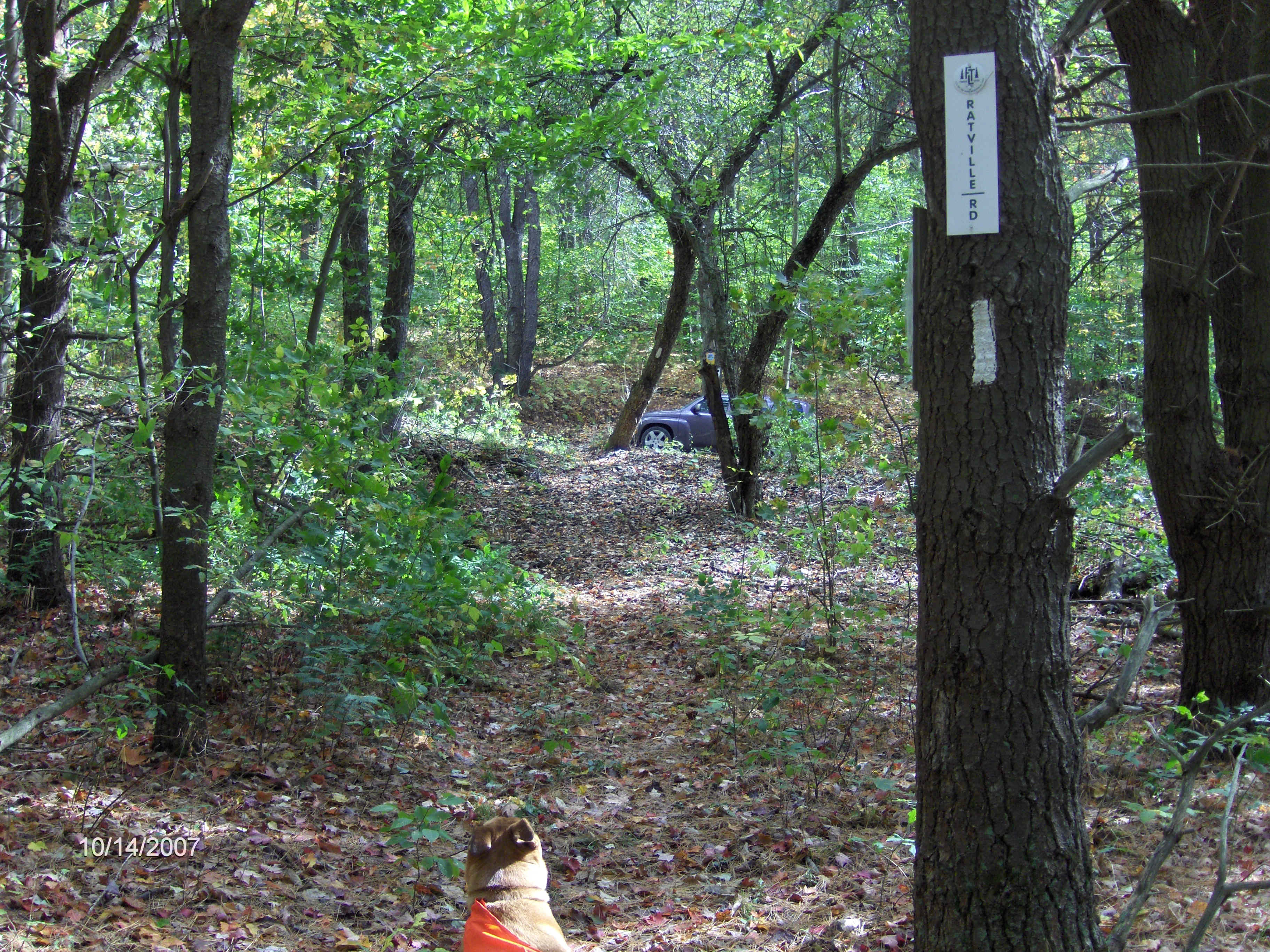
Finger Lakes Trail approaching Ratville Road
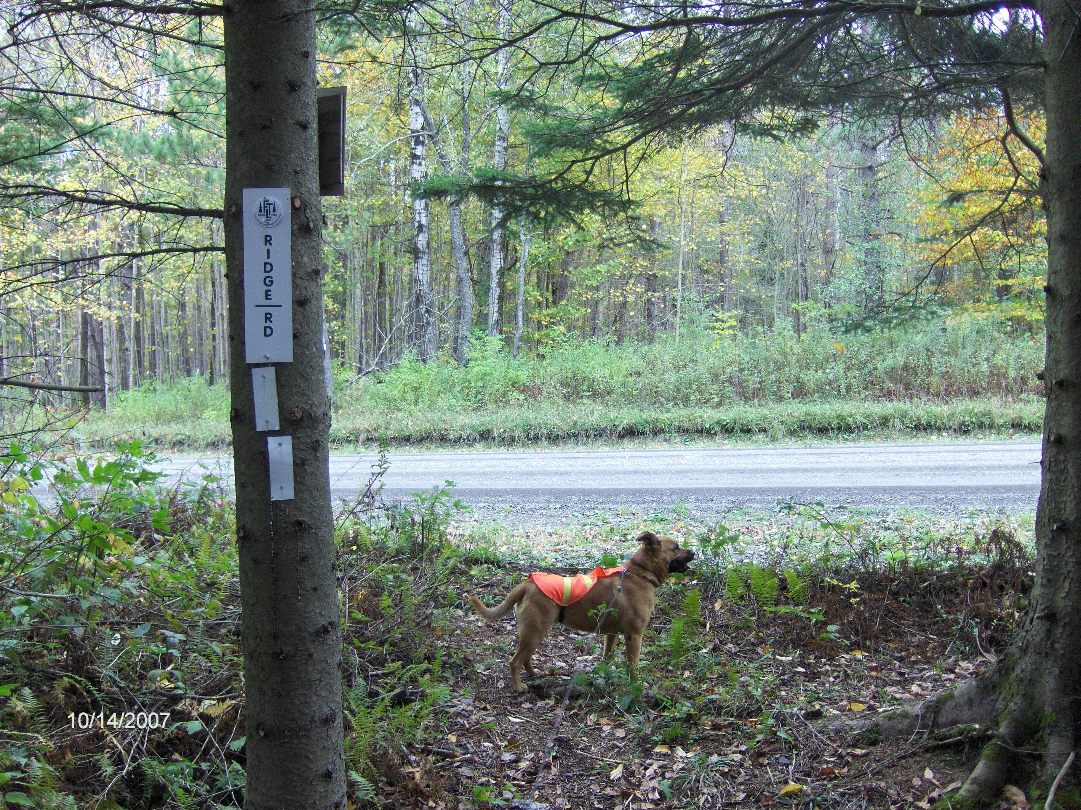
Finger Lakes Trail reaching Ridge Road
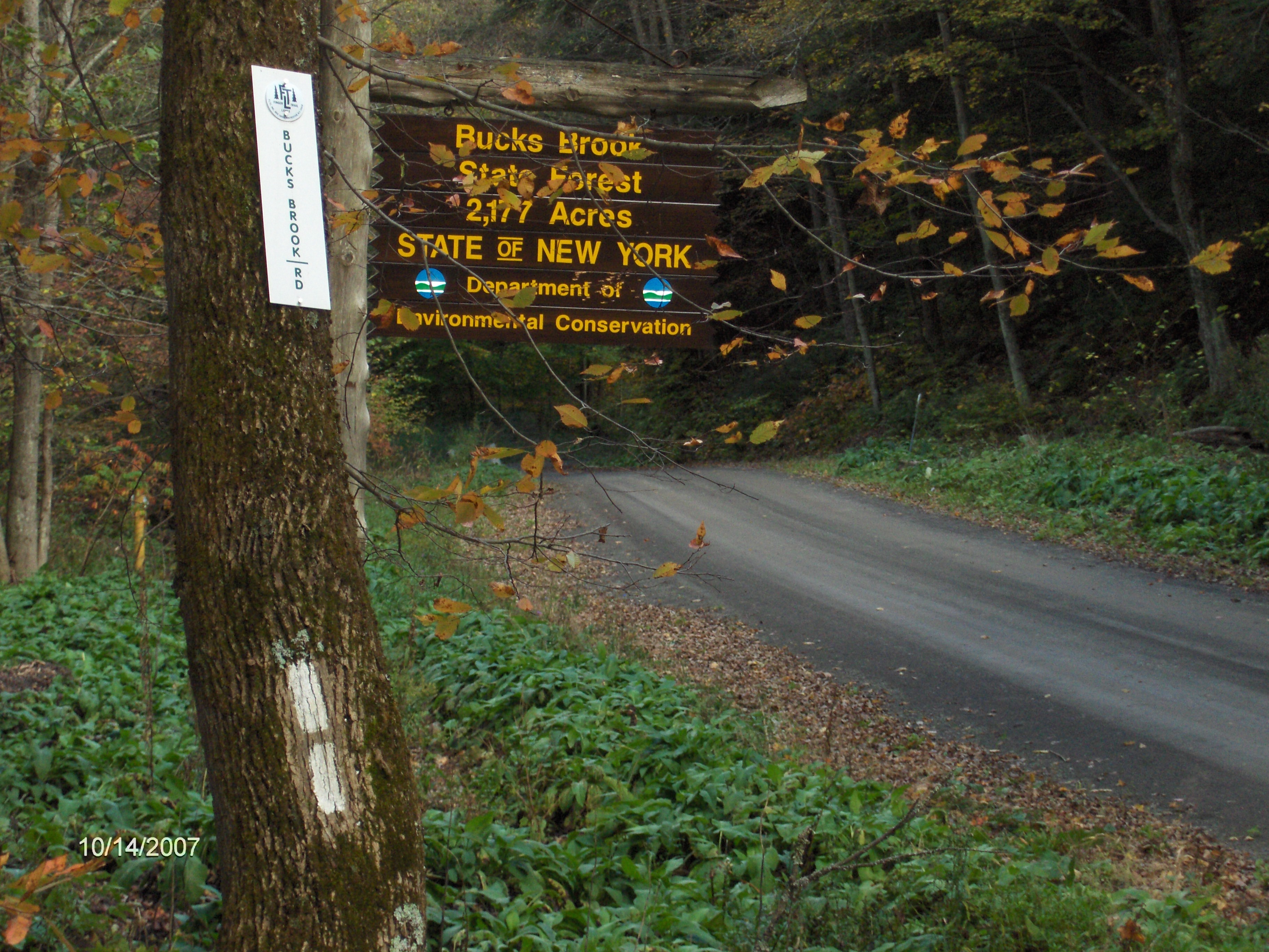
Finger Lakes Trail reaches Bucks Brook Road
Mile Elevation Finger Lakes Trail Description 0.0 1684 feet Bucks Brook State Forest Boundary. North of this point the FLT runs through PRIVATE PROPERTY. It is closed by the landowner to hikers for HUNTING from 10/1 to 12/31. Follow white blazes.
0.15 1703 feet Cross seasonal dirt Ratville Road. (limited shoulder parking)
0.7 1877 feet Highest point along FLT in Bucks Brook State Forest.
1.1 1726 feet Trail register then reach dirt Ridge Road. Turn left and follow road for 100 feet, then turn right back into forest.
1.25 1696 feet Footbridge over Bucks Brook. Trail Register. Bivouac Area.
1.6 1817 feet Old Logging Road. Turn right, then quick left following white blazes.
2.18 1702 feet Old ruins on left, then trail turns right just before reaching stream. Bivuoac Area
2.23 1681 feet Cross old jeep road and pass over two old stone fences.
2.7 1765 feet Many logging roads in area, follow white blazes carefully.
3.6 1668 feet Steep descent to Bucks Brook Road.
4.1 1361 feet Reach Bucks Brook Road. (Parking) End of Bucks Brook State Forest section of the Finger Lakes Trail. FLT begins again at the Otselic River Trailhead off NY 26. There is a large parking area there. See FLT - Otselic State Forest.
| CNY Hiking HOME PAGE | Finger Lakes Trail Central Section | Finger Lakes Trail |
| Bucks Brook State Forest | Bucks Brook State Forest Loop | Otselic State Forest |
contact CNY HIKING by email at
contact@cnyhiking.com
(c) 2006-today CNY Hiking - All rights reserved. Any
use of information from this site without permission is strictly forbidden.