| Miles |
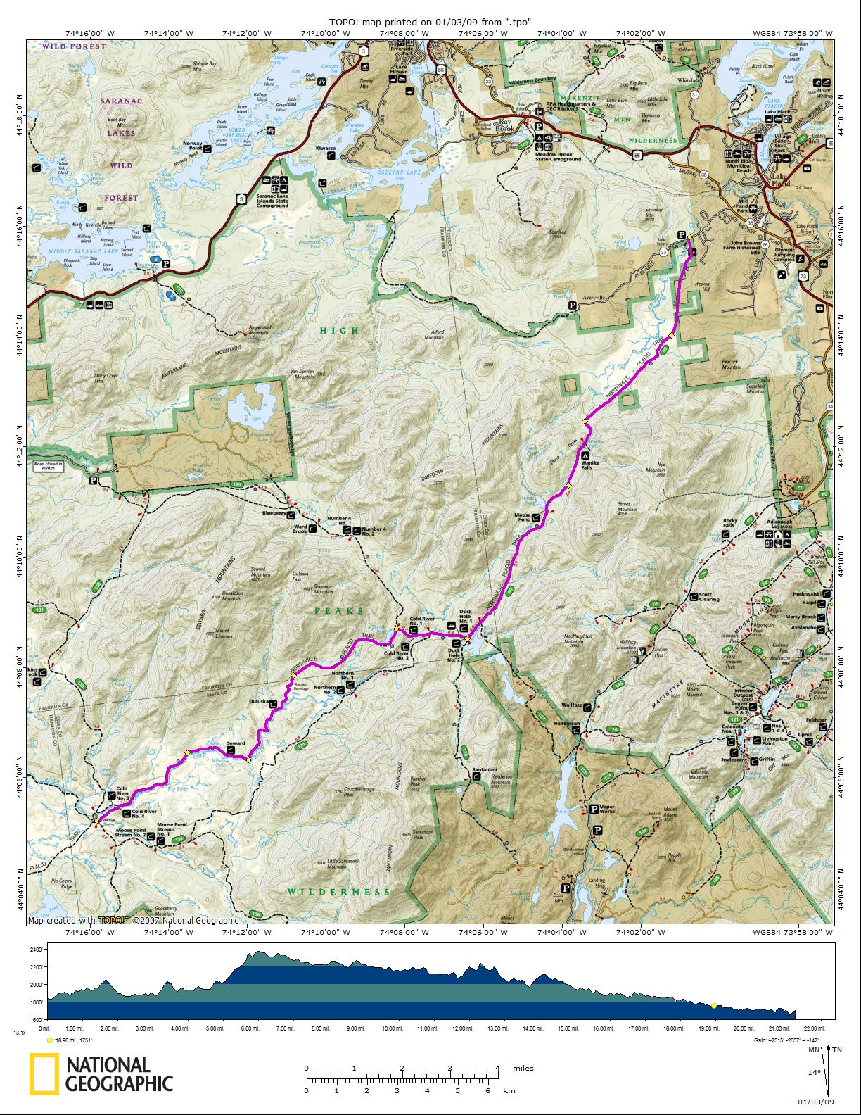
Trail Description
|
| 00.00 |
Shattuck Clearing. The trail follows the gravel road
southeasterly for .15 miles then turns left into the woods. |
| 00.25 |
Cross Moose Creek on a suspension bridge. The trail
continues northeasterly to the south bank of Cold River. |
| 00.75 |
Cross Cold River on a suspension bridge. A lean-to is
located immediately on the left and another .1 mile downstream. The
trail turns right after crossing the bridge and follows the Cold River
upstream. |
| 04.02 |
In a balsam fir setting is Seward lean-to. Just beyond
the lean-to is the Natural Dam formed by rock ledges across the Cold
River. |
| 06.55 |
Ouluska Pass Lean-to |
| 06.80 |
Big Dam was once a lumber camp area and is often made a
camping place. The "hermit of Cold River", Noah John Rondeau, lived here
for many years on land of the Santa Clara Lumber Co., now part of the
Forest Preserve. He welcomed real lovers of the woods but shunned
curiosity seekers. He made a frugal living by hunting, trapping and
serving as a guide. Two Wigwams from his "Cold River City" the "Beauty
Parlor" and the "Hall of Records" can be seen at the Adirondck Museum at
Blue Mt. Lake. He died in 1967, at the age of 84. |
| 10.50 |
Mountain Pond (2,142' elev.) is in a wild setting. The
trail follows the old lumber road through second growth forests to the
junction with a fire truck trail. Right on this truck trail .40 miles to
two Cold River lean-tos |
| 12.10 |
At the Duck Hole are two lean-tos and a side trail to
the right (blue markers) leading to Bradley Pond, Lake Sandford and
Tahawus. |
| 12.50 |
A side trail (red markers) on the right leads to Indian
Pass, Mt. Marcy and Tahawus. The main trail, with blue markers,
continues on upstream. |
| 16.00 |
Moose Pond lean-to |
| 17.20 |
This is the divide between the Moose and Chubb Rivers.
Wanika Falls lean-to is on a side trail to the right at 17.50 miles.
|
| 18.20 |
Trail turns to the right of the former trail to
Averyville and crosses the Chubb River on a log bridge. |
| 24.25 |
Averyville County Rd., turn right to Lake Placid. To the
left is the Chubb River bridge. Across the bridge 800 feet to the right
is the entrance to trailhead parking. |
| 25.50 |
Old Military Rd. and Lake Placid Village. The end of the
trail. |