Northville-Placid Trail
Blue Ridge
Wilderness
Wakely Dam to NY 28
![]()
| CNY Hiking HOME PAGE | Northville-Placid Trail | Hiking in Adirondack Park | Blue Ridge Wilderness | Lake Durant Campground |
|
Hiking in the Adirondacks Northville-Placid Trail Blue Ridge Wilderness Wakely Dam to NY 28
|
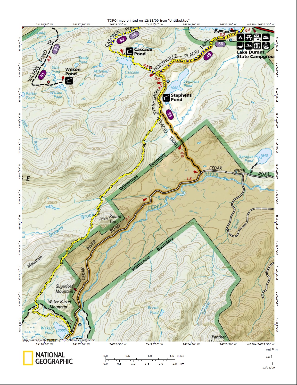
A long walk along dirt Cedar River Road which included passing by the very popular Wakely Dam Recreational Area was shortened in August 2009 with the opening of the first phase of a trail relocation that took the trail off private property and a dangerous beaver area. A future trail relocation will eliminate more of this road walk.
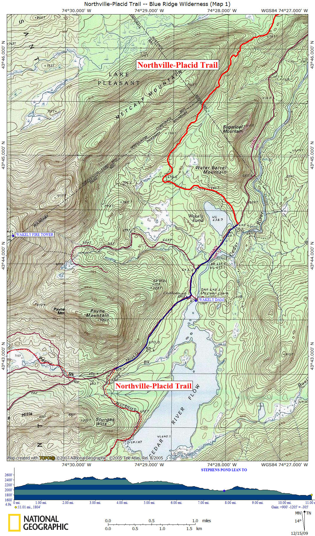
Our description begins at the new trailhead 0.7 miles north of Wakely Dam and a bit north of the Wakely Mountain Trail. The trail's first mile is along an old road called Gould Road and your actually walking in Moose River Plains Wild Forest until entering Blue Ridge Wilderness after 2.2 miles of hiking.
The portion of the trail on the Gould Road is temporary. A future phase will construct a new route through the woods south of Wakely Dam, if conditions are suitable. In addition, the trail will be routed up the Wakely Mountain trail for about a mile, then northeastward along another arm of the Gould Road to the section of new trail construction. Once all construction is complete, the road walk along this part of the Northville Lake Placid Trail will be reduced from 7.8 miles to 0.3 miles.
You're walking along a section of trail that was professionally built in three months at a cost of over $60,000 and travels through an old growth forest that very few have ever seen due to its remoteness. This forest includes many trees from the original Adirondack Park. During this new section of trail, there was only one footbridge that was built.
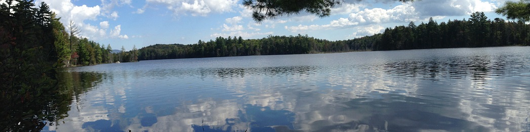
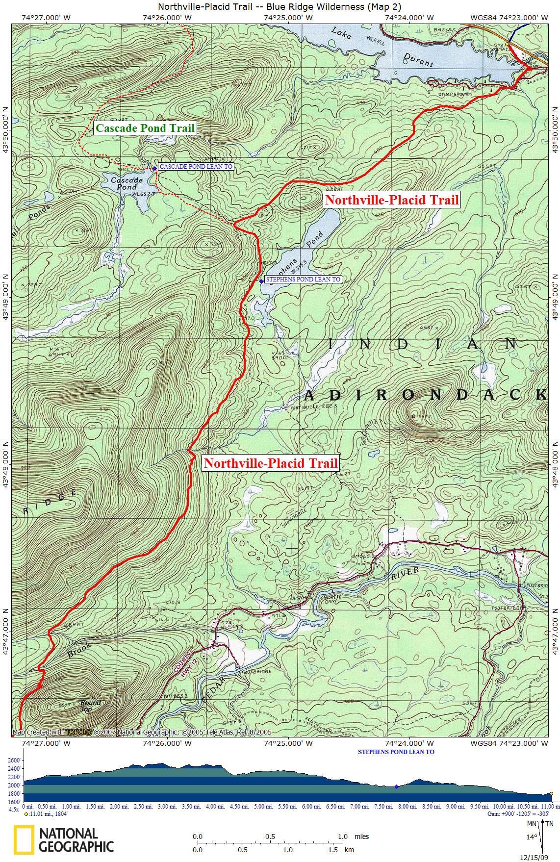
At 7.2 miles reach the original trail and the Stephens Pond Lean To at 7.8 miles. There was trail work done in this area in 2014. The Cascade Pond Trail is reached at 8.25 miles. This four mile trail is used by many through hikers heading to the hamlet of Blue Mountain Lake. This trail also has an impressive bridge over Rock Pond plus a newer lean to at Cascade Pond. At 10.5 miles you're entering Lake Durant State Campground and the end of this section is reached at NY 28 after 11 miles. You are now 79.4 miles from the Northville kiosk.
There are a few pictures, maps and a detailed description of this section of the Northville-Placid Trail below. Be sure to check out the NY DEC website at Adirondack Trail Information for updated trail conditions. We recommend that you purchase the Northville-Placid Trail (National Geographic Trails Illustrated Map)
to help plan your Northville-Placid Trail adventure.
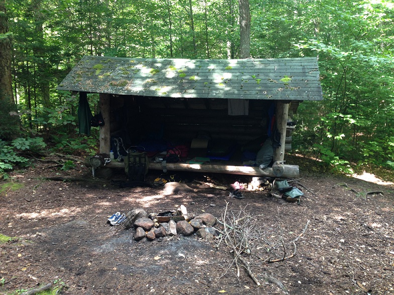
Stephens Pond Lean To
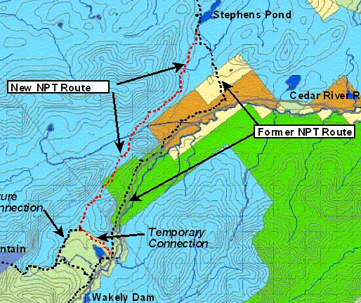
August 2009 Northville-Placid Trail reroute
Mile Elevation Description (Cedar River Road to NY 28) 0.0 2109 ft New section of trail (Aug 2009) begins off Cedar River Road after a 2.3 mile road walk. Parking. Follow old Gould Road.
0.9 2205 ft Cross stream.
2.2 2452 ft Enter Blue Ridge Wilderness.
2.5 2430 ft Cross small stream.
4.3 2258 ft Cross Brown Brook.
4.6 2283 ft Cross stream.
6.4 2141 ft Cross stream.
7.2 2030 ft End of new trail section.
7.8 1962 ft Stephens Pond Lean To.
8.25 2150 ft Junction of the red marked Cascade Pond Trail.
10.5 1793 ft Entering Lake Durant State Campground.
11.0 1804 ft Reach NY 28 and the end of this section. The hamlet of Blue Mtn Lake is four miles to the west.
| CNY Hiking Home Page | Adirondack Park | Northville-Placid Trail |