Boyce Hill
State Forest
NY 242 to CR 17
![]()
| CNY Hiking HOME PAGE | Finger Lakes Trail | NCT in Western New York | North Country Trail in NY |
|
North Country Trail Boyce Hill State Forest NY 242 to CR 17
|
This is a short 4.8 mile section of the North Country Trail and features Boyce Hill State Forest, where you'll find the Boyce Hill Lean To. This stretch of the NCT coincides with the white blazed Finger Lakes Trail. Boyce Hill State Forest is in Cattaraugus County in the Town of Franklinville. Its western border is on NY 242 at Phillips Road. Its eastern border is near Jackson Road which is off County Route 17 (Bakerstand Rd.).
The North Country Trail enters Boyce Hill State Forest off NY 242 near the intersection of Phillips Rd, about 0.1 mile east of "Devereaux Schoolhouse". The trail enters the state forest in its northwest corner through a stand of pines and ascends. The trail then briefly descends before climbing again. In the middle of the state forest the trail enters a hardwood forest as well as crosses a DEC Loop Trail. At 1.5 miles the trail reaches the Boyce Hill Lean To built in October 2012. There is a picnic table, bench, open air privy and fire ring.
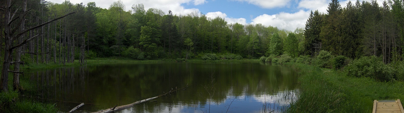
Soon the trail enters another section of pines and then soon passes by a pond. There is camping opportunities near the pond along the side of the trail. Soon the trail reaches the state forest dirt road and turns left following the forest road. There is a small parking area for about four cars where the trail reaches the truck trail. Most vehicles can drive this seasonal dirt road. The trail turns right at the state forest sign and reaches Jackson Road at 2.7 miles after leaving NY 242. There is a nice panoramic view where the trail reaches Jackson Road.
Walk along Jackson Road for 0.3 miles until the trail turns right off the road just prior to County Route 17. The trail is now on PRIVATE PROPERTY. Cross County Route 17 at 3.8 miles. The trail reaches Rogers Road at 4.1 miles where you'll turn right and follow the road. NOTE: A trail reroute in May 2016 has eliminated this road walk. Our info has not been updated. FOLLOW white blazes closely! At the end of the road turn right onto Bear Creek Road and soon reach a bend in the road at the Bear Creek State Forest Boundary. This is the end of this section of the NCT. For a continuation see Bear Creek State Forest.
Look below for a few pictures, a map and trail description of this section of the North Country Trail.
NCT in Boyce Hill State Forest
Mile Elevation North Country Trail Description 0.0 1716 feet NY 242 parking (just past Phillips Road). Enter Boyce Hill State Forest. Follow white blazes. Some shoulder parking. GPS N42 20.268 W78 33.296
0.4 1904 feet Trail levels briefly before ascending again.
0.9 2004 feet Begin to descend.
1.3 1876 feet Begin to ascend.
1.5 1988 feet Cross DEC Boyce Hill State Forest Loop Trail. Boyce Hill Lean To
1.85 2100 feet Trail begins to level off.
2.1 2114 feet Trail bears left passing pond.
2.2 2117 feet Trail veers right.
2.23 2122 feet Highest point in Boyce Hill State Forest along NCT.
2.25 2116 feet Reach State Forest Forest Road. Parking. GPS N42 19.958 W78 31.193 DEC Loop Trail turns right following forest road. NCT turns left following forest road.
2.5 2087 feet DEC Loop Trail junction on left. NCT continues to follow forest road.
2.6 2035 feet Trail turns right at State Forest sign.
2.7 1980 feet Reach Jackson Road and turn left following road.
3.0 1950 feet Turn right off road just prior to reaching County Route 17. Entering PRIVATE PROPERTY. 3.8 1799 feet Cross County Route 17. Still on PRIVATE PROPERTY. 4.1 1862 feet Reach Rogers Road, turn right following road. NOTE a May 2016 REROUTE has eliminated this roadwalk. 4.65 1826 feet Turn right on Bear Creek Road. 4.8 1792 feet Reach Bear Creek State Forest boundary. Parking. GPS N42 21.210 W78 29.916
For a continuation see Bear Creek State Forest.


Boyce Hill Lean To

View from where NCT reaches Jackson Road
| CNY Hiking HOME PAGE | Finger Lakes Trail | NCT in Western New York | North Country Trail in NY |
