Hiking in Chenango County
New York State Lands
Ludlow Creek State Forest
![]()

| CNY Hiking HOME PAGE | FLT in Ludlow Creek State Forest | Hiking in Chenango County | FLT Central Section | Finger Lakes Trail |
|
Hiking in Chenango County New York State Lands Ludlow Creek State Forest
|
|
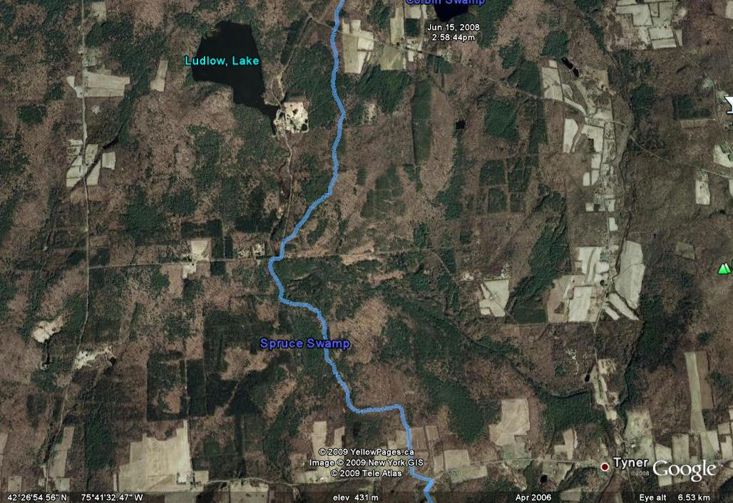
The 3198 acre Ludlow Creek State Forest is located within the towns of Smithville and McDonough in Chenango County. The forest is named after the outlet creek of Lake Ludlow which runs through the central section of the forest.
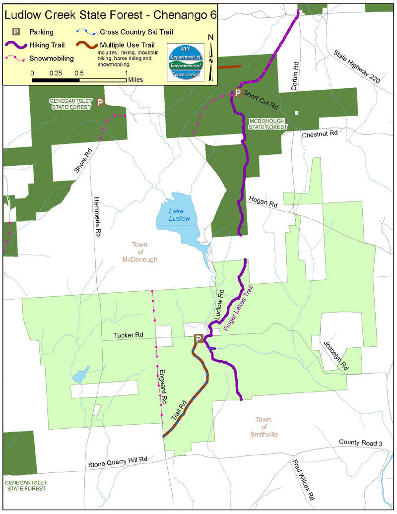
Ludlow Creek State Forest is a fairly solid, contiguous block of state-owned land. Town roads that cross through the forest include Tucker, Hammerle, Ludlow and Hogan Roads. Tucker Road was originally built in the 1930's as a truck trail by the Civilian Conservation Corps (CCC's). The CCC's also built the bridge on this road spanning Ludlow Creek, locally known as the High Bridge.
Tucker Road is now owned and maintained by the town of Smithville. The Department of Environmental Conservation maintains one section of the Public Forest Access Road between Tucker Road and Engaard Road. The majority of Engaard Road through the State forest has been abandoned and is no longer maintained. The Ludlow Creek State Forest lies at the midpoint of a triangle formed by the villages of Oxford, Smithville Flats, and McDonough. NY 220 and County Route 3 form a loop between these villages and around the forest.
All of the town roads on the forest are good quality, gravel-surfaced roads, which may be traveled with any passenger car. Most of these roads are plowed during the winter; however, some sections may be left unplowed. There is one designated parking area on the forest located near the corner of Tucker Road and the Public Forest Access Road. However, there are many additional places to park vehicles along the sides of the town roads, as well as on old log decks adjacent to the roads.
The Ludlow Creek State Forest has relatively gentle topography. The highest elevation on the forest is approximately 1,670 feet and is located on a peak between the Public Forest Access Road and Engaard Road.. The lowest elevation is about 1,300 feet and is found along Ludlow Creek at its southernmost point on the forest.
Some of the most scenic areas on this state forest can be found along Ludlow Creek and in the areas surrounding the wetlands. The Ludlow Creek lean-to was dedicated in the summer of 2000 and is located along the Finger Lakes Hiking Trail just south of the High Bridge. This is a high-quality shelter located in a scenic area, overlooking the creek. A section of the Finger Lakes Trail crosses through the forest and is popular with both through hikers and day hikers
Ludlow Creek State Forest is bordered by a mix of privately owned woodlands and agricultural lands. The most popular recreational activities on the forest are hunting and hiking. Winter activities include cross-country skiing and snowshoeing, as well as snowmobiling on the sections of abandoned and unplowed roads
Directions
From NY 220, east of McDonough, turn south on Chestnut St., then right onto Shorer's Woods Road, then left onto Hammerle Road. Two miles on Hammerle will bring you to the northwest extremity of the forest.
| CNY Hiking HOME PAGE | Finger Lakes Trail in Ludlow Creek State Forest | McDonough State Forest |
| Finger Lakes Trail | Bowman Lake State Park | New Michigan State Forest |
![]()