Finger Lakes Trail
Ludlow Creek
State Forest
![]()
| CNY Hiking HOME PAGE | Hiking in Chenango County | FLT Central Section | Ludlow Creek State Forest |
|
Hiking in Chenango County Finger Lakes Trail Ludlow Creek State Forest
|
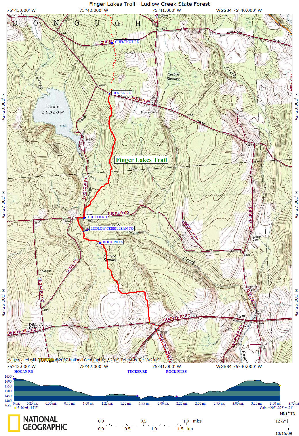
This section of the Finger Lakes Trail begins off Hogan Road in McDonough State Forest before heading into private property and then into the 3198 acre Ludlow Creek State Forest. The trail while in this state forest passes two wetland areas as well as a section that runs near scenic Ludlow Creek. The trail crosses Ludlow Creek on "high bridge", a bridge built on Tucker Road by the CCC in the 1930's and rebuilt in 2010.
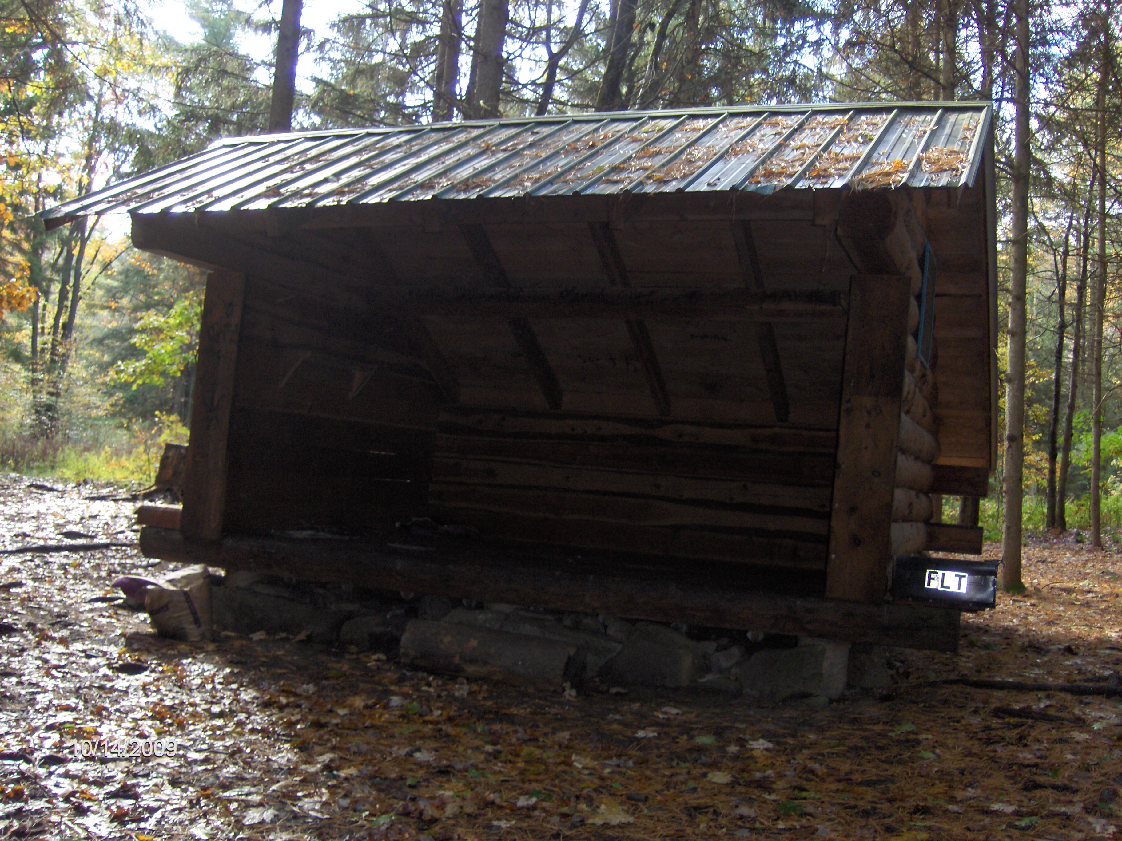
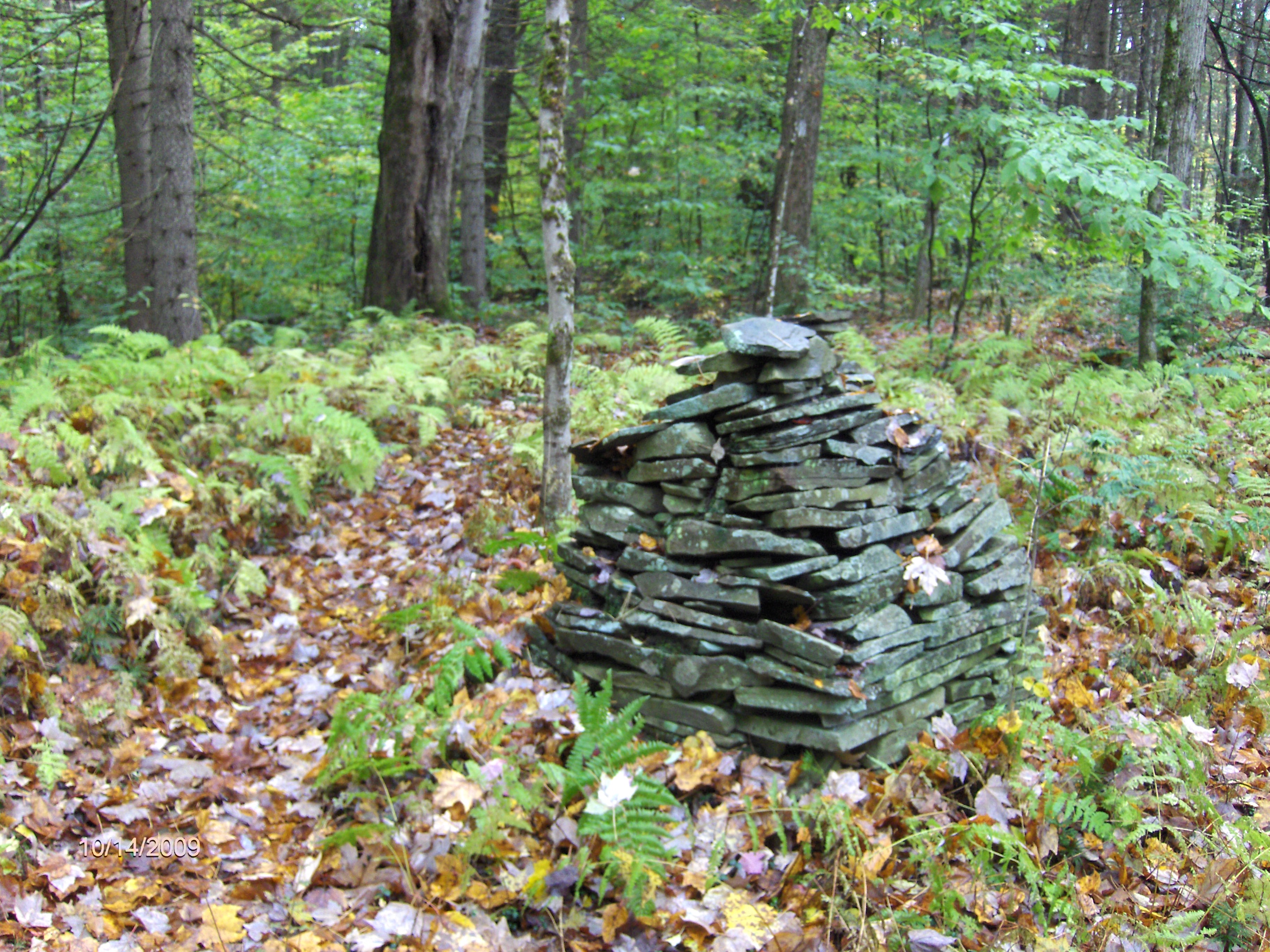
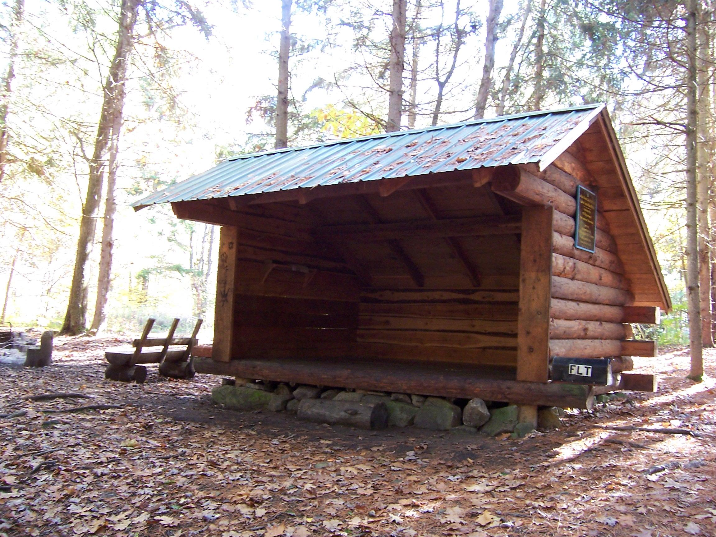
The Ludlow Creek Lean To, built in 2000, overlooks the creek at a very scenic location with a small waterfall and is a popular stopping place for Finger Lakes Trail through hikers as well as day hikers. The trail also passes the mysterious "Rock Piles". Legend has that the piles were made by Native Americans many years ago. It has also been said that they were created recently by white man.
This scenic 3.6 mile section of the Finger Lakes Trail is an easy to moderate hike. Look below for some pictures, a video, map and trail description of this great section of the trail. This stretch of the Finger Lakes Trail is featured on map M24 from the FLTC.
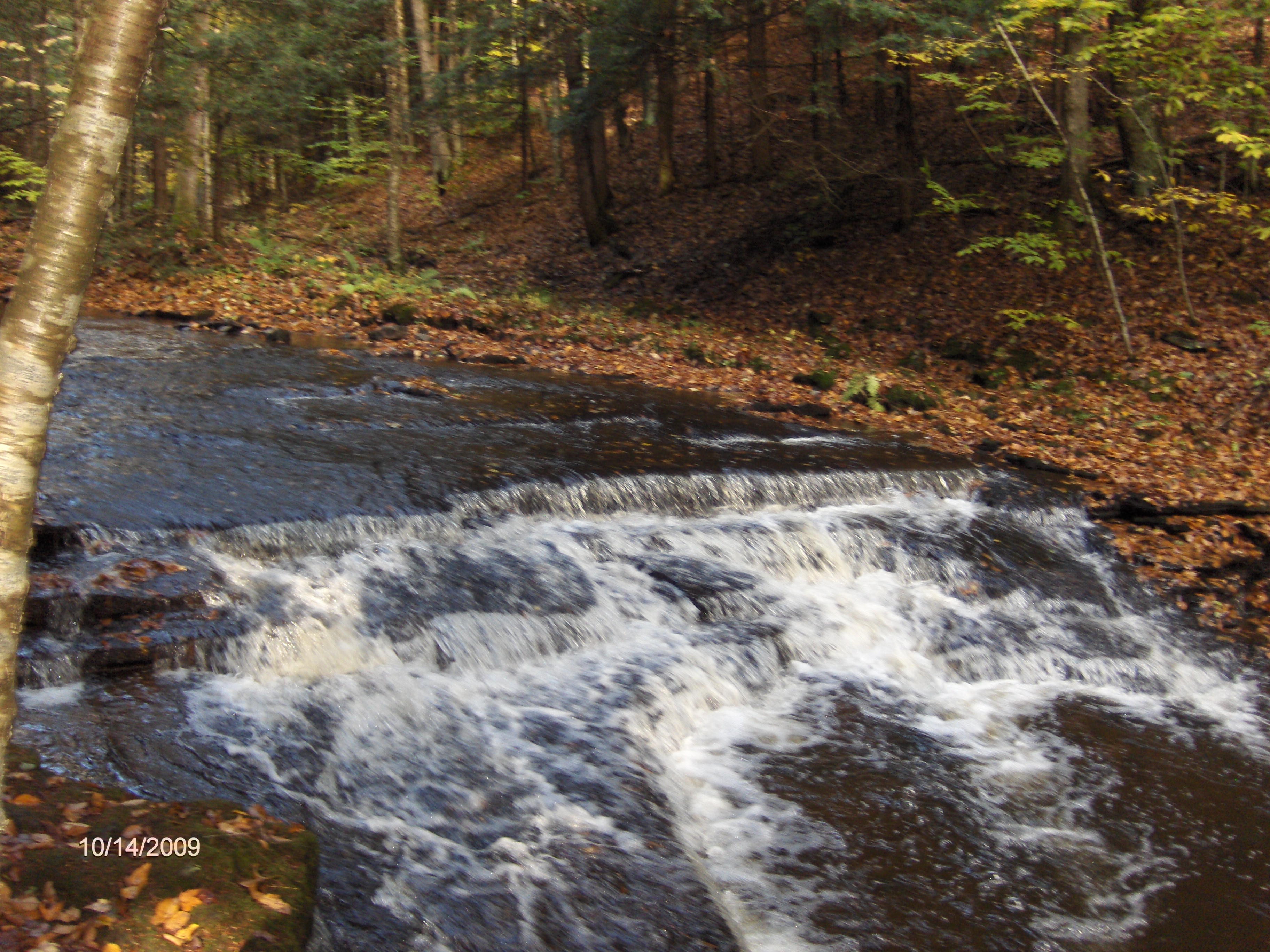
Ludlow Creek near the lean to
Ludlow Creek Lean To
Rock pile along trail
Mile Elevation Trail Description (follow white blazes) 0.0 1626 feet Trail heads south off Hogan Road. Parking. You are in McDonough State Forest. GPS N42 28.136 W75 41.785
0.3 1577 feet Leave McDonough State Forest, entering private property.
0.6 1552 feet Enter Ludlow Creek State Forest.
1.5 1459 feet Trail register.
1.55 1454 feet Reach and turn left on Ludlow Road.
1.65 1451 feet Turn right on Tucker Road. Parking. Cross the "High Bridge" over Ludlow Creek.
1.7 1415 feet Trail turns left off road. DEC Parking Area down the road GPS N42 26.854 W75 42.288
1.9 1433 feet Blue blazed trail on left leads to Ludlow Creek Lean To.
2.2 1442 feet The mysterious "Rock Piles"
2.4 1482 feet Spruce Swamp is off to your right.
2.5 1467 feet Cross brook on bridge.
2.6 1502 feet Leave Ludlow Creek State Forest and enter PRIVATE PROPERTY.
3.2 1605 feet Trail register.
3.3 1607 feet Open field, cross diagonally left to fence line. Stay on 8 ft wide path between fences passing horse barn and log cabin.
3.55 1555 feet Reach Stone Quarry Road and the end of this section. See Bowman Creek section for a continuation of the Finger Lakes Trail. GPS N42 25.795 W75 41.235
| CNY Hiking HOME PAGE | Finger Lakes Trail | FLT Central Section | Ludlow Creek State Forest |