Finger Lakes Trail
Susquehanna
River
![]()
| CNY Hiking HOME PAGE | Hiking in Chenango County | FLT Eastern/Catskill Section | Bainbridge, NY website | Finger Lakes Trail Mile by Mile |
|
Hiking in Chenango County Finger Lakes Trail Susquehanna River
|
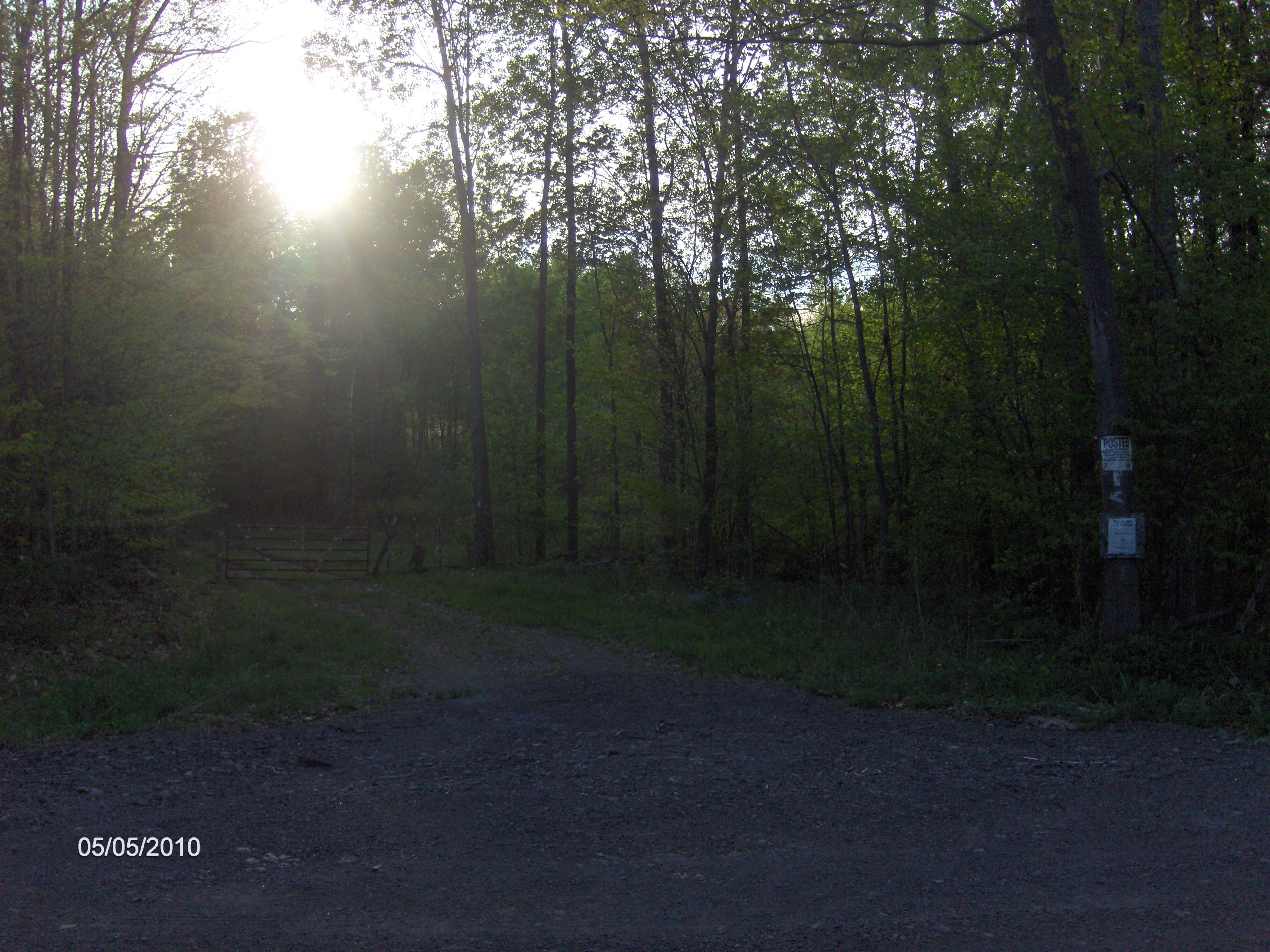
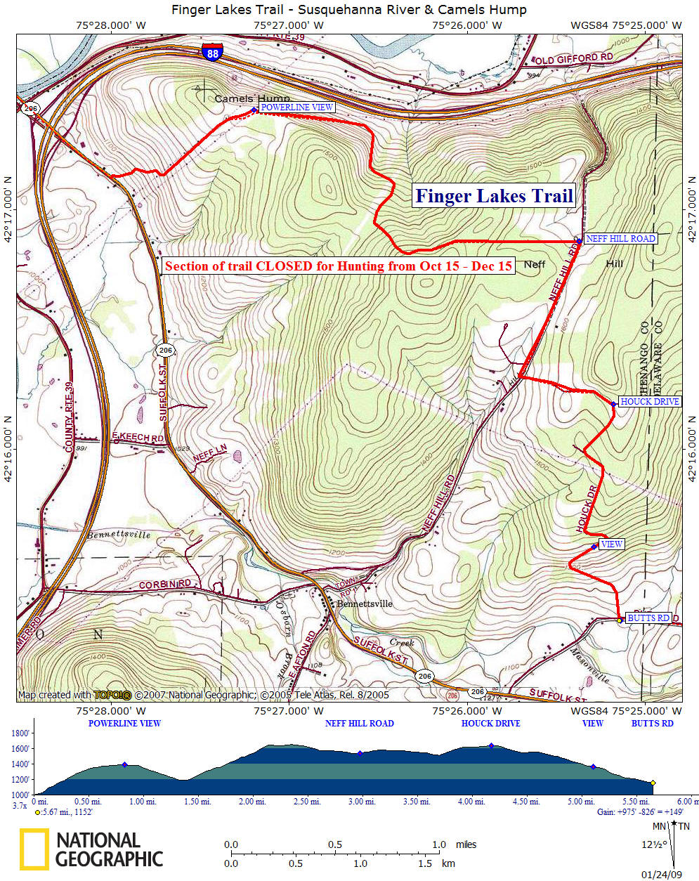
This section of the Finger Lakes Trail begins after leaving Bainbridge, crossing the Susquehanna River on the NY 206 bridge, going under the I-88 bridge and turning left off NY 206 soon after I-88. The trail from here to Neff Hill Road (3 miles) is CLOSED for Hunting from Oct 15 - Dec 15. Please respect the landowners request and stay off the trail during those dates.
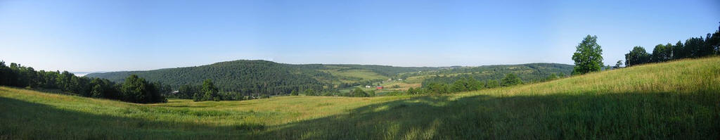
The trail begins off NY 206 by following the left side of a hedgerow. The trail will cross under power lines and begin to follow the power lines as you ascend up Camels Hump. You haven't made a wrong turn and landed in Vermont. This is a different "Camels Hump". You have some views behind you as you climb, but the best views are as you veer right with the power lines. Here you have a fantastic view of the Susquehanna River Valley. Remember that you are on private property and stay on the marked trail.
The trail continues to follow close to the power lines, heading closer and closer to I-88 before veering right onto an old logging road, which is really more of a gully than a road. The trail now ascends Neff Hill before leveling and then slightly descending to Neff Hill Road.
Once you reach Neff Hill Road, then remainder of this section of the trail are on little used roads. The trail turns left on Highland Acres Road and ascends up the road before turning right on Houck Road. Now you begin a long descent toward Butts Road, NY 8 and Masonville. There is one more good view along Houck Road before reaching Butts Road. This is the last section of the Finger Lakes Trail in Chenango County. The trail now enters Delaware County on it's eastern journey toward the Catskills.
This 5.7 mile section of the Finger Lakes Trail is moderate hiking with 2.7 miles of road walk and 3 miles of trail on private property.
Bainbridge is a popular rest stop and re-supply point for FLT thru hikers. There a few motels, bed & breakfasts, grocery stores, post office and a campground all located nearby the white blazes of the Finger Lakes Trail. This stretch of the Finger Lakes Trail is featured on map M26 from the FLTC.
Directions: This section of trail is a little over 90 minutes away from Syracuse, NY. To reach this section take I 81 south to the Whitney Point exit. Turn left on NY 79/US 11 and follow road into the village. Look for the NY 206 signs and turn left on NY 26, then a quick right on NY 206. It is 27 miles to Bainbridge on NY 206. There is no good parking here. The GPS coordinates are N42 17.131 W75 28.000.
Finger Lakes Trail at Neff Hill Road
Mile Elevation Trail Description (follow white blazes) 0.0 1003 feet Trail turns left off NY 206 about 0.25 mile past the I-88 interchange. Ascend up Camels Hump by following left side of hedgerow. From here to Neff Hill Road the trail is CLOSED for hunting from Oct 15 - Dec 15.
0.3 1186 feet Cross under power lines and trail turns left.
0.7 1381 feet Trail veers right. Camels Hump.
0.8 1388 feet View of Susquehanna River Valley. Trail descends with power lines.
1.4 1191 feet Trail turns right and ascends Neff Hill on old logging road that now just a gully.
2.2 1648 feet Trail levels off.
2.4 1653 feet Descend toward Neff Hill Road.
3.0 1535 feet Reach Neff Hill Road and turn right following road. Road walk next 2.7 miles.
3.7 1512 feet Turn left on Highland Acres Road.
4.2 1640 feet Turn right on Houck Road.
4.6 1555 feet Pass under power lines, continue to descend on road.
5.1 1368 feet View
5.7 1152 feet Reach Butts Road and the end of this section. Parking. The FLT turns left and follows Butts Road to NY 8 south and Masonville before heading back on NY 206 for a bit. In Masonville there is a convenience store, general store and post office. For a continuation see the Masonville section.
| CNY Hiking HOME PAGE | Hiking in Chenango County | FLT Eastern/Catskill Section | Bainbridge, NY website | Finger Lakes Trail Mile by Mile |