Finger Lakes Trail
Pharsalia
WMA
![]()
| CNY Hiking HOME PAGE | Pharsalia WMA | FLT Central Section | Hiking in Chenango County |
|
Hiking in Chenango County Finger Lakes Trail Pharsalia WMA
|

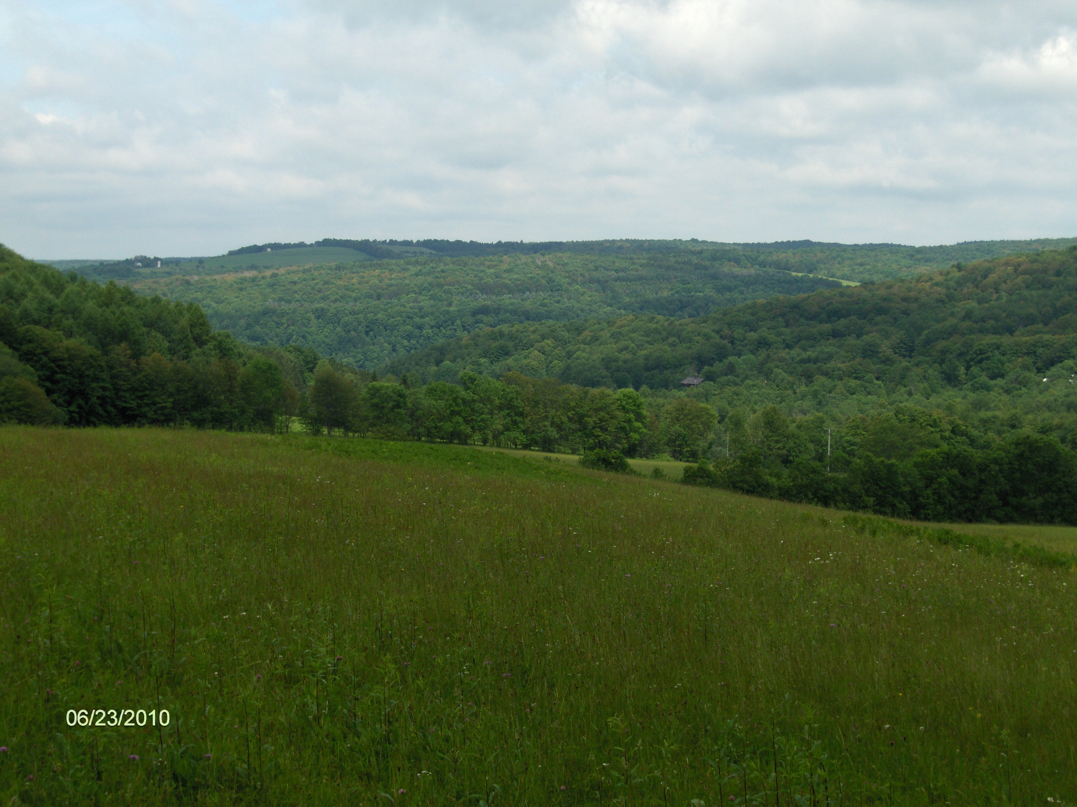
Hiking through Pharsalia WMA along the Finger Lakes Trail will have you wondering what you'll see next. This section has a little bit of everything. As you hike from Stage Road on private property the views from along a field are surprising. Then soon after you enter the WMA, after crossing a stream and some steep climbing at times, you are treated with the "Waterfalls of Pharsalia" (if not dry).
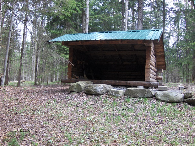
The Perkins Pond Lean To is located just off the trail along a blue blazed trail north of Church Hill Road. The lean to is actually in Perkins Pond State Forest. After some tough hiking during the first part of this section, the trail soon levels out, crosses a couple of seasonal roads and takes you by the first of two ponds by the trail. The first pond (Johnson Pond) is the larger of the two and is a popular fishing spot. You'll see some camping spots along the eastern shore of the pond. This is a great spot to take a break.
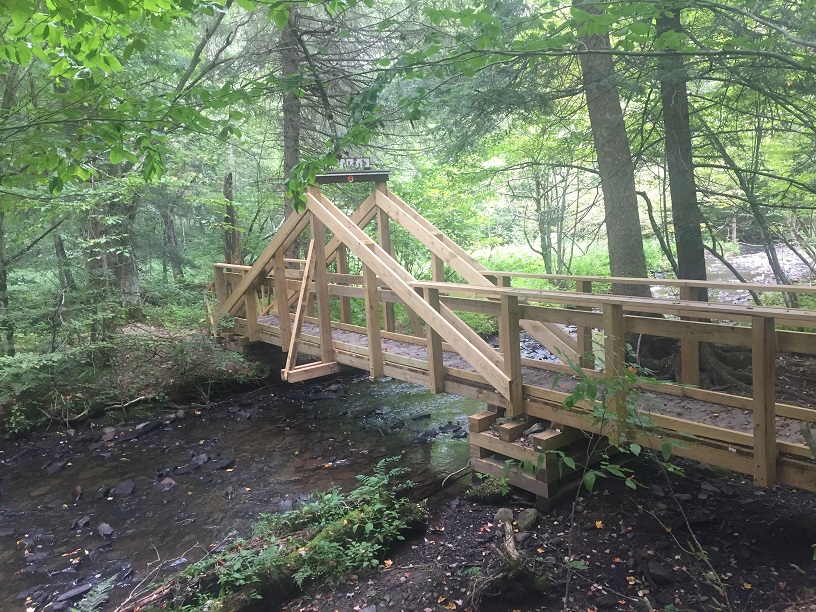
You'll pass the remnants of an old CCC camp before passing the second pond, which is reminiscent of ponds in the Adirondacks. After crossing Canasawacta Creek, the trail reaches NY 23 and the end of this section. Look below for a few pictures, map, detailed description and videos of this section of trail. This stretch of the Finger Lakes Trail is featured on map M23 from the FLTC.
While in the area check out Alice's Dowry Bed & Breakfast in Cincinnatus. It's conveniently located for those looking to hike the Finger Lakes Trail.
Part of the 'Waterfalls of Pharsalia' along the FLT (picture courtesy of Kirk Doyle)
Perkins Lean To
View from the trail near Stage Road
Footbridge just before reaching NY 23
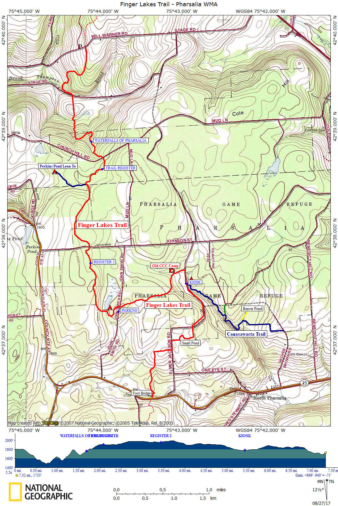
Mile Elevation Description (Following WHITE BLAZES) 0.0 1797 feet Trail crosses Will Warner Road. Shoulder parking west of trail crossing GPS N42 39.734 W75 44.306
0.85 1547 feet Cross Stage Road. Shoulder parking GPS N42 39.293 W75 44.395. Follow edge of field. Views
1.1 1561 feet Enter woods.
1.3 1663 feet Enter Pharsalia WMA
1.7 1820 feet The "Waterfalls of Pharsalia" are along the trail on your right
1.95 1882 feet Cross dirt Church Hill Road. Shoulder parking GPS N42 38.708 W75 44.007
2.1 1908 feet Trail register.
2.4 1904 feet Blue blazed trail on right goes 0.4 mile to Perkins Pond Lean-To
3.2 1964 feet Cross dirt Johnson Street. Shoulder parking GPS N42 37.873 W75 44.182
4.05 1896 feet Johnson Pond. There is some primitive camping on the east side of the pond.
4.35 1934 feet Cross John Smith Road. Pull off parking to the south. GPS N42 37.267 W75 43.805
5.1 1822 feet Pass by an old CCC camp from the 1930s. 5.3 1780 feet Right on Elmer Jackson Rd and follow dirt road. Shoulder parking GPS N42 37.647 W75 42.958
5.4 1785 feet Kiosk near Lower Pond. Camping on east side of pond. Junction of blue blazed Canasawacta Creek Trail that follows a branch of the scenic stream for awhile and ends 1.6 miles at Grover Brown Road. 6.0 1882 feet Turn left off the road. GPS N42 37.132 W75 42.871 6.2 1842 feet Pass small pond. 6.4 1857 feet Turn left on dirt road. 6.5 1833 feet Turn right off road and follow along an old woods road. 6.7 1848 feet Turn left off old woods road. Trail follows an old stone fence for a bit. 7.2 1691 feet Cross Canasawacta Creek on a really nice footbridge. 7.3 1733 feet Reach NY 23. Trail crosses road and enter Pharsailia Woods State Forest. VERY BUSY ROAD. Shoulder parking GPS N42 36.458 W75 43.390
| CNY Hiking HOME PAGE | Pharsalia WMA | Hiking in Chenango County |