Catskill Forest Preserve
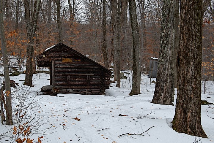
Balsam Lake Mountain Wild Forest
Willowemoc Wild Forest
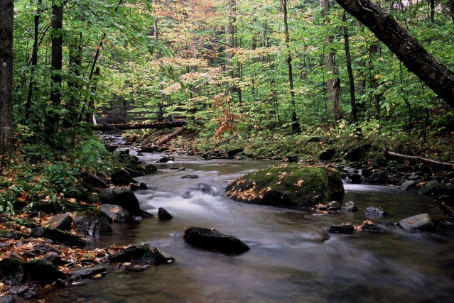
Fall Brook
![]()
| CNY Hiking HOME PAGE | Finger Lakes Trail | FLT Eastern/Catskill Section | Catskill Forest Preserve |
|
Finger Lakes Trail Catskill Forest Preserve Balsam Lake Mountain Wild Forest Willowemoc Wild Forest Fall Brook
|
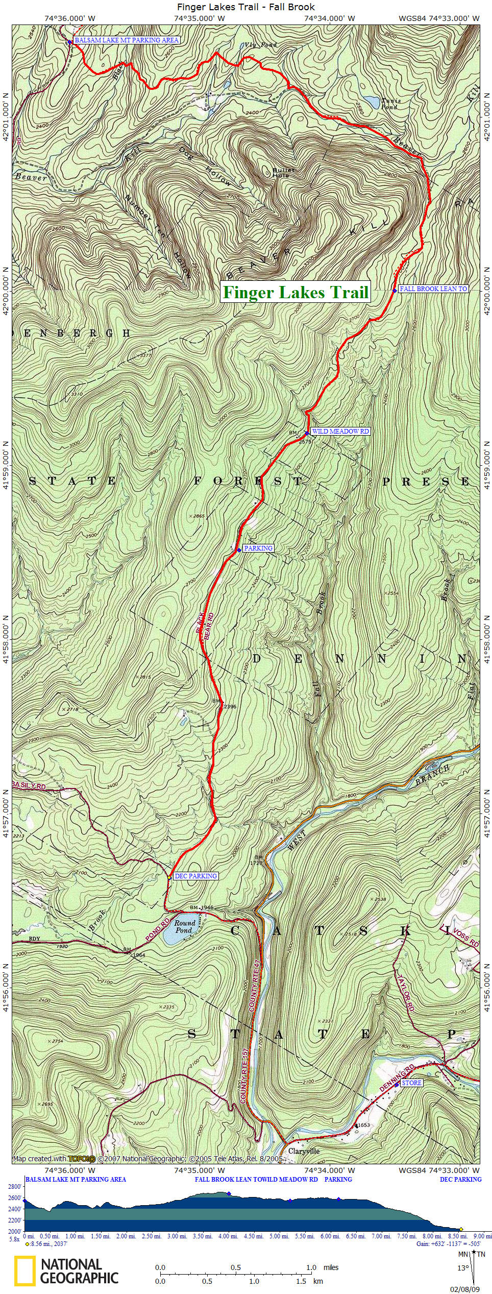
This 8.6 mile section of the Finger Lakes Trail lies within the Balsam Lake Mountain and Willowemoc Wild Forest of the Catskill Forest Preserve. After completing the Mill Brook Ridge section, this part of the trail is a welcomed relief. There is an overall elevation gain of over 600 feet, however you lose over 1100 feet in elevation in this section.
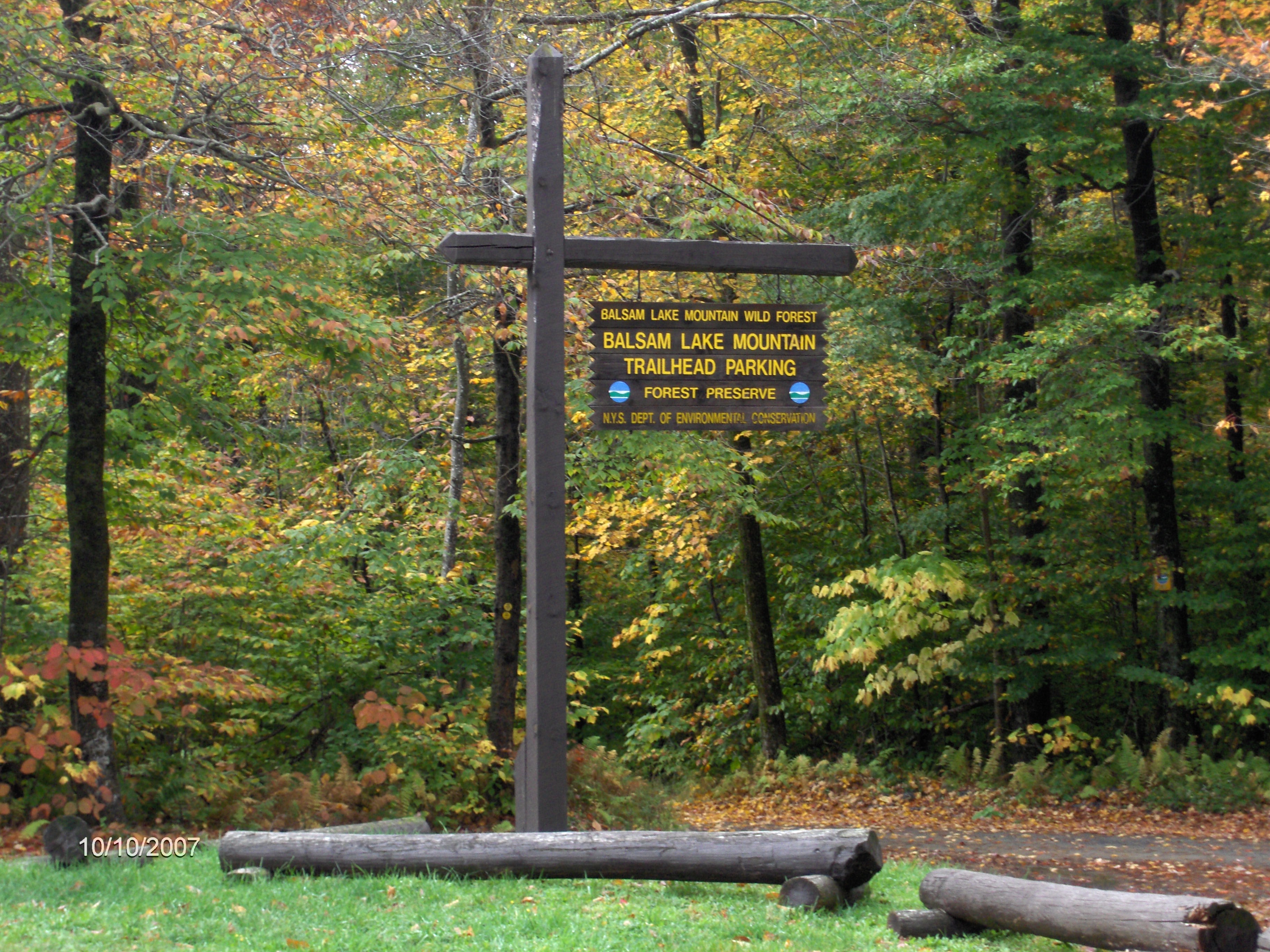
From the Balsam Lake Mountain Trailhead, follow the Neversink-Hardenburgh Trail (yellow discs) out of the parking area. Soon you will cross Black Brook on a footbridge and then a footbridge over Gulf of Mexico Brook. The trail then reaches and follows an old logging road that ends up turning into a footpath.
You are in the upper sections of the Beaverkill River, a few miles from its source between Graham and Doubletop Mountains. There are a few camping spots along this section of trail. The trail will cross the river on stones, then at an open meadow with a nice view of Graham Mountain the trail turns right.
The trail will soon begin to follow near Fall Brook. More camping spots mark the change and soon reach Fall Brook Lean To. The trail continues for another 1.4 miles before reaching Wild Meadow Road. The trail now follows this road to a DEC Parking Area near its end for the end of this section.
The Finger Lakes Trail now follows roads into Claryville, the last hamlet before the trails eastern terminus. The trail follows Denning Road to its next and last trailhead. Located in this area is the Frost Valley YMCA Camp, located on County Route 47.
Directions from Syracuse: This section of the Finger Lakes Trail is over 160 miles away from Syracuse and is a 3 hour trip. I-81 south to NY 17 East. NY 17/I-86 East to Exit 94 Roscoe. Turn left on Stewart Ave, then right on old NY 17/CR 179. Sharp left on Beaverkill Rd/CR 152. Beaverkill Road becomes Turnwood Road/CR 54 after 9 miles. Follow Turnwood/Beaverkill Road to the Balsam Lake Mountain Trailhead.
Fall Brook Lean To
Mile Elevation Trail Description 0.0 2542 feet From the parking area at the Balsam Lake Mountain Trailhead. Follow yellow discs of the Neversink-Hardenburgh Trail.
0.5 2356 feet Cross Black Brook on footbridge.
1.3 2412 feet Cross Gulf of Mexico Brook on footbridge.
1.5 2426 feet Cross outlet of Vly Pond.
2.0 2412 feet Turn left on old logging road. Now following Beaverkill River.
3.0 2553 feet Trail turns right.
4.0 2669 feet Fall Brook Lean To.
5.2 2549 feet Trail reaches the end of Wild Meadow Road. Now following road.
6.2 2577 feet Parking.
6.7 2563 feet Road begins to descend.
8.6 2037 feet DEC Parking area and the end of this section. The FLT is on all roads for the next 12.8 miles to the final trailhead on Denning Road. The FLT goes through Claryville, the final small hamlet on the trail and passes Claryville General Store as well as the Strauss Center of the Frost Valley YMCA. For a continuation see Denning Trailhead.
| CNY Hiking HOME PAGE | Finger Lakes Trail | FLT Eastern/Catskill Section | Catskill Forest Preserve |