in Pennsylvania
Delaware Water Gap
to Mount Minsi
![]()
| CNY Hiking HOME PAGE | Best of the AT in Pennsylvania | Appalachian Trail in Pennsylvania |
|
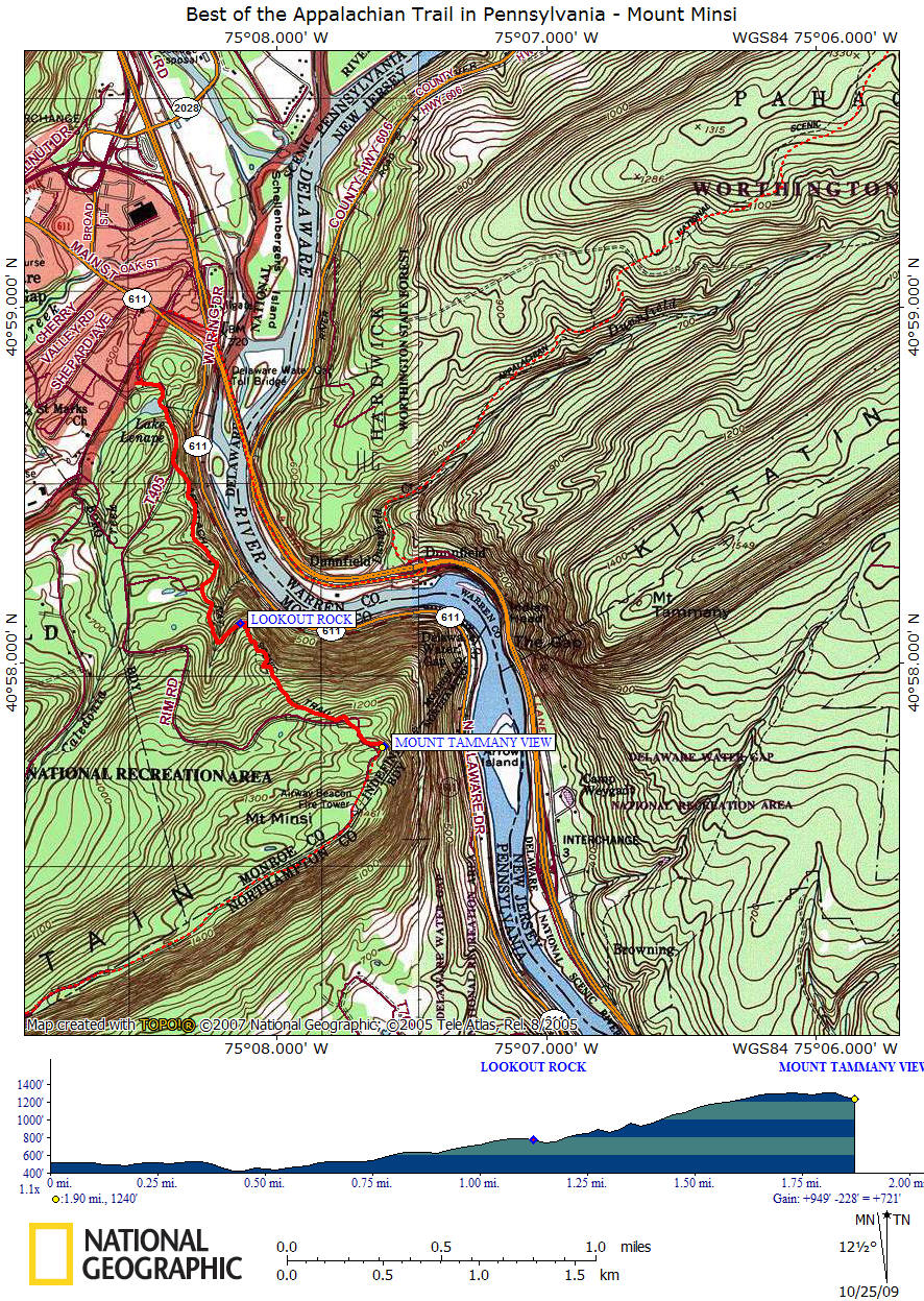
Best of the Appalachian Trail in Pennsylvania Delaware Water Gap to Mount Minsi
|

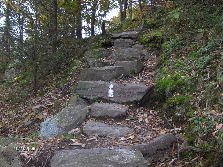
There are a few steep climbs on this 3.8 mile round trip hike, but it's worth every step you take. As you climb out of Delaware Water Gap and pass Lake Lenape, there are several outstanding views of the gap as well as Mount Tammany. The trail sometimes utilizes the many rocks by using them as steps.
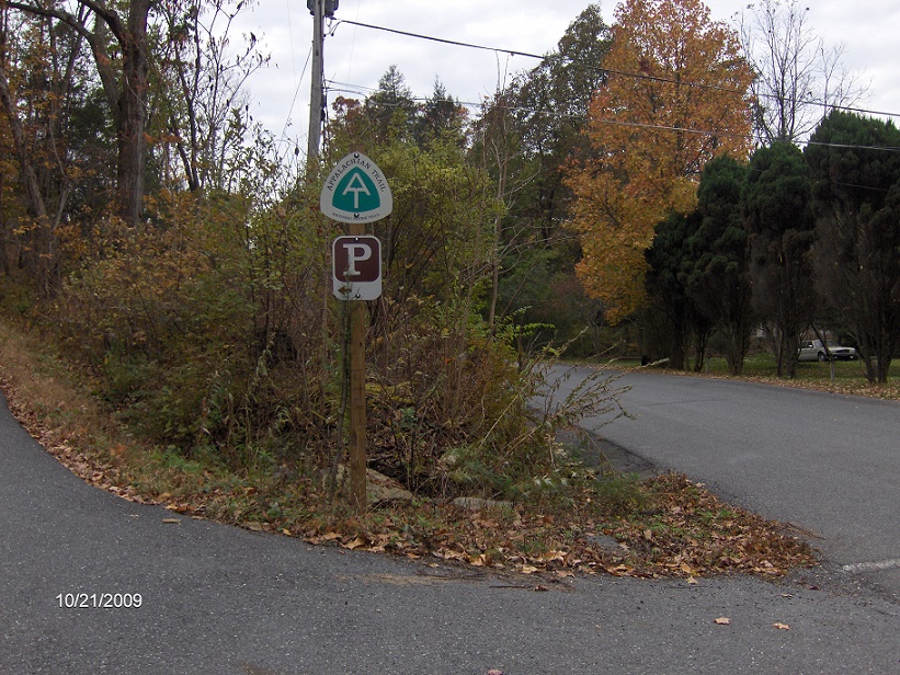
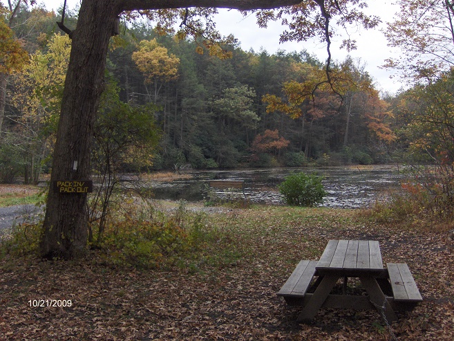
From the Mountain Road parking area, your "southbound" on the white blazed Appalachian Trail. Pass by a kiosk and the trail starts as a paved path as you pass by Lake Lenape after just 0.15 miles of walking. There is a couple of benches to enjoy the lake as well as a picnic table if you wish to have a picnic prior to continuing your hike. A gentle climb starts on the fire road. Look at the cliffs to your right as you walk.
After 0.35 miles of walking along the wide fire road, the Appalachian Trail turns left off the road. The fire road does meet up again with the AT at 1.7 miles, which creates a loop option. At 0.7 miles, Council Rock is on your left (there is a sign). The views are now through the trees as this view point is experiencing over growth. From here it's a short while before reaching Winona Cliffs at 0.9 miles.
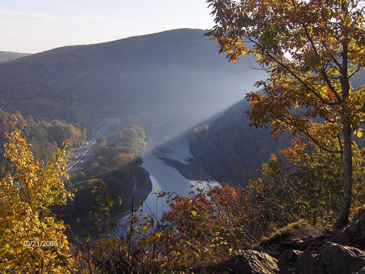
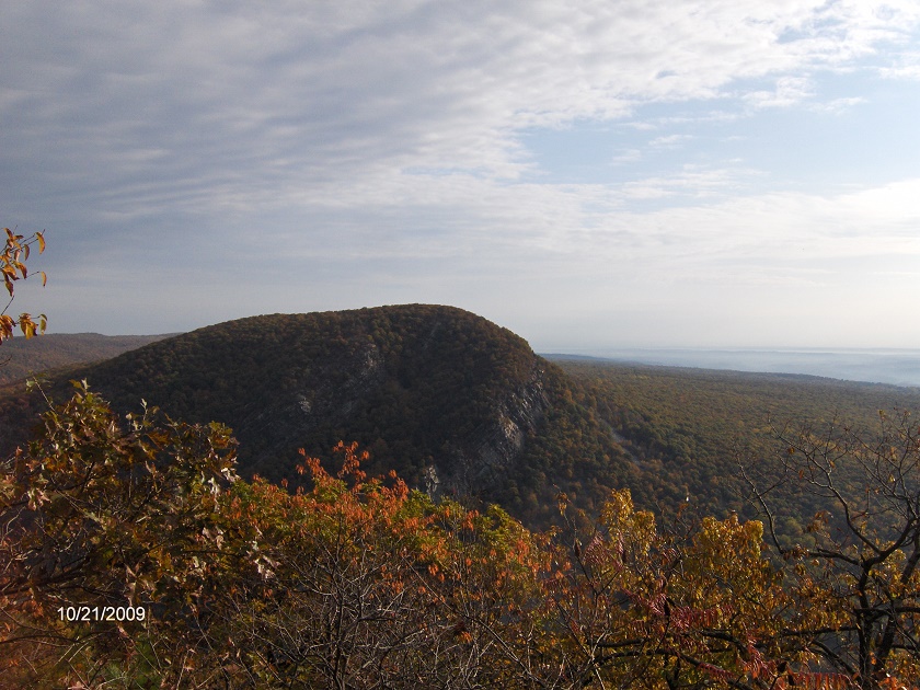
Cross Eureka Creek at 1 mile and Lookout Rock at 1.15 miles. The climb becomes steeper now as you ascend quickly toward the summit of Mount Minsi. At 1.7 miles reach the fire road and the climb is a bit easier as you make you last ascent to a wonderful rock outcropping at 1.9 miles with a spectacular view of Mount Tammany as well as the New Jersey "wilderness" across the Delaware River.
There is one more view plus the wooded summit of Mount Minsi further along the AT if you want to extend the length of your hike. Don't expect to be alone on this hike, as it is one of the most popular hikes along the AT in Pennsylvania. Look below for pictures, a video and map of this hike.
DIRECTIONS: From Syracuse, I-81 South to Scranton, PA. I-380 South to I-80 East. I-80 East to the PA 611 exit for Delaware Water Gap (plus rest area). Take PA 611 south into village. Turn right on Mountain Road (you'll see AT sign on left). Veer left at AT parking sign. Park in the large parking area. The GPS coordinates are N40 58.788 W75 08.518 for those who have a GPS devise in their vehicle. Head to the "gate" and kiosk to start your hike.
Pictures from along the Appalachian Trail
AT parking sign off Mountain Road
Picnic table at Lake Lenape along the Appalachian Trail
Rock steps along the Appalachian Trail
View from Lookout Rock
Mount Tammany from Mount Minsi
| CNY Hiking HOME PAGE | Best of the AT in Pennsylvania | Wolf Rocks & Lunch Rocks |
contact CNY HIKING by email at contact@cnyhiking.com
(c) 2006-today CNY Hiking - All rights reserved. Any use of information from this site without permission is strictly forbidden.