North Country Trail
Sweedler Nature Preserve
at Lick Brook
![]()
| CNY Hiking HOME PAGE | Finger Lakes Trail | FLT Central Section | NCT in Central New York | Hiking in Tompkins County |
|
Hiking in Tompkins County North Country Trail Sweedler Nature Preserve at Lick Brook
|

History
After the Revolutionary War, the land that is now the Sweedler Nature Preserve was cleared and used for agriculture. The farms in the area were later abandoned, leaving the land to recover and eventually return to forest. Since the 1800's, Lick Brook has been a favorite picnic and hiking spot. In 1993, the Finger Lakes Land Trust purchased Lick Brook from Moss and Kristin Sweedler. Today, thanks to the Sweedlers and contributing members, the Land Trust owns this "Lost Gorge" to protect its unique and largely undisturbed woodland from future development.
Natural History
Lick Brook's 128 acres provide excellent examples of the area's geologic history and ecological systems. During the last ice age, glaciers thousands of feet thick covered much of northern North America. The ice scoured the land, sculpting the beautiful topography of the Finger Lakes Region.
Much of the Sweedler Preserve is covered by stands of Eastern Hemlock and White Pine, but many varieties of trees and shrubs thrive here, including familiar oak and maple as well as the less common cucumber magnolia. In the autumn, Lick Brook becomes part of a colorful tapestry that blankets the region in red, yellow and orange. The steep topography of the preserve dictates the downward flow of soil nutrients, which collect in the forest and meadows at the base of the slope. This produces a tremendous springtime wildflower display. Among the flowers that cover the forest floor are Wild Geranium, Dutchman's Breeches, and the aptly named Spring Beauty.
Finger Lakes Trail - North Country Trail
The Finger LakesTrail / North Country Trail enters Sweedler Nature Preserve from the west near the parking area off NY 13/38/96. The trail crosses Cayuga Inlet and soon enters the preserve. The crossing at Cayuga Inlet is the lowest point of the Finger Lakes Trail in all of New York state at 430 feet. After crossing Lick Brook there is a side trail that leads to the High Falls of Lick Brook. There is also a blue blazed trail that steeply leads up the gorge with some views of a few other falls/cascades. Following the FLT/NCT, the trail ascends at a better grade and passes an unnamed waterfall.
This section of the trail is one of the most popular in New York. It climbs over 1000 feet from Cayuga Inlet on it's way to Danby State Forest. The trail reaches Townline Road and leaves Sweedler Preserve as the trail turns right, following the road. The orange blazed trail ahead travels 1.9 miles to Buttermilk Falls State Park. This spur trail is closed for hunting from Oct 13-Dec15. Please respect the landowners request and stay off the trail during these dates. Remember that it's the generosity of these landowners that allows the trail to continue through these private lands.
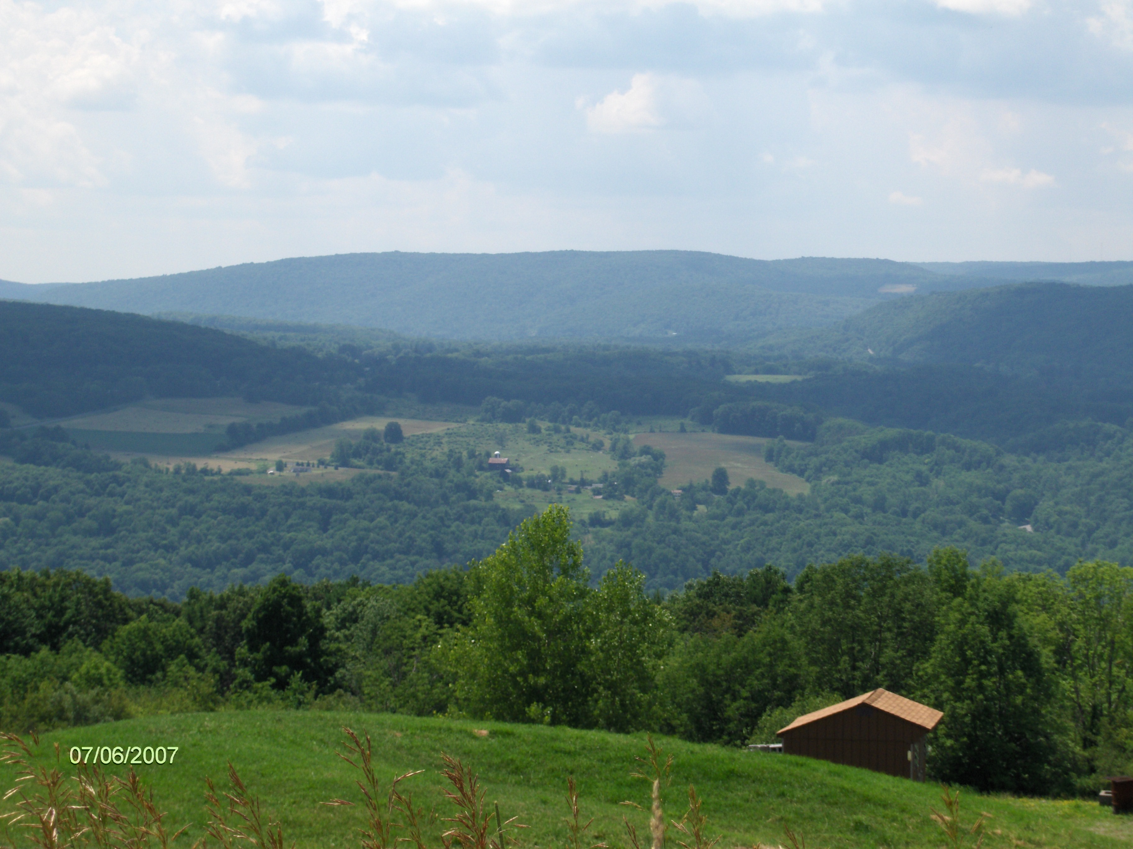
As you walk along Townline Road, at times you'll have nice views to your right. The trail leaves Townline Road on an abandoned section of the road near the corner of Layden Road. You are still on private property. After crossing Hilltop Road, there are impressive views of Inlet Valley to your right and soon in front of you. The trail reaches Bruce Hill Road and the end of this stretch of the FLT/NCT. There was an update in late 2012 which the trail now continues off road across Bruce Hill Road, eliminating the road walk. We will update this soon on our site.
DIRECTIONS - From Ithaca, NY 13/34/96 south past Buttermilk Falls State Park and NY 327. The parking area is off NY 34/96 at the NY 13 split on the left side. GPS coordinates are N42 23.893 W76 32.770 for those who have a GPS devise.
High Falls of Lick Brook
Mile Elevation Description 0.0 436 ft From the large parking area off NY 13/34/96 follow the white blazes east.
0.2 430 ft Cross Cayuga Inlet. If you cross using the railroad bridge --> Warning: This is an active railroad.
0.5 435 ft Cross Lick Brook and enter Sweedler Nature Preserve.
0.6 477 ft Lower falls of Lick Brook on your right. Junction with steep blue blazed loop trail.
1.25 824 ft High Falls of Lick Brook. Junction with steep blue blazed loop trail. Views.
1.5 918 ft Trail Register. Soon reach Town Line Rd and leave Sweedler Nature Preserve. Turn right and follow road. Junction with orange spur trail straight ahead that leads 1.9 miles to Buttermilk Falls State Park.
2.5 1148 ft Pass Jersey Hill Road on left. Views on your right from time to time.
3.15 1308 ft Layen Road on left. Continue straight on old section of Town Line Road. The trail is CLOSED for hunting from here to Bruce Hill Road from Oct 1 - Dec 22.
3.5 1370 ft Cross Hilltop Rd. Views.


4.6 1354 ft Reach Bruce Hill Rd. The trail has been rerouted where it continues off road until reaching Comfort Road. We will update soon. Next section is in Danby State Forest.

| CNY Hiking HOME PAGE | Finger Lakes Trail | Finger Lakes Trail Central Section |
| North Country Trail in CNY | Danby State Forest | Robert Treman State Park |