Moose River Plains Wild Forest
Bug & Eagle
Nest Lakes
via the Uncas Trail
![]()
| CNY Hiking HOME PAGE | Arnold's Rock Trail |
|
Hiking in Adirondack Park Moose River Plains Wild Forest Bug & Eagle Nest Lakes via the Uncas Trail
|
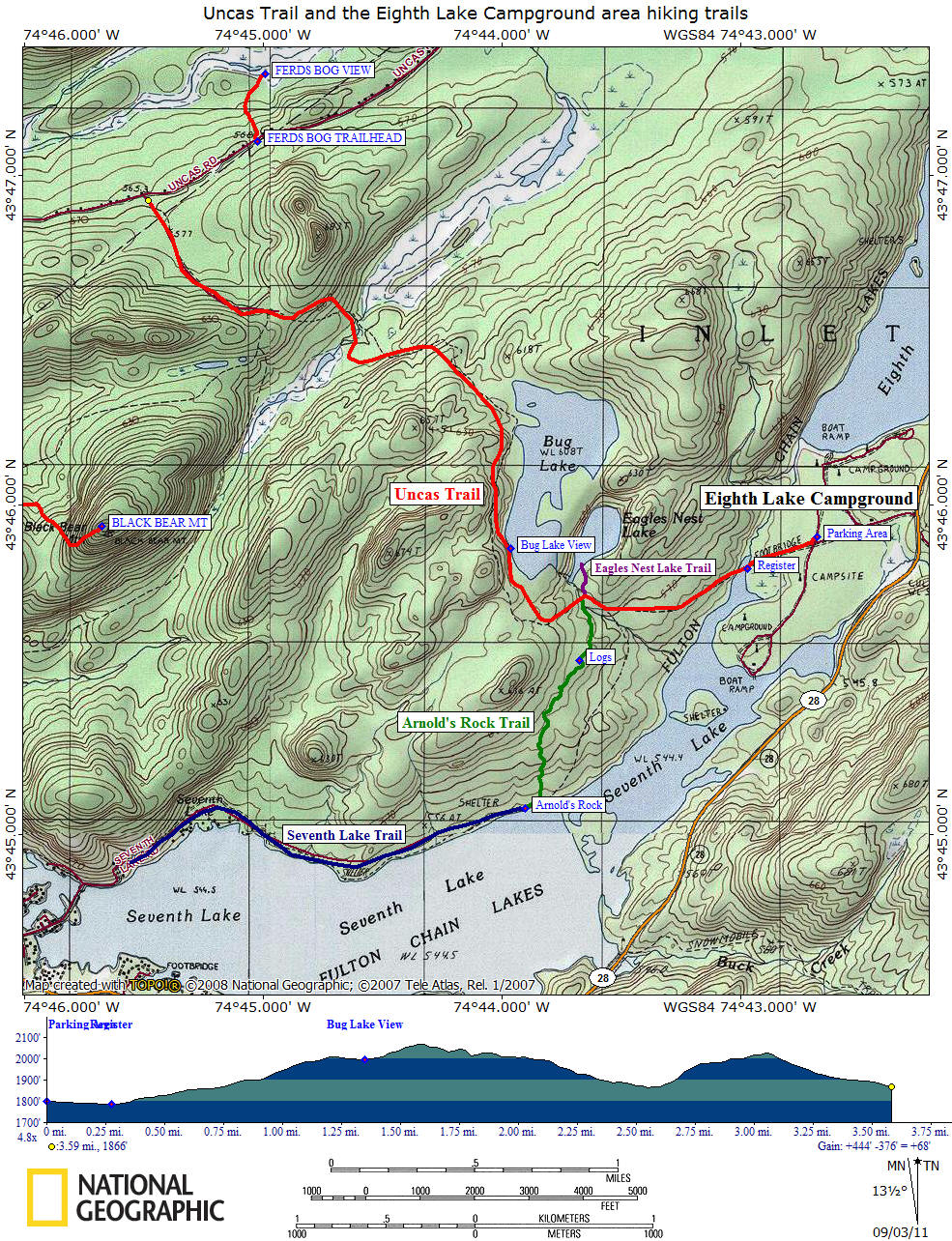
The 3.6 mile Uncas Trail is part of the original Uncas Road that was built a long time ago. We recommend anyone visiting Eighth Lake Campground to take a hike along this famous old road to Bug Lake and a side trip to Eagles Nest Lake.
The Uncas Trail begins in Eighth Lake Campground between campsite 68 and 72 with a small parking area off the main campground road. Here is a map of the campground from the NY DEC. From between the two campsites, the trail follows the old road. There are DEC trail signs at the start of the trail and the first 300 feet of the trail is open to vehicles (although a bit rough). There is a gate and a few parking spots as the trail leaves the campground and enters Moose River Plains Wild Forest. You are following yellow trail markers.
Sign at the start of the Uncas Trail at Eighth Lake Campground
After passing the gate the trail comes to a trail register and the bridge over Seventh Lake Inlet. After crossing the bridge, the old road heads uphill. It's a steady climb on a gentle grade. You may pass bicyclists along the wide trail from the campground.
At 0.9 miles the trail reaches the junction of the short side trail that leads 0.1 miles (sign says its 0.3 miles, it's not that far) to Eagles Nest Lake. Take the short side trip to this scenic lake. Some maps and older guide book show this trail as a "loop" that goes back to the main Uncas Trail, we saw no evidence of that when we explored the area in 2011. So plan a quick out and back adventure to Eagles Nest Lake. The Eagles Nest Lake Trail tends to be muddy in parts and be sure to veer right at an unmarked intersection prior to reaching the lake.
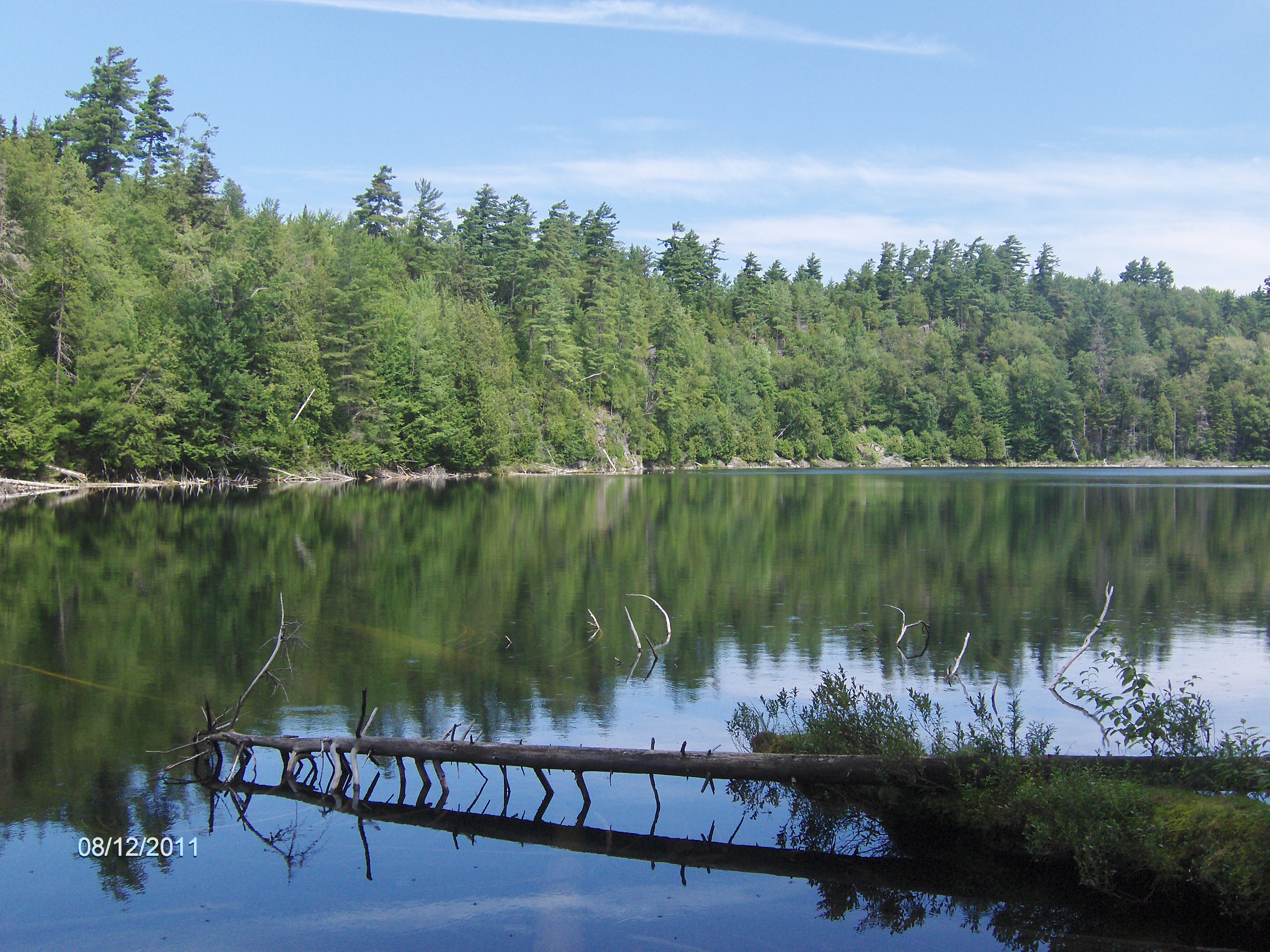
Eagles Nest Lake
Back on the Uncas Trail, the trail crosses the outlet to Bug and Eagles Nest Lake on a nice bridge. Soon after crossing the bridge you'll pass the junction of the newly built (in 2011) Arnold's Rock Trail that leads 0.9 mile to the shore of Seventh Lake and toward Arnold's Rock, where you can continue along the north shore of the lake along the Seventh Lake Trail.
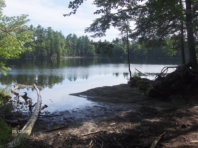
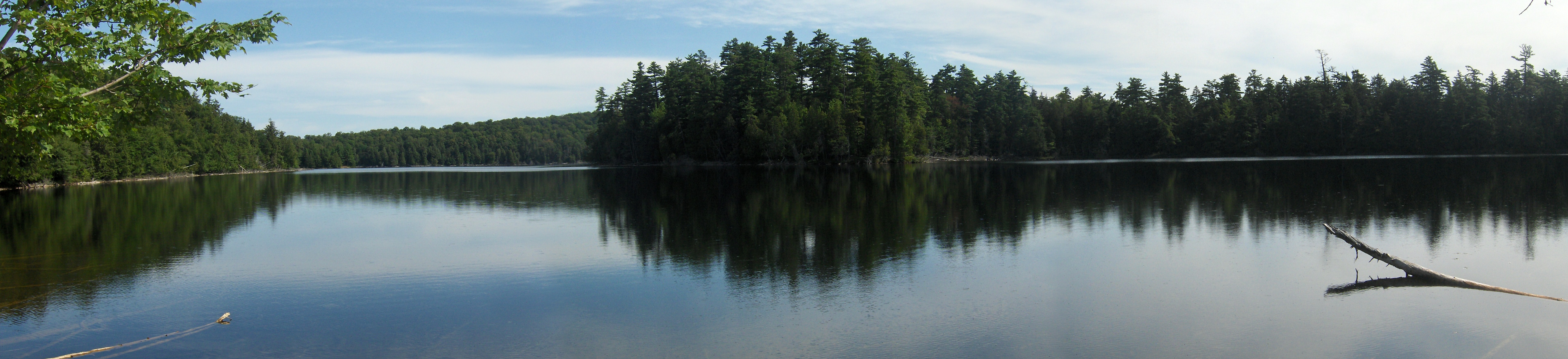
At 1.35 miles there is a very short side trail on the left that leads to a rocky outcrop along the shore of Bug Lake with a nice view of the lake. This is the perfect picnic spot and a nice turn around place for those who don't want to explore the trail further. The old road follows near Bug Lake briefly before turning NW.
Rocky outcrop on Bug Lake
At 2.55 miles the trail crosses No Luck Brook on a long bridge. At 2.95 miles the trail reaches the junction of the Black Bear Mountain Trail on the left. The Uncas Trail ends at the Uncas Road trailhead at 3.6 miles. If your hiking to Black Bear Mountain, use the NY 28 trailhead just south of Inlet. It's shorter and less of an elevation gain.
Directions: The southern trailhead is located at Eighth Lake Campground off NY 28 about 6.1 miles east of Inlet. There is parking off the main campground road near campsite 68. The northern trailhead is located off dirt Uncas Road.
Look below for a trail map and a video of my hike to Bug Lake and Eagles Nest Lake.
Thanks for visiting this website and we hope you found this information helpful in planning your Adirondack adventure! Please help this website by donating using the button below!
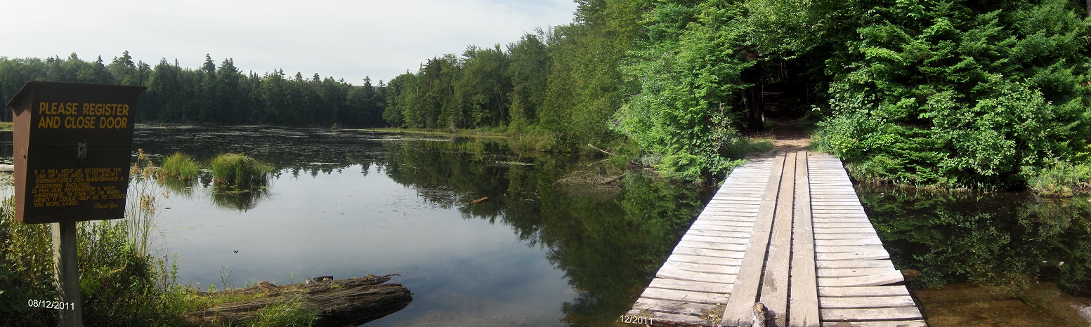
Uncas Trail register and bridge over Seventh Lake Inlet
| CNY Hiking HOME PAGE |