Waterfalls in Central & Western NY
High Falls &
Lower Falls
of Rochester
![]()
| CNY Hiking HOME PAGE | Hiking in Central New York | Hiking in Monroe County | Waterfalls in Central & Western NY |
|
Hiking in
Monroe County Waterfalls in Central & Western NY High Falls & Lower Falls of Rochester
|
Located in the city of Rochester along the Genesee River are the 78 foot Lower Falls, the 20 foot Middle Falls and the spectacular 96 foot High Falls. A combination of easy walks and short drives makes at least two of these waterfalls a must see when visiting the Rochester area. Look below for information on each of these waterfalls.
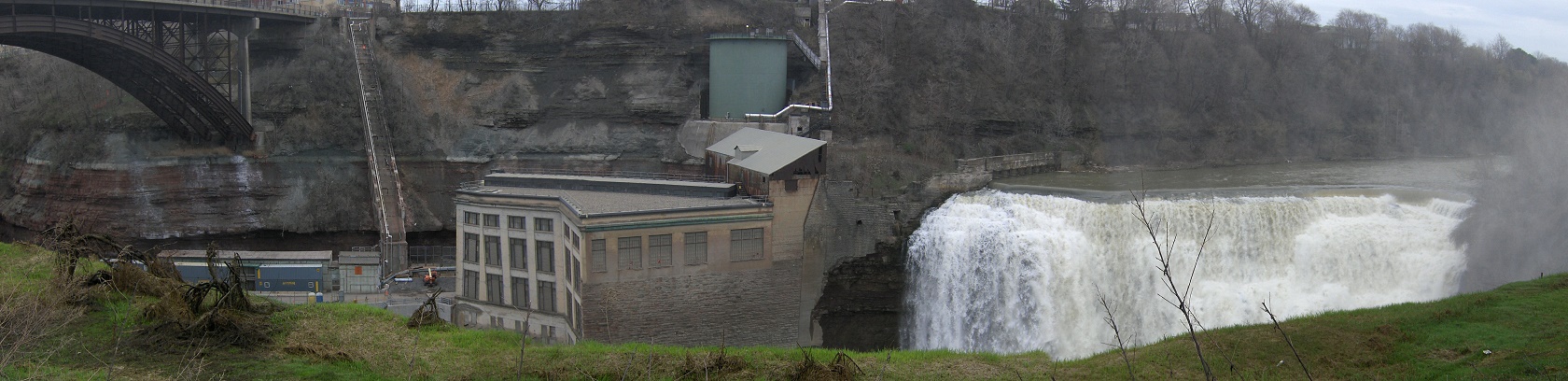
Lower Falls - The Lower Falls are easily accessed from a large parking area at Maplewood Park off Driving Park Avenue, south of NY 104. The GPS coordinates of the parking area is N43 10.928 W77 37.821 for those who have a GPS devise in their vehicle. Be forewarned about this area, as it does seem to have some seedy characters that hang out in the park at times. Keep alert if you decide to take a walk in this area.
From the parking area, walk past the rest room building and past the Genesee Riverway Trail kiosk. Take the trail that leads into the gorge and soon you'll be walking toward (under) the Driving Park Ave bridge. You might notice the remains of old buildings on the left between the trail and river gorge. Soon the trail goes under the big bridge as the sound of the falls get louder. At 0.2 miles you arrive at the first overlook (panorama above). Continue on, keeping left at each trail junction and arrive at the best view of Lower Falls at 0.3 miles near a sculpture.
Middle Falls - A short distance upstream from Lower Falls are Middle Falls, however I wouldn't waste anytime looking for the falls as they were dammed a long time ago for the power plant at the Lower Falls.
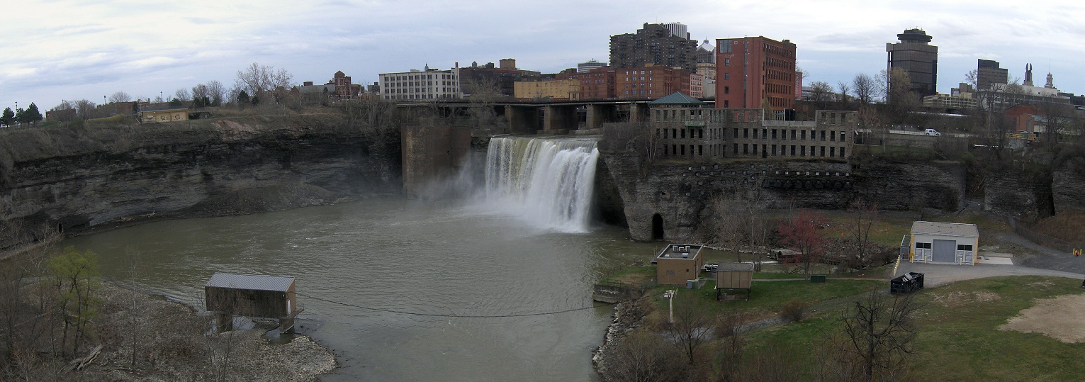
High Falls - This 96 foot waterfall is the most spectacular of the three Rochester waterfalls. A pedestrian bridge over the Genesee River Gorge allows visitors a great opportunity to view High Falls. The toughest thing about these falls is the parking. Some guide books will have you park in a small six car parking area on the east side of the river near the Genesee Brewery. We suggest parking at one of the metered parking spots on Mill Street, north of Platt Street on the west side of the river.
Walk along Mill Street and then turn left on Platt Street to reach the pedestrian bridge. Walk over the bridge to get the views of the gorge and of High Falls. The GPS coordinates of where you should park along Mill Street is N43 09.665 W77 37.074 for those who have a GPS devise in their vehicle. Be sure you have coin for the meter. Look below for a map, a video and a picture of High Falls from the pedestrian bridge.
You can find more information on these waterfalls as well as many other waterfalls in the book New York Waterfalls: A Guide for Hikers & Photographers
.

High Falls of the Genesee River in Rochester
| CNY Hiking HOME PAGE | Hiking in Central New York | New York State Parks |