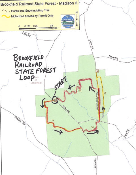
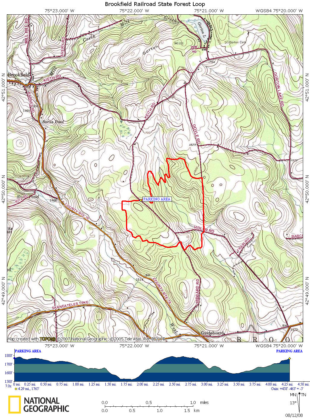
This circuit hike utilizes the Brookfield Trail System to create a 4.3 mile loop in Brookfield Railroad State Forest. This hike is moderate as there is an overall elevation change of 465 feet. These are horse trails, however hikers are always welcomed. Be sure to have your dogs on a leash for the safety of your dog and those riding their horses.
There are a couple of pictures, maps and a detailed description of this loop hike below.
Directions: From Morrisville, NY --> US 20 EAST to NY 12 SOUTH. Turn left on County Route 78. Continue straight onto Keith Road, then right on Vidler Road. Enter the state forest, then in 1/4 mile reach where the trails cross the road. Park on the side of the road.
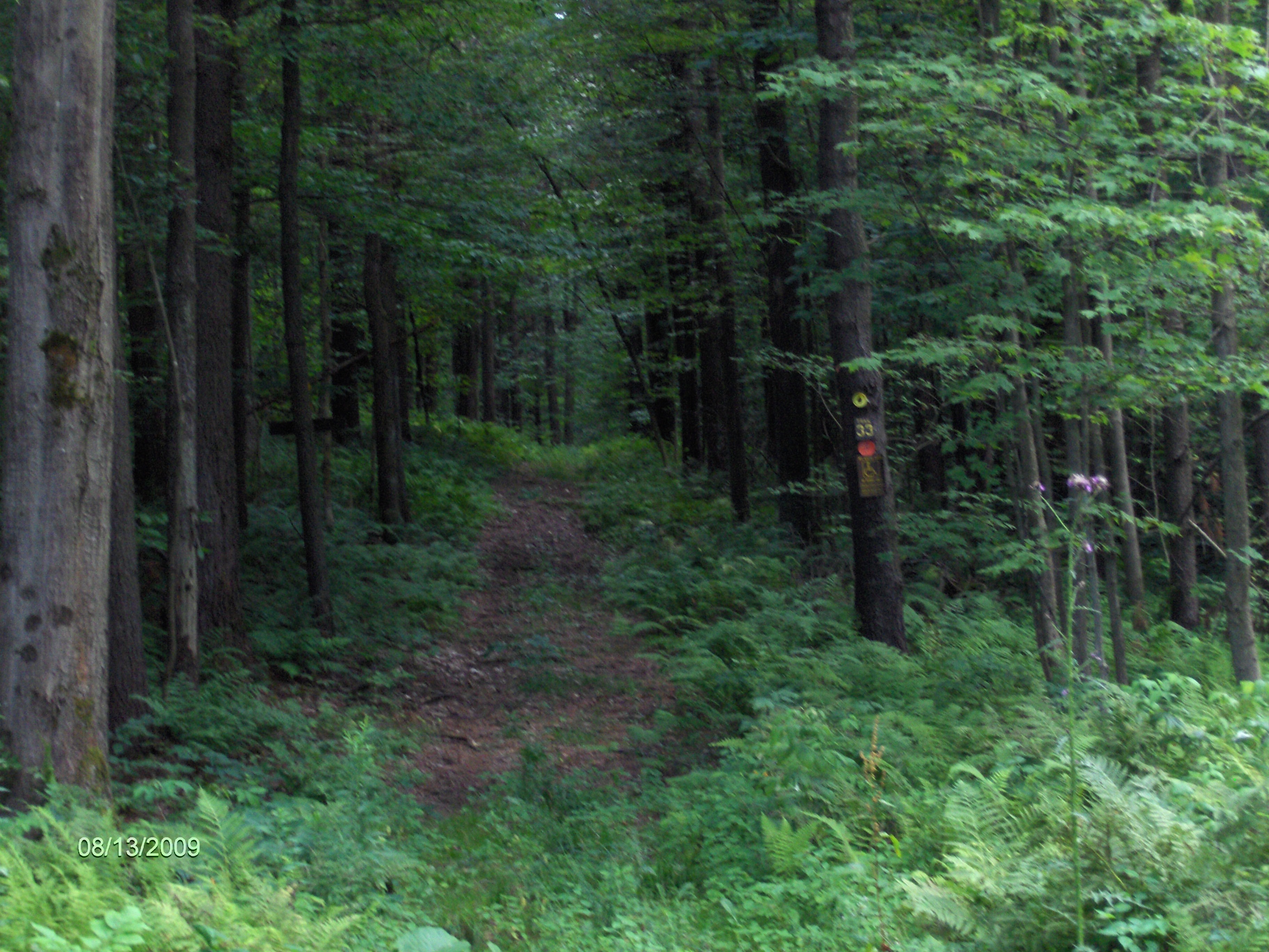
mileage elevation description 0.0 1765 feet Start at the parking area on Vidler Road. Head west on Trail 33.
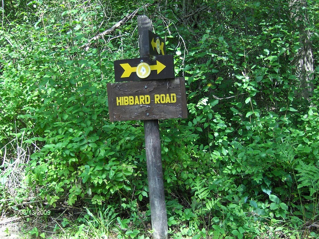
1.3 1640 feet Reach Hibbard Road and turn right following the seasonal dirt road.
1.4 1659 feet Turn left off dirt road onto Trail 34. Descend steeply.
1.9 1526 feet Cross Vidler Road, follow seasonal dirt Will Mason Road. Ascend.
2.5 1791 feet Turn left off road and onto Trail 36. Highest point of hike.
3.4 1590 feet Cross stream.
4.3 1765 feet Reach parking area and end of this loop hike.
Trail sign on Hibbard Road
Trail 33