Peaks of Otter
Sharp Top
Trail
![]()
| CNY Hiking HOME PAGE | Peaks of Otter | Virginia BRP Highlights |
|
Blue Ridge Parkway Peaks of Otter Sharp Top Trail
|
The Sharp Top Trail, despite its strenuous ascent of 1,400 feet in only 1.5 miles, has been one of most popular recreation trails in the country since the nineteenth century. Thousands of people continue to make this hike every year. Most take a bus to the summit and walk down. There is a modest fee for this service. You have the choice for one way or a round trip for the bus ride.
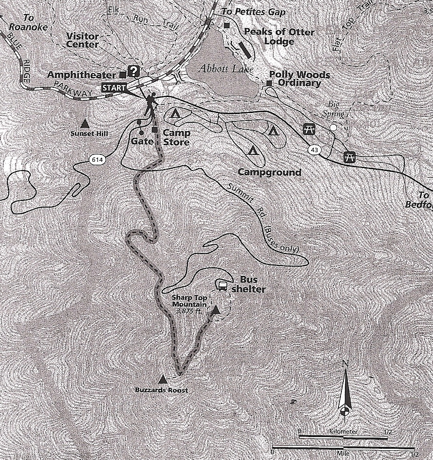
The trail originates at the camp store across the Parkway from the Visitor Center at milepost 86 of the Blue Ridge Parkway. The trail is very steep and quite strenuous. Be sure to carry plenty of drinking water, especially in warm weather, as there is no water available along the trail or at the summit. Even if your taking the bus to the summit and walking down, be prepared!
From the camp store, the trail begins to ascend steadily, but not too steeply for about the first 0.25 mile. Once you cross the bus road, the trail begins to ascend steeply and also begins to encounter a fair amount of exposed rock.
At about 0.5 miles, you will begin to see some pretty impressive stone walls as you continue your ascent. At one mile, you will see Buzzard's Roost looming off to the right. Achieving the main ridgeline at 1.2 miles, you will see a spur trail that leads off to Buzzard's Roost.
Either hike down that trail for about 600 feet to the outcropping, or continue on for another quarter of a mile to the true summit. There is a paved pathway that leads down to the bus shelter at the end of the bus road. Ignore that path and continue on past the summit shelter (no camping allowed), and walk to stone and mortar walls where you can climb the boulders at the summit for some truly spectacular 360 degree views. We have included a video from the summit, some pictures and a map below.
This is the most popular hike in the Peaks of Otter Recreational Area and expect to have company on the summit. It is a must do hike in the area. This hike is featured in the hiking guide book Hiking the Blue Ridge Parkway
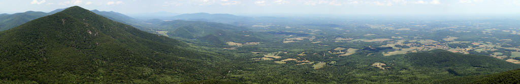
. The panorama above is from along the summit of Sharp Top.
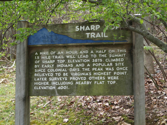
The sign that marks the start of the Sharp Top Trail
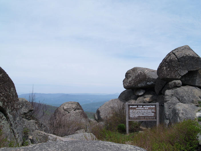
Approaching the summit of Sharp Top
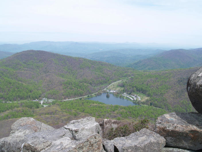
The signature view from the summit of Sharp Top
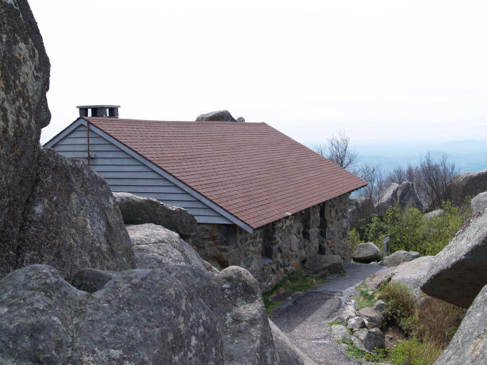
Shelter near the summit of Sharp Top

Hikers enjoying the popular summit of Sharp Top on a beautiful spring day
| CNY Hiking HOME PAGE | Peaks of Otter | Virginia BRP Highlights |
