Apple Orchard
Falls
Apple Orchard Falls, Cornelius Creek,
Appalachian Trail
![]()
| CNY Hiking HOME PAGE | Virginia BRP Highlights | Blue Ridge Parkway |
|
Blue Ridge Parkway Apple Orchard Falls Apple Orchard Falls, Cornelius Creek, Appalachian Trail
|
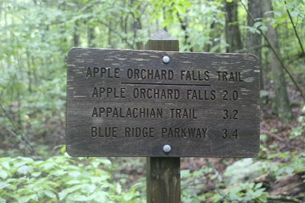
At milepost 78.4 of the Blue Ridge Parkway is the Sunset Fields Overlook, home to a trailhead of the 3.4 mile Apple Orchard Falls Trail. This trail is a National Recreational Trail and this area is very popular, mostly due to the beautiful 150 foot waterfalls. It is well worth exploring.
Most hikers visit the falls from the Sunset Fields Overlook, where the Apple Orchard Falls Trail descends 1000 feet in elevation over 1.4 miles, for a 2.8 mile round trip. The easiest hike to the falls requires a drive along forest service roads (rough but can be driven on by cars), to the end of Apple Tree Road (see directions below). From this trailhead it is only 0.75 miles to the falls with an elevation gain of 600 feet for a 1.5 mile round trip. Both hikes are moderate, with the return to Sunset Fields Overlook from the falls a bit strenuous for some.
Even when the falls are diminished by drought, Apple Orchard Falls are spectacular. A multi-tier cascade bouncing from ledge to ledge down a sharp cliff. The National Forest Service has constructed a great wooden bridge with a viewing platform right below the falls. You'll also encounter wooden steps as you descend toward the base of the falls. It's definitely worth the visit, whichever way you decide to come.
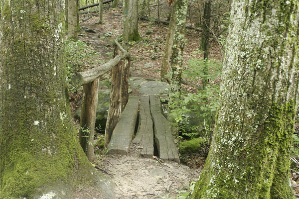
Log bridge along the Apple Orchard Falls Trail
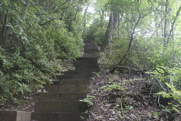
Wooden steps near base of Apple Orchard Falls
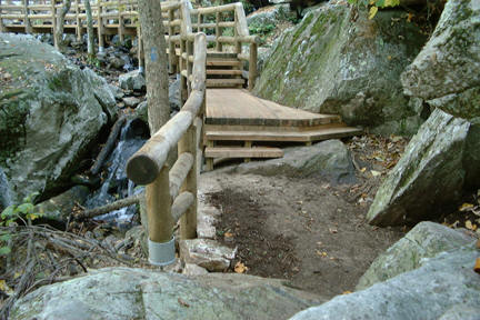
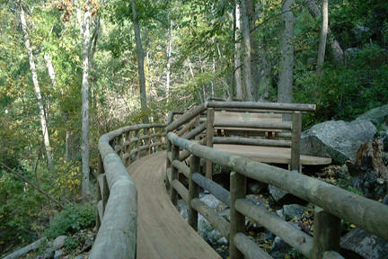
Part of the bridge and platform the National Forest Service built along the Apple Orchard Falls Trail
Most visitors are unaware of the area's other National Recreational Trail, the 2.9 mile Cornelius Creek Trail. The walk along Cornelius Creek is surprising pleasant as the trail is the creek's constant companion for most of the way. There was a logging train crash along the creek in 1910.
You could do a nice but strenuous 7.6 mile loop hike utilizing the Appalachian Trail, Cornelius Creek Trail and the Apple Orchard Falls Trail. This loop has an elevation change of over 2300 feet. Give yourself plenty of time if you decide to do this loop hike (at least 6 hours).
There is also a six mile loop option utilizing an old logging road and the two National Recreational Trails. If you do decide to do one of the loop options, we would suggest using the Cornelius Creek Trail as your ascending trail, as it has a gentler climb compared to the Apple Orchard Falls Trail.
The North Creek Campground is also close by with some creek side sites. This is just one of many campgrounds located in George Washington National Forest. This National Forest has numerous hiking trail to explore as well as free primitive camping available. There are a few campsites along Forest Road 812 as you descend from the Blue Ridge Parkway.
Below is more information on the trails and directions to the trailheads. There is also a couple of maps as well as a few pictures below.
Apple Orchard Falls Trail (3.4 miles)
can be reached from any of three trailheads and may be hiked as a loop trail when combined with Cornelius Creek Trail. There is an elevation change of 2000 feet from Sunset Fields Overlook to Forest Road 59 at North Creek.From the Blue Ridge Parkway:
The trail begins at an elevation of 3500 feet at the Sunset Field Overlook near milepost 78. The trail crosses the Appalachian Trail at 0.2 mile and Apple Orchard Spur (an old logging road) at 0.8 mile. The trail continues down and joins FR 59 at the parking area for Cornelius Creek and Apple Orchard Falls Trails.From North Creek: To reach the trailhead at North Creek, take Exit 168 (Arcadia exit) off I-81. Follow Va. 614 for 2.9 miles through Arcadia to FR 59. Turn left onto FR 59. The Road ends at the trailheads for Apple Orchard Falls and Cornelius Creek Trails.
From Apple Tree Road: Apple Tree Road (FR 3034) ends about 100 feet from the trail and provides a point of access about .75 mile below the Falls. To reach FR 3034, take Exit 168 (Arcadia exit) off I-81. Follow Va. 614 for 2.9 miles through Arcadia to FR 59. Turn left onto FR 59. Go 3 miles, just past North Creek Campground, turn left onto FR 768. At intersection with FR 812, turn right on FR 812 and go about 3.4 miles to FR 3034. Turn right on FS 3034 and park at the end of the road (2.1 miles).
From the Blue Ridge Parkway at Parkers Gap take FR 812 for 3 miles and turn left onto FR 3034 (Apple Tree Road).
Cornelius Creek Trail (2.9 miles)
can be reached from any of three trailheads and may be hiked as a loop trail when combined with Apple Orchard Falls Trail.North Creek: To reach the trailhead at North Creek, take Exit 168 (Arcadia exit) off I-81. Follow Va. 614 for 2.9 miles through Arcadia to FR 59. Turn left onto FR 59. The Road ends at the trailheads for Apple Orchard Falls and Cornelius Creek Trails.
Blue Ridge Parkway: Take Apple Orchard Falls Trail, which begins at an elevation of 3500 feet at the Sunset Field Overlook near milepost 78, to the Appalachian Trail at 0.2 mile. Take the Appalachian Trail south to Cornelius Creek Trail.
Take Apple Orchard Falls Trail from Sunset Fields 0.8 miles to Apple Orchard Spur (an old logging road). Turn left on the old road to Cornelius Creek Trail. The trail continues down and joins FR 59 at the parking area for CorneliusCreek and Apple Orchard Falls Trails.


| CNY Hiking HOME PAGE | Virginia BRP Highlights | Blue Ridge Parkway |