New York State Parks
Betty & Wilbur Davis
Andy's
Trail

| CNY Hiking HOME PAGE | Betty & Wilbur Davis State Park | New York State Parks | Hiking in Otsego County | Park Trail Map |
|
Hiking in Otsego County New York State Parks Betty & Wilbur Davis Andy's Trail
|
|
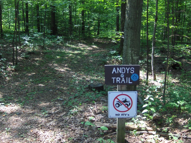
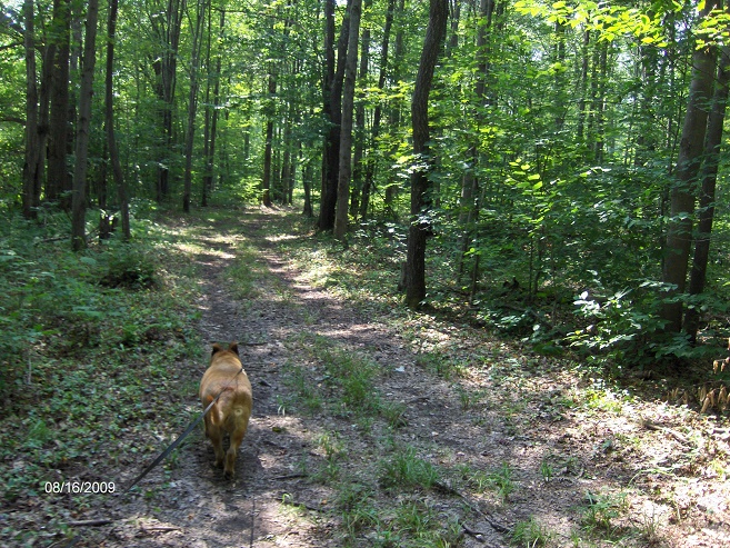
Andy's Trail is the main hiking trail in Betty & Wilbur Davis State Park located near Cooperstown, NY. This trail loops around the park boundary for a pleasant 2.8 mile loop hike with minimal ups and downs.
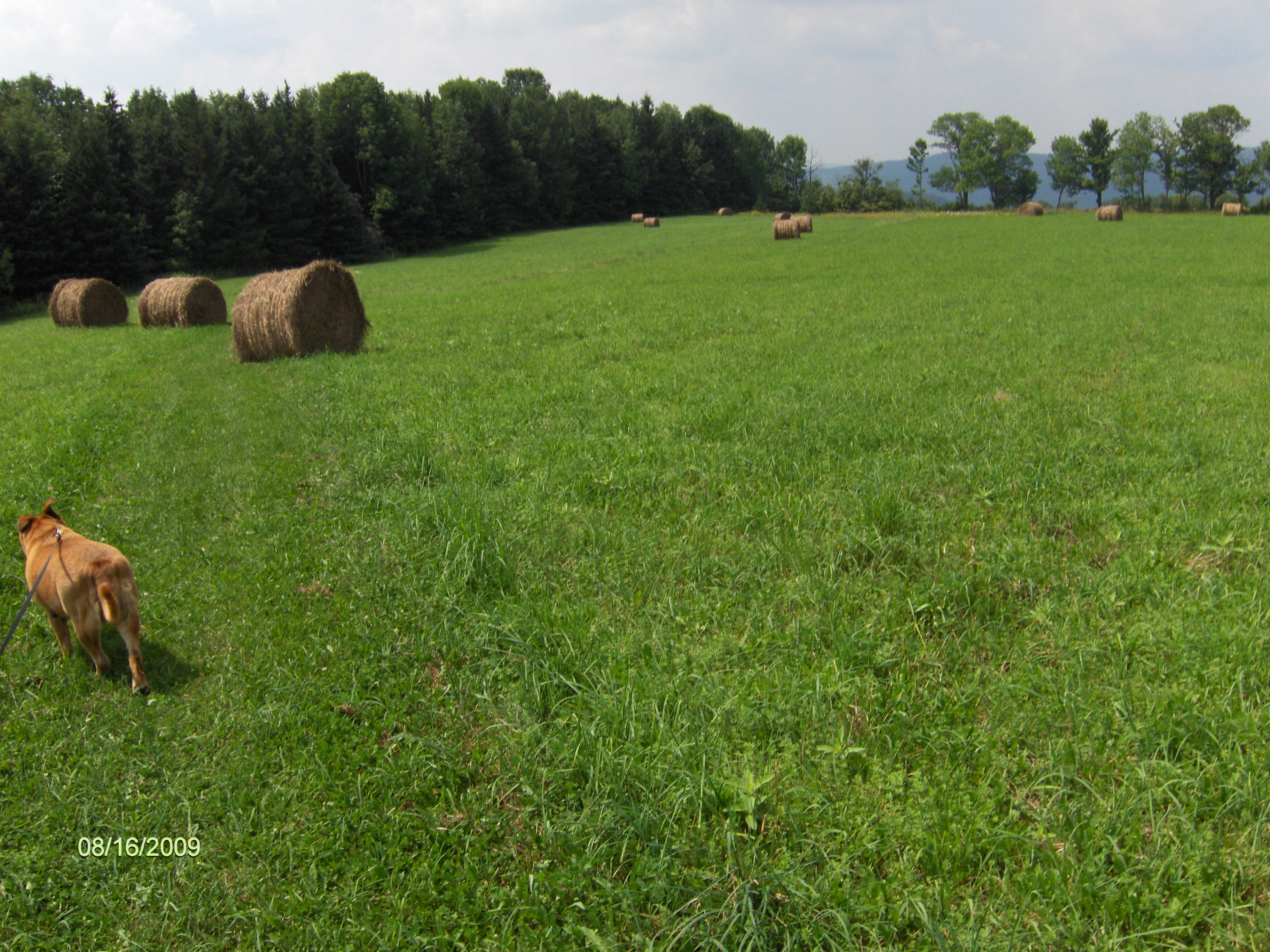
There are benches along the trail to take a break.The trail is marked with NY State Park markers, but the colors of the markers change as you hike the loop. Sometimes blue, then green, red and even yellow markers. It is a pretty easy trail to follow. The only "tough" spots to follow are the field below Betty's Cabin and near Weeping Willow Pond.As you hike there are numbered markers for the "nature trail", which is Andy's Trail.
Below are the ten items you will see from the "Self Interpretive Nature Trail" brochure that you can get from the parking area near the "West View Cabins". You will also find a trail sign in sheet and kiosk located there.There are a few pictures below from our hike that we did in mid August 2009. Look below for a topo map and description of this pleasant loop hike. This is one of our favorite hikes we've done.
- Ground Pine & Princess Pine
- Ferns
- Blue Bottle Gentian
- Red Oak
- Hemlock
- Larch
- American Basswood
- Blackberry Bush
- White Birch
- Stone Wall
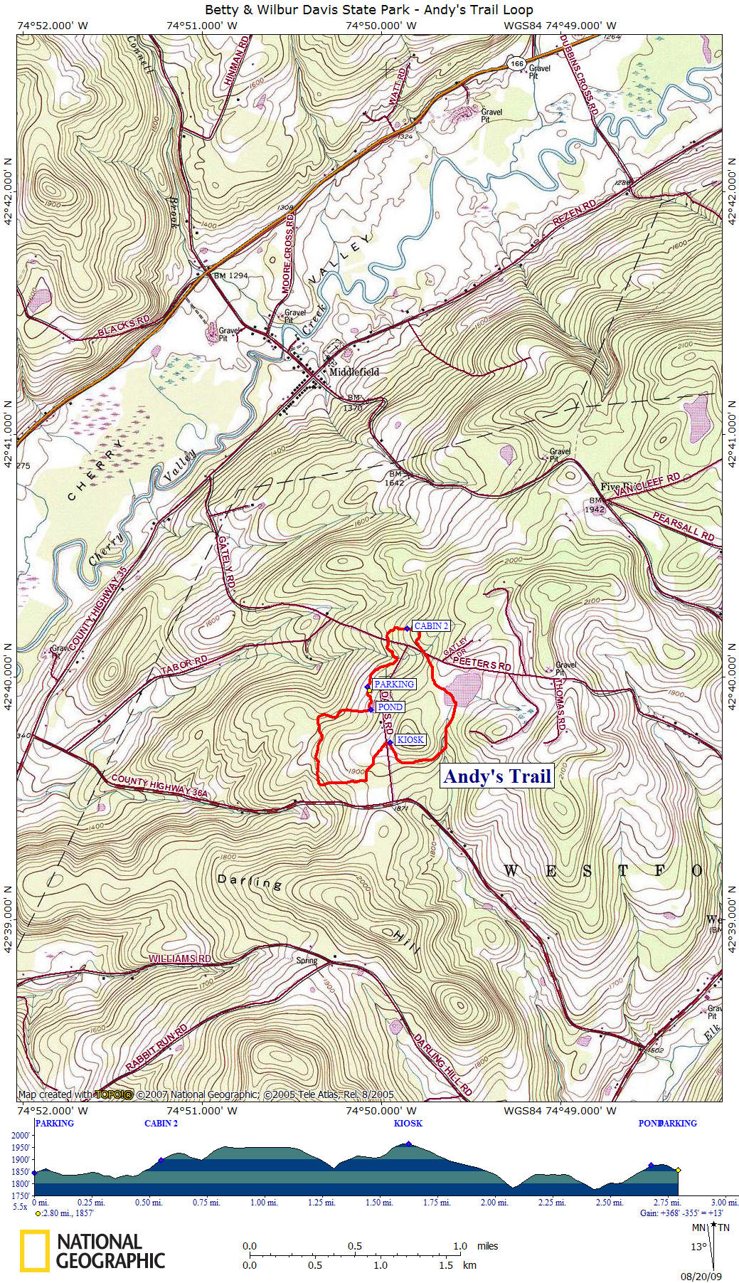
Mile Elevation Trail Description of Andy's Trail 0.0 1844 feet From the new large parking area near the rest rooms and playground head toward the park entrance road (north) then enter woods following blue NY State Park Trail discs.
0.25 1846 feet Trail reaches dirt Davis Road and crosses small stream then turns left back into woods.
0.4 1834 feet Trail crosses dirt Gately Road.
0.55 1896 feet Pass close by cabin #2 on your right. Trail continues to follow stone wall and will veer right soon.
0.7 1898 feet Trail crosses dirt Gately Road. Soon another trail comes in on your left near bench.
1.25 1894 feet Trail is following a small stream and passes by a deer stand on your left. Then a bench on your right.
1.5 1922 feet Leave woods and enter field. Betty's Cabin toward right. Soon views.
1.6 1966 feet Highest point along Andy's Trail. Views. Soon Kiosk & Trail Register. Cross dirt Davis Road and trail veers toward left diagonally toward pine trees, not straight down vehicle tracks. Soon enter pine forest. Descend.
1.85 1881 feet Trail turns right.
2.1 1783 feet Trail turns right. Bench.
2.3 1839 feet Trail follows edge of field briefly up until bench and marker #9. Re-enter woods. Descend.
2.4 1777 feet Lowest point along trail. Marker #10 "Stone Wall"
2.55 1802 feet Begin to ascend, soon leave woods and enter edge of field. Head toward parking area straight ahead.
2.65 1875 feet Go up the stairs toward Weeping Willow Pond. Turn left at pond and follow next to pond. VIEWS to your left. Bench.
2.75 1878 feet Turn left and go down stairs toward rest rooms and large parking area.
2.8 1844 feet Pass by Pavilion and rest rooms. Reach large parking area and end of this hike.
Andy's Trail
Hiking Andy's Trail
Andy's Trail passing thru an open field
| CNY Hiking HOME PAGE | Betty & Wilbur Davis State Park | New York State Parks | Hiking in Otsego County | Park Trail Map |

![]()